- Newhey
-
Coordinates: 53°36′00″N 2°05′54″W / 53.6001°N 2.0982°W
Newhey 
Huddersfield Road in Newhey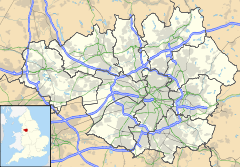
 Newhey
Newhey shown within Greater ManchesterOS grid reference SD934115 Metropolitan borough Rochdale Metropolitan county Greater Manchester Region North West Country England Sovereign state United Kingdom Post town ROCHDALE Postcode district OL16 Dialling code 01706 Police Greater Manchester Fire Greater Manchester Ambulance North West EU Parliament North West England UK Parliament Rochdale List of places: UK • England • Greater Manchester Newhey (archaically New Hey[1]) is a suburban village in the Milnrow area of the Metropolitan Borough of Rochdale,[2] in Greater Manchester, England. It lies at the foot of the Pennines, by Junction 21 of the M62 motorway and on the River Beal, 2.7 miles (4.3 km) east-southeast of Rochdale, 10.3 miles (16.6 km) northeast of Manchester.
Historically a part of Lancashire, Newhey was anciently a hamlet within the township of Butterworth. It was described in 1828 as "consisting of several ranges of cottages and two public houses".[3] In the early 19th century a major road was built through Newhey from Werneth to Littleborough. Newhey was incorporated into the Milnrow Urban District in 1894.
Newhey expanded as part of an unplanned process of urbanisation, brought on by the introduction of textile manufacture during the Industrial Revolution, and is now home to the Ellenroad Steam Museum - the engine house of the former Ellenroad Ring Mill, the rest of which was demolished in 1985. It holds the world's largest working steam engine.[citation needed]
Contents
History
 Ellenroad Ring Mill, as it was in 1984.
Lying by the older localities of Milnrow, Ogden and Haugh, Newhey is thought to have acquired its name as a result of land reclamation.[3]
Newhey was home to the Newhey Brick and Terracotta Co. Ltd., a prosperous brick and tile works which opened on Huddersfield Road in 1899. Its bricks are found in buildings worldwide. Most mills and associated terraced houses in the Rochdale and Oldham areas were built from this "Newhey brick".[citation needed]
In the 1920s, Newhey had at least five cotton mills, including Ellenroad, Newhey, Coral, Haugh and Garfield (demolished 1969).[citation needed]
Governance
From a very early time, Newhey was part of the Butterworth township of Rochdale parish, in the Hundred of Salfordshire.
From 1894 to 1974, Newhey was part of Milnrow Urban District in the administrative county of Lancashire.[4] In the local government reforms of 1974, this Urban District status was abolished and Newhey is now part of the Metropolitan Borough of Rochdale.
Newhey was previously part of the Littleborough and Saddleworth constituency. It is now represented in the House of Commons as part of the parliamentary constituency of Rochdale.
Geography
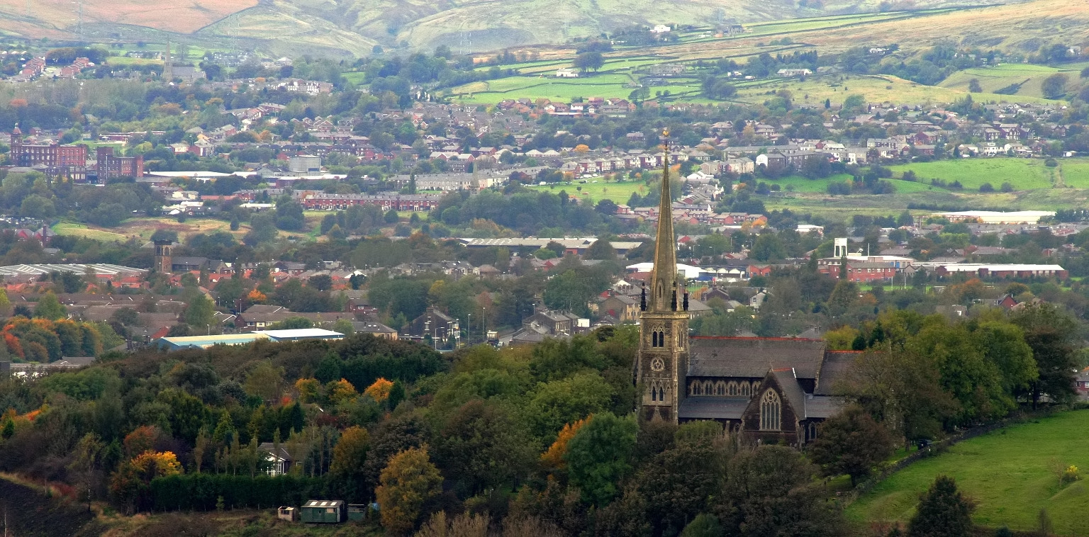
 Looking over Newhey
Neighbouring towns, villages and places. 
Rochdale Milnrow Tunshill Castleton 
Ogden  Newhey

Thornham Shaw and Crompton Denshaw Localities in and around Newhey include Haugh and Woodbottom. Several reservoirs lie above and to the east, including Ogden, Kitcliffe and Piethorne.
Landmarks
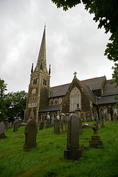 St Thomas's at Newhey
Milnrow War Memorial, a Grade II listed structure, is in Newhey's Memorial Park.[5] Originally in central Milnrow (set back from the road near Milnrow Bridge), it was unveiled in 1924 by Major General A Solly-Flood, a former commander of 42nd (East Lancashire) Division. Sculpted from Sandstone by G Thomas in 1923, the memorial is surmounted by a bronze statue of a World War I Infantry soldier with rifle and fixed bayonet, symbolic of the district's young manhood in early World War I. The plinth has bronze and slate panels which show the names of local men who died in the two World Wars.[6]
Ellenroad Engine House was designed by Sir Philip Stott, 1st Baronet. Its tall chimney makes it a local landmark.
Newhey parish church, dedicated to Saint Thomas[disambiguation needed
 ], was built in 1876 to serve the new Anglican parish of Newhey.[7] Its patron is the Bishop of Manchester.[8] The church was badly damaged by arson on 21 December 2007.[9]
Transport
Newhey is served by the M62 motorway and New Hey railway station.
References
- ^ Youngs (1991), p. 172.
- ^ Rochdale Metropolitan Borough Council (N.D.), p. 32.
- ^ a b Butterworth (1828), p. 113.
- ^ Milnrow UD, Vision of Britain. URL accessed 3 January 2007.
- ^ Wyke, Terry (2005). Public Sculpture of Greater Manchester. Liverpool University Press. ISBN 0-85323-567-8.
- ^ Memorial - maintenance - Rochdale Metropolitan Borough Council
- ^ Newhey EP Lancashire through time | Local history overview for the Ecclesiastical Parish
- ^ Townships - Butterworth | British History Online
- ^ Church hit by fire - News - Rochdale Observer
Bibliography
- Butterworth, James (1828). A History And Description Of The Town And Parish Of Rochdale In Lancashire. W D Varey.
- Rochdale Metropolitan Borough Council (N.D.). Metropolitan Rochdale Official Guide. London: Ed. J. Burrow & Co. Limited.
- Youngs, F. (1991). Local Administrative Units: Northern England. Royal Historical Society.
External links
- Ellenroad Engine House Tourist attraction home page
- Newhey Community Primary School School Home Page
- St Thomas Church, Newhey Church Home Page
- St Thomas School, Newhey School Home Page
Ceremonial county of Greater Manchester Statutory City Region - Greater Manchester Combined Authority
- Greater Manchester Statutory City Region
Metropolitan districts Major settlements - Altrincham
- Ashton-in-Makerfield
- Ashton-under-Lyne
- Atherton
- Audenshaw
- Blackley
- Bolton
- Bury
- Cadishead
- Chadderton
- Clifton
- Denton
- Droylsden
- Dukinfield
- Eccles
- Failsworth
- Farnworth
- Golborne
- Heywood
- Hindley
- Horwich
- Hyde
- Irlam
- Kearsley
- Leigh
- Littleborough
- Manchester
- Middleton
- Milnrow
- Mossley
- Oldham
- Partington
- Pendlebury
- Prestwich
- Radcliffe
- Ramsbottom
- Rochdale
- Royton
- Sale
- Salford
- Shaw and Crompton
- Stalybridge
- Stockport
- Stretford
- Swinton
- Tottington
- Tyldesley
- Urmston
- Walkden
- Westhoughton
- Whitefield
- Wigan
- Worsley
See also: List of civil parishes in Greater Manchester
Rivers Topics - Castles
- Churches
- Demography
- Football clubs
- Geography
- Grade I listed buildings
- Grade II* listed buildings
- Museums
- Parliamentary constituencies
- People
- Places
- Schools
- SAMs
- SSSIs
Categories:- Geography of Rochdale
- Villages in Greater Manchester


Wikimedia Foundation. 2010.