- Clark County, South Dakota
-
Clark County, South Dakota 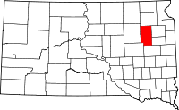
Location in the state of South Dakota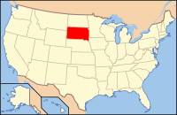
South Dakota's location in the U.S.Founded 1873 Seat Clark Largest city Clark Area
- Total
- Land
- Water
968 sq mi (2,507 km²)
958 sq mi (2,481 km²)
10 sq mi (26 km²), 1.02%Population
- (2010)
- Density
3,691
4/sq mi (2/km²)Clark County is a county located in the U.S. state of South Dakota. As of the 2010 census, the population was 3,691.[1] Its county seat is Clark.[2]
Contents
Geography
According to the U.S. Census Bureau, the county has a total area of 968 square miles (2,507.1 km2), of which 958 square miles (2,481.2 km2) is land and 10 square miles (25.9 km2) (1.02%) is water.
Townships
The county is divided into twenty-seven townships: Ash, Blaine, Collins, Cottonwood, Darlington, Day, Eden, Elrod, Fordham, Foxton, Garfield, Hague, Lake, Lincoln, Logan, Maydell, Merton, Mount Pleasant, Pleasant, Raymond, Richland, Rosedale, Spring Valley, Thorp, Warren, Washington, and Woodland.
Major highways
 U.S. Highway 212
 South Dakota Highway 20
 South Dakota Highway 25
 South Dakota Highway 28
Adjacent counties
- Day County, South Dakota - north
- Codington County, South Dakota - east
- Hamlin County, South Dakota - southeast
- Kingsbury County, South Dakota - south
- Beadle County, South Dakota - southwest
- Spink County, South Dakota - west
Demographics
Historical populations Census Pop. %± 1880 114 — 1890 6,728 5,801.8% 1900 6,942 3.2% 1910 10,901 57.0% 1920 11,136 2.2% 1930 11,022 −1.0% 1940 8,955 −18.8% 1950 8,369 −6.5% 1960 7,134 −14.8% 1970 5,515 −22.7% 1980 4,894 −11.3% 1990 4,403 −10.0% 2000 4,143 −5.9% 2010 3,691 −10.9% U.S. Decennial Census As of the census[3] of 2000, there were 4,143 people, 1,598 households, and 1,110 families residing in the county. The population density was 4 people per square mile (2/km²). There were 1,880 housing units at an average density of 2 per square mile (1/km²). The racial makeup of the county was 98.65% White, 0.07% Black or African American, 0.60% Native American, 0.10% Asian, 0.02% Pacific Islander, 0.19% from other races, and 0.36% from two or more races. 0.48% of the population were Hispanic or Latino of any race. 44.2% were of German, 24.9% Norwegian and 5.0% English ancestry.
There were 1,598 households out of which 29.30% had children under the age of 18 living with them, 61.60% were married couples living together, 4.70% had a female householder with no husband present, and 30.50% were non-families. 28.10% of all households were made up of individuals and 16.40% had someone living alone who was 65 years of age or older. The average household size was 2.54 and the average family size was 3.14.
In the county, the population was spread out with 27.00% under the age of 18, 5.80% from 18 to 24, 22.00% from 25 to 44, 23.00% from 45 to 64, and 22.20% who were 65 years of age or older. The median age was 42 years. For every 100 females there were 97.40 males. For every 100 females age 18 and over, there were 97.40 males.
The median income for a household in the county was $30,208, and the median income for a family was $35,559. Males had a median income of $24,421 versus $19,543 for females. The per capita income for the county was $15,597. About 10.90% of families and 14.80% of the population were below the poverty line, including 20.10% of those under age 18 and 16.00% of those age 65 or over.
Cities and towns
- Bradley 72
- Carpenter
- Clark 1,139
- Crocker 19
- Elrod
- Garden City 53
- Naples 41
- Raymond 50
- Vienna 45
- Willow Lake 263
2010 United States Census population[4]
See also
References
- ^ United States Census Bureau. "2010 Census Data". United States Census Bureau. http://2010.census.gov/2010census/data/. Retrieved 4 August 2011.
- ^ "Find a County". National Association of Counties. http://www.naco.org/Counties/Pages/FindACounty.aspx. Retrieved 2011-06-07.
- ^ "American FactFinder". United States Census Bureau. http://factfinder.census.gov. Retrieved 2008-01-31.
- ^ "Incorporated Places and Minor Civil Divisions: South Dakota". Population Census. 2010 United States Census. 2011-07-18. http://factfinder2.census.gov/faces/tableservices/jsf/pages/productview.xhtml?pid=DEC_10_PL_GCTPL1.ST13&prodType=table. Retrieved 2011-08-04.

Day County Spink County 
Codington County  Clark County, South Dakota

Beadle County Kingsbury County Hamlin County Municipalities and communities of Clark County, South Dakota Cities 
Towns Bradley | Garden City | Naples | Raymond | Vienna
Unincorporated
communityCategories:- South Dakota counties
- Clark County, South Dakota


Wikimedia Foundation. 2010.