- Dodge County, Minnesota
-
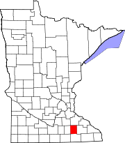
Dodge County, Minnesota 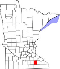
Location in the state of Minnesota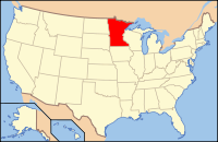
Minnesota's location in the U.S.Founded February 20, 1855 [1] Named for Henry Dodge Seat Mantorville Largest city Kasson Area
- Total
- Land
- Water
439.63 sq mi (1,139 km²)
439.50 sq mi (1,138 km²)
0.12 sq mi (0 km²), 0.03%Population
- (2010)
- Density
20,087
40/sq mi (16/km²)Time zone Central: UTC-6/-5 Website www.co.dodge.mn.us Dodge County is a county located in the U.S. state of Minnesota. The population was 20,087 as of the 2010 census.[1] Its county seat is Mantorville.[2]
Dodge County is part of the Rochester, MN Metropolitan Statistical Area.
Contents
History
Dodge County was originally inhabited by Native Americans, as many counties in Minnesota were. This area was a common hunting and battle ground for the Mdewakanton Sioux, often fighting the Sauk and Fox Indians who had wandered into their territory. The first white person to visit Dodge County, however, is not known. It is believed by some that a French fur trader from Canada was the first, setting foot on its soil in the spring of 1655. Guides deemed this area unsafe due to the Natives living there. But, it was not until over two hundred years later that the locality truly came to life.
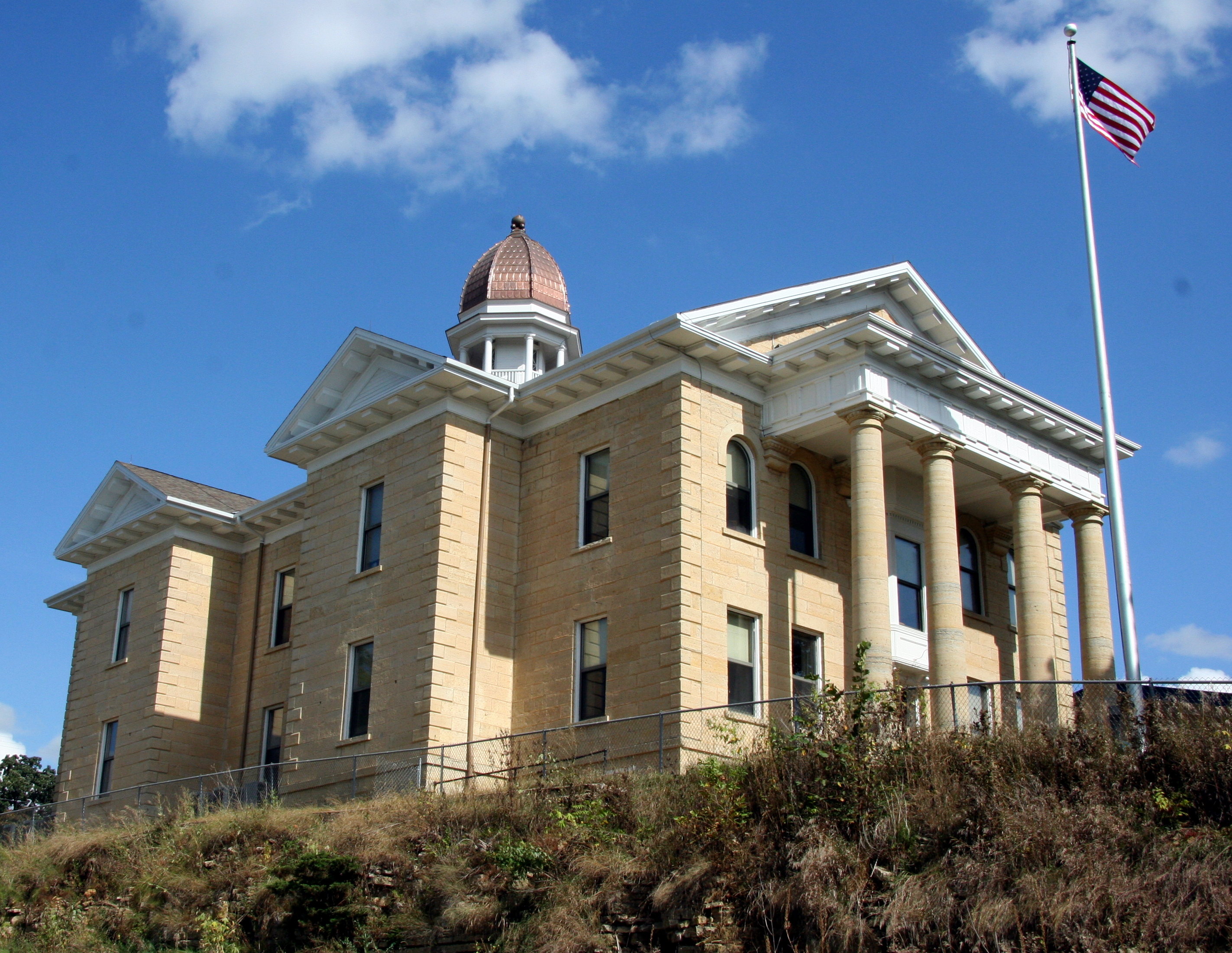
It was in 1853 that government surveyors set lines for the townships. A year later, the Mantor brothers, along with Eli P. Waterman, established their claims, which would later be an important town to the area known as "Mantorville." Still a year later, in 1855, Dodge County was organized for local government. In the first few years of growth, its main settlers were Germans and people of Scandinavian descent, mostly Norwegians. With increasing growth and improvement, Dodge County was officially placed in the Fifth Judicial District by the State Constitution on May 11, 1858. Its name, given in honor of Wisconsin governor Henry Dodge, lives on with pride for its colorful past. The Dodge County Courthouse, designed by E. Townsend Mix and built of locally quarried limestone in 1865, is the oldest working courthouse in Minnesota.
Presidential Election Results 2000-2008 Year Democrat Republican 2008 43.70% 4,463 53.54% 5,468 2004 41.72% 4,117 56.68% 5,593 2000 41.86% 3,370 52.34% 4,213 Geography
According to the 2000 census, the county has a total area of 439.63 square miles (1,138.6 km2), of which 439.50 square miles (1,138.3 km2) (or 99.97%) is land and 0.12 square miles (0.31 km2) (or 0.03%) is water.[3]
Lakes
- Rice Lake: located almost entirely in Steele County (Havana Township), but the far eastern edge extends into Dodge County.
Major highways
 U.S. Highway 14
 U.S. Highway 218
 Minnesota State Highway 30
 Minnesota State Highway 56
Airport
Dodge Center Municipal Airport is the only public airport in the county.
Adjacent counties
- Rice County (northwest)
- Goodhue County (northeast)
- Olmsted County (east)
- Mower County (south)
- Steele County (west)
Topography
Dodge County is located in the Southeastern part of Minnesota and spans 24 miles (39 km) long and 18 miles (29 km) wide. To the North and center of the county, it is hilly, high, and rolling with pebbly, loose soil, laid with a considerable amount of timber. This makes it well-suited for grain raising. The Southern part is quite the opposite. Being it is flat and wet, it's adapted perfectly for grazing and raising stock. The soil in this area is excellent for yielding huge crops, considering its extremely fertile soil. The heavy, black, clay loam makes this area a prime location for agriculture.
Dodge County's plentiful amount of sand and rock also make the area a center for building. Quarries in Mantorville were once enterprises and consist of layers of thick stone which can be cut into any desired shape. Wasioja is also known around the nation for its excellent "Wasioja stone."
Other physical features include:
Streams:
- Dodge Center Creek
- Harkcom Creek
- Henslin Creek
- Little Cedar River
- Maston Creek
- Millikin Creek
- Tompkins Creek
Lakes:
- Zumbro River Reservoir
- Rice Lake
Demographics
Historical populations Census Pop. %± 1860 3,797 — 1870 8,598 126.4% 1880 11,344 31.9% 1890 10,864 −4.2% 1900 13,340 22.8% 1910 12,094 −9.3% 1920 12,552 3.8% 1930 12,127 −3.4% 1940 12,931 6.6% 1950 12,624 −2.4% 1960 13,259 5.0% 1970 13,037 −1.7% 1980 14,773 13.3% 1990 15,731 6.5% 2000 17,731 12.7% 2010 20,087 13.3% U.S. Decennial Census As of the census[4] of 2000, there were 17,731 people, 6,420 households, and 4,853 families residing in the county. The population density was 40 people per square mile (16/km²). There were 6,642 housing units at an average density of 15 per square mile (6/km²). The racial makeup of the county was 96.58% White, 0.20% Black or African American, 0.17% Native American, 0.41% Asian, 0.01% Pacific Islander, 1.89% from other races, and 0.73% from two or more races. 2.99% of the population were Hispanic or Latino of any race. 34.2% were of German, 26.9% Norwegian, 5.8% Irish, 5.8% American and 5.1% English ancestry according to Census 2000.
 Age pyramid of county residents based on 2000 U.S. census data.
There were 6,420 households out of which 40.70% had children under the age of 18 living with them, 64.70% were married couples living together, 7.20% had a female householder with no husband present, and 24.40% were non-families. 20.20% of all households were made up of individuals and 9.70% had someone living alone who was 65 years of age or older. The average household size was 2.73 and the average family size was 3.15.
In the county the population was spread out with 30.20% under the age of 18, 7.60% from 18 to 24, 29.90% from 25 to 44, 20.20% from 45 to 64, and 12.10% who were 65 years of age or older. The median age was 35 years. For every 100 females there were 98.80 males. For every 100 females age 18 and over, there were 97.90 males.
The median income for a household in the county was $47,437, and the median income for a family was $54,261. Males had a median income of $34,195 versus $25,903 for females. The per capita income for the county was $19,259. About 4.40% of families and 5.80% of the population were below the poverty line, including 5.80% of those under age 18 and 9.60% of those age 65 or over.
Cities and towns
 Dodge County Courthouse.
Cities Townships Unincorporated - Berne
† Blooming Prairie is mainly in Steele County but extends into Dodge County.
See also
References
- ^ "2010 Census Redistricting Data (Public Law 94-171) Summary File". American FactFinder. United States Census Bureau. http://factfinder2.census.gov/faces/tableservices/jsf/pages/productview.xhtml?pid=DEC_10_PL_GCTPL2.ST05&prodType=table. Retrieved 25 April 2011.
- ^ "Find a County". National Association of Counties. http://www.naco.org/Counties/Pages/FindACounty.aspx. Retrieved 2011-06-07.
- ^ "Census 2000 U.S. Gazetteer Files: Counties". United States Census. http://www.census.gov/tiger/tms/gazetteer/county2k.txt. Retrieved 2011-02-13.
- ^ "American FactFinder". United States Census Bureau. http://factfinder.census.gov. Retrieved 2008-01-31.
External links

Rice County Goodhue County Steele County 
Olmsted County  Dodge County, Minnesota

Mower County Municipalities and communities of Dodge County, Minnesota Cities Blooming Prairie‡ | Claremont | Dodge Center | Hayfield | Kasson | Mantorville | West Concord
Townships Unincorporated
communitiesBerne
Ghost town Rice Lake‡
Footnotes ‡This populated place also has portions in an adjacent county or counties
Categories:- Minnesota counties
- Dodge County, Minnesota
- Rochester, Minnesota metropolitan area


Wikimedia Foundation. 2010.