- Otsego, Minnesota
-
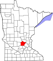
Otsego, Minnesota — City — Location of Otsego, Minnesota
Coordinates: 45°16′18″N 93°35′56″W / 45.27167°N 93.59889°W Country United States State Minnesota County Wright Area – Total 30.3 sq mi (78.6 km2) – Land 29.4 sq mi (76.1 km2) – Water 1.0 sq mi (2.5 km2) Elevation 879 ft (268 m) Population (2010)[1] – Total 13,571 – Density 217.5/sq mi (84.0/km2) Time zone Central (CST) (UTC-6) – Summer (DST) CDT (UTC-5) ZIP codes 55301, 55362 ,55330 Area code(s) 763 FIPS code 27-49138[2] GNIS feature ID 0649039[3] Website http://www.ci.otsego.mn.us/ Otsego is a city in Wright County, Minnesota, United States. The population was 13,571 at the 2010 census.[1]
Minnesota State Highway 101 serves as one of the main routes in the city.
Geography
Otsego is located at the confluence of the Mississippi and Crow Rivers. According to the United States Census Bureau, the city has a total area of 30.3 square miles (78 km2), of which, 29.4 square miles (76 km2) of it is land and 1.0 square mile (2.6 km2) of it (3.20%) is water.
Demographics
Historical populations Census Pop. %± 2000 6,389 — 2010 13,571 112.4% U.S. Decennial Census As of the census[2] of 2000, there were 6,389 people, 2,062 households, and 1,674 families residing in the city. The population density was 217.5 people per square mile (84.0/km²). There were 2,120 housing units at an average density of 72.2 per square mile (27.9/km²). The racial makeup of the city was 97.26% White, 0.25% African American, 0.36% Native American, 0.72% Asian, 0.56% from other races, and 0.85% from two or more races. Hispanic or Latino of any race were 1.27% of the population. 41.0% were of German, 16.1% Norwegian, 7.0% Swedish, 6.9% Irish and 6.1% American ancestry according to Census 2000.
There were 2,062 households out of which 46.9% had children under the age of 18 living with them, 71.0% were married couples living together, 5.4% had a female householder with no husband present, and 18.8% were non-families. 12.7% of all households were made up of individuals and 2.6% had someone living alone who was 65 years of age or older. The average household size was 3.10 and the average family size was 3.41.
In the city the population was spread out with 32.5% under the age of 18, 7.7% from 18 to 24, 34.2% from 25 to 44, 21.4% from 45 to 64, and 4.2% who were 65 years of age or older. The median age was 32 years. For every 100 females there were 108.8 males. For every 100 females age 18 and over, there were 109.1 males.
The median income for a household in the city was $57,422, and the median income for a family was $59,319. Males had a median income of $39,568 versus $28,273 for females. The per capita income for the city was $20,209. About 3.1% of families and 3.2% of the population were below the poverty line, including 2.4% of those under age 18 and 13.8% of those age 65 or over.
References
- ^ a b "2010 Census Redistricting Data (Public Law 94-171) Summary File". American FactFinder. U.S. Census Bureau, 2010 Census. http://factfinder2.census.gov/faces/tableservices/jsf/pages/productview.xhtml?pid=DEC_10_PL_GCTPL2.ST13&prodType=table. Retrieved 23 April 2011.
- ^ a b "American FactFinder". United States Census Bureau. http://factfinder.census.gov. Retrieved 2008-01-31.
- ^ "US Board on Geographic Names". United States Geological Survey. 2007-10-25. http://geonames.usgs.gov. Retrieved 2008-01-31.
Municipalities and communities of Wright County, Minnesota Cities Albertville | Annandale | Buffalo | Clearwater‡ | Cokato | Dayton‡ | Delano | Hanover‡ | Howard Lake | Maple Lake | Monticello | Montrose | Otsego | Rockford‡ | St. Michael | South Haven | Waverly
Townships Albion | Buffalo | Chatham | Clearwater | Cokato | Corinna | Franklin | French Lake | Maple Lake | Marysville | Middleville | Monticello | Rockford | Silver Creek | Southside | Stockholm | Victor | Woodland
Unincorporated
communitySilver Creek
Ghost town Footnotes ‡This populated place also has portions in an adjacent county or counties
Coordinates: 45°16′27″N 93°35′29″W / 45.27417°N 93.59139°W
Categories:- Populated places in Wright County, Minnesota
- Cities in Minnesota
- Minnesota populated places on the Mississippi River


Wikimedia Foundation. 2010.