- New Hope, Minnesota
-
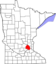
New Hope, Minnesota — City — Location in Hennepin County, Minnesota
Coordinates: 45°2′N 93°23′W / 45.033°N 93.383°W Country United States State Minnesota County Hennepin Founded Incorporated 1936 Government – Mayor Kathi Hemken Area – Total 5.2 sq mi (13.6 km2) – Land 5.1 sq mi (13.2 km2) – Water 0.04 sq mi (0.1 km2) 0.39% Elevation 932 ft (284 m) Population (2010)[1] – Total 20,339 – Density 4,098.6/sq mi (1,582.5/km2) Time zone Central (UTC-6) – Summer (DST) Central (UTC-5) ZIP codes 55427, 55428 Area code(s) 763 FIPS code 27-45628[2] GNIS feature ID 0648510[3] Website www.ci.new-hope.mn.us New Hope is a city in Hennepin County, Minnesota, United States and a suburb of Minneapolis. The population was 20,339 at the 2010 census.[1]
Contents
History
New Hope was originally a farming community in Crystal Lake Township. In 1936 the city of Crystal, Minnesota was incorporated, taking up all of former Crystal Lake Township. The farmers in the western part of the city broke off and formed New Hope Township. In 1953 with suburbia moving in and farmers moving out New Hope was re-incorporated as a borough.
Geography
According to the United States Census Bureau, the city has a total area of 5.2 square miles (13 km2), of which, 5.1 square miles (13 km2) of it is land and 0.04 square miles (0.10 km2) of it (0.39%) is water. It is 12 miles northwest of downtown Minneapolis.
U.S. Route 169 serves as one of the main routes in the city.
Demographics
Historical populations Census Pop. %± 1960 3,552 — 1970 23,180 552.6% 1980 23,087 −0.4% 1990 21,853 −5.3% 2000 20,873 −4.5% 2010 20,339 −2.6% U.S. Decennial Census As of the census[2] of 2000, there were 20,873 people, 8,665 households, and 5,268 families residing in the city. The population density was 4,098.6 people per square mile (1,583.3/km²). There were 8,746 housing units at an average density of 1,717.4 per square mile (663.4/km²). The racial makeup of the city was 86.66% White, 5.78% African American, 0.46% Native American, 3.21% Asian, 0.04% Pacific Islander, 1.74% from other races, and 2.11% from two or more races. Hispanic or Latino of any race were 3.45% of the population.
There were 8,665 households out of which 27.2% had children under the age of 18 living with them, 47.2% were married couples living together, 10.4% had a female householder with no husband present, and 39.2% were non-families. 32.3% of all households were made up of individuals and 12.5% had someone living alone who was 65 years of age or older. The average household size was 2.29 and the average family size was 2.91.
In the city the population was spread out with 21.3% under the age of 18, 8.1% from 18 to 24, 30.2% from 25 to 44, 22.7% from 45 to 64, and 17.8% who were 65 years of age or older. The median age was 38 years. For every 100 females there were 86.6 males. For every 100 females age 18 and over, there were 83.4 males.
The median income for a household in the city was $46,795, and the median income for a family was $60,424. Males had a median income of $41,192 versus $29,454 for females. The per capita income for the city was $23,562. About 4.1% of families and 6.5% of the population were below the poverty line, including 7.8% of those under age 18 and 6.3% of those age 65 or over.
Schools
Most school age children go to public school in the Robbinsdale School District
References
- ^ a b "2010 Census Redistricting Data (Public Law 94-171) Summary File". American FactFinder. U.S. Census Bureau, 2010 Census. http://factfinder2.census.gov/faces/tableservices/jsf/pages/productview.xhtml?pid=DEC_10_PL_GCTPL2.ST13&prodType=table. Retrieved 23 April 2011.
- ^ a b "American FactFinder". United States Census Bureau. http://factfinder.census.gov. Retrieved 2008-01-31.
- ^ "US Board on Geographic Names". United States Geological Survey. 2007-10-25. http://geonames.usgs.gov. Retrieved 2008-01-31.
External links
Municipalities and communities of Hennepin County, Minnesota Cities Bloomington | Brooklyn Center | Brooklyn Park | Champlin | Chanhassen‡ | Corcoran | Crystal | Dayton‡ | Deephaven | Eden Prairie | Edina | Excelsior | Golden Valley | Greenfield | Greenwood | Hanover‡ | Hopkins | Independence | Long Lake | Loretto | Maple Grove | Maple Plain | Medicine Lake | Medina | Minneapolis | Minnetonka | Minnetonka Beach | Minnetrista | Mound | New Hope | Orono | Osseo | Plymouth | Richfield | Robbinsdale | Rockford‡ | Rogers | Shorewood | Spring Park | St. Anthony‡ | St. Bonifacius | St. Louis Park | Tonka Bay | Wayzata | Woodland
Township Unorganized
territoryFootnotes ‡This populated place also has portions in an adjacent county or counties
Categories:- Cities in Minnesota
- Populated places in Hennepin County, Minnesota
- New Hope, Minnesota
- Populated places established in 1936


Wikimedia Foundation. 2010.