- National Register of Historic Places listings in Adams County, Colorado
-
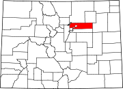
 Location of Adams County in Colorado
This is a list of the National Register of Historic Places listings in Adams County, Colorado.
This is intended to be a complete list of the properties and districts on the National Register of Historic Places in Adams County, Colorado, United States. The locations of National Register properties and districts for which the latitude and longitude coordinates are included below, may be seen in a Google map.[1]
There are 14 properties and districts listed on the National Register in the county.
-
- This National Park Service list is complete through NPS recent listings posted November 10, 2011.[2]
Contents: Counties in Colorado (links in italic lead to a new page) Adams - Alamosa - Arapahoe - Archuleta - Baca - Bent - Boulder - Broomfield - Chaffee - Cheyenne - Clear Creek - Conejos - Costilla - Crowley - Custer - Delta - Denver - Dolores - Douglas - Eagle - El Paso - Elbert - Fremont - Garfield - Gilpin - Grand - Gunnison - Hinsdale - Huerfano - Jackson - Jefferson - Kiowa - Kit Carson - La Plata - Lake - Larimer - Las Animas - Lincoln - Logan - Mesa - Mineral - Moffat - Montezuma - Montrose - Morgan - Otero - Ouray - Park - Phillips - Pitkin - Prowers - Pueblo - Rio Blanco - Rio Grande - Routt - Saguache - San Juan - San Miguel - Sedgwick - Summit - Teller - Washington - Weld - Yuma Current listings
[3] Landmark name [4] Image Date listed Location City or town Summary 1 Adams County Courthouse 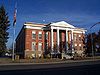
October 4, 2006 22 S. 4th Ave.
39°59′11″N 104°49′02″W / 39.986389°N 104.817222°WBrighton 2 Bowles House 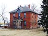
November 3, 1988 3924 W. 72nd Ave.
39°49′38″N 105°02′17″W / 39.827222°N 105.038056°WWestminster 3 Brannan Sand and Gravel Pit No. 8-Lake Sangraco Boathouse Complex 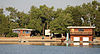
August 16, 2011 Off Lowell Boulevard south of 62nd Ave.
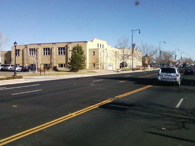
39°48′22″N 105°1′56″W / 39.80611°N 105.03222°W[5]Berkley 4 Brighton High School 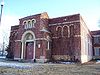
January 23, 1998 830 E. Bridge St.
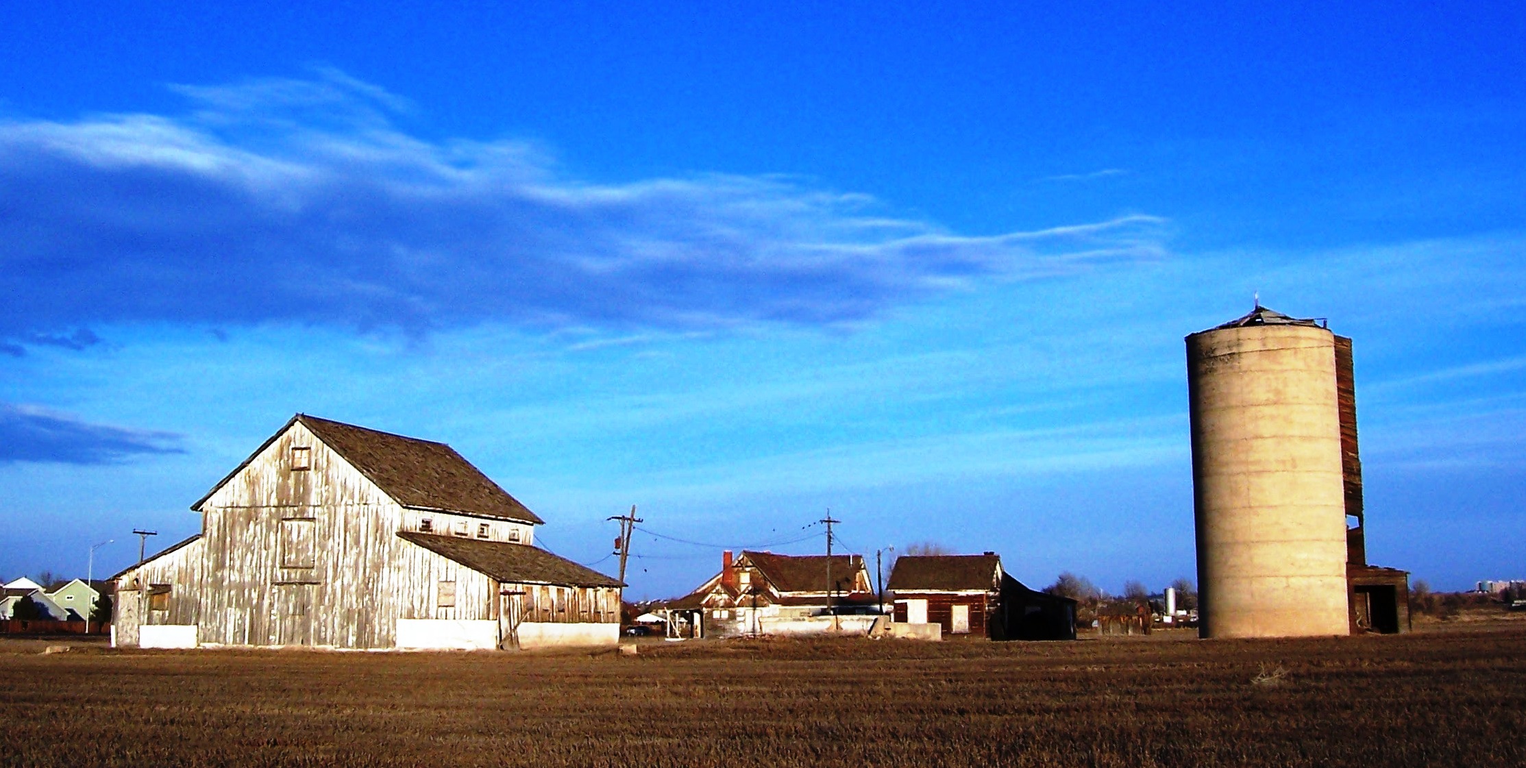
39°59′09″N 104°48′40″W / 39.985833°N 104.811111°WBrighton 5 Bromley Farm-Koizuma Hishinuma Farm 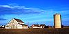
August 16, 2007 15820 E. 152nd Ave.
39°58′17″N 104°48′05″W / 39.971389°N 104.801389°WBrighton 6 Eastlake Farmers Co-Operative Elevator Company 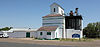
May 17, 2010 126th Ave and Claude Ct.
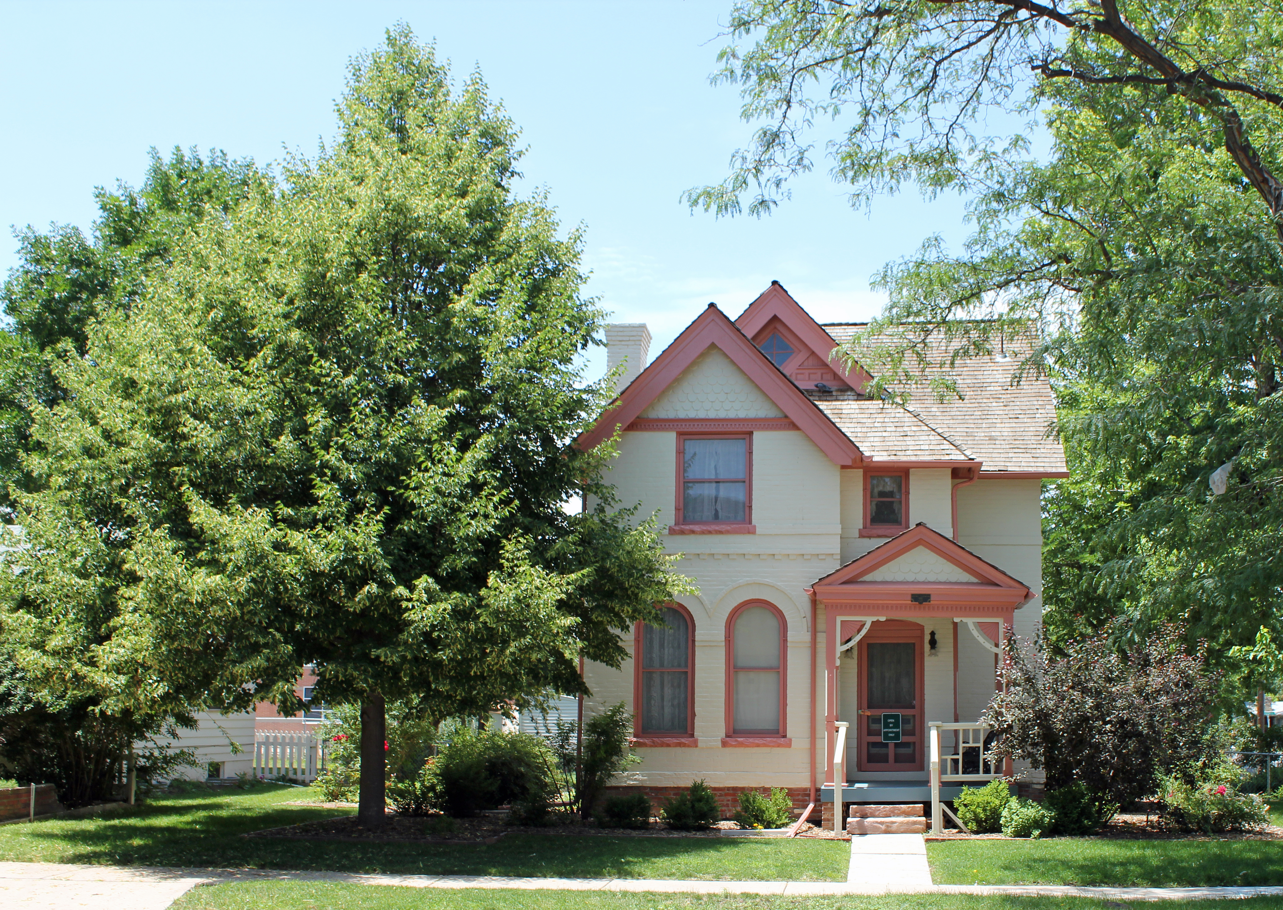
39°55′31″N 104°57′51″W / 39.925278°N 104.964264°WThornton 7 William J. Gregory House 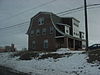
February 23, 1996 8140 Lowell Boulevard
39°50′40″N 105°02′01″W / 39.844444°N 105.033611°WWestminster 8 Harris Park School 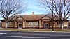
August 30, 1990 7200 Lowell Boulevard
39°49′40″N 105°02′00″W / 39.827778°N 105.033333°WWestminster 9 Riverside Cemetery 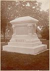
October 28, 1994 5201 Brighton Boulevard
39°47′39″N 104°57′33″W / 39.794167°N 104.959167°WCommerce City Extends into Denver 10 M.J. Lavina Robidoux House September 15, 2011 1615 Galena St.
39°44′32″N 104°52′11″W / 39.742333°N 104.869722°WAurora 11 Thede Farmhouse 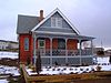
January 30, 1998 3190 W. 112th Ave.
39°53′42″N 104°57′04″W / 39.895°N 104.951111°WNorthglenn 12 Union High School 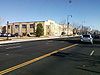
January 14, 2000 3455 W. 72nd Ave.
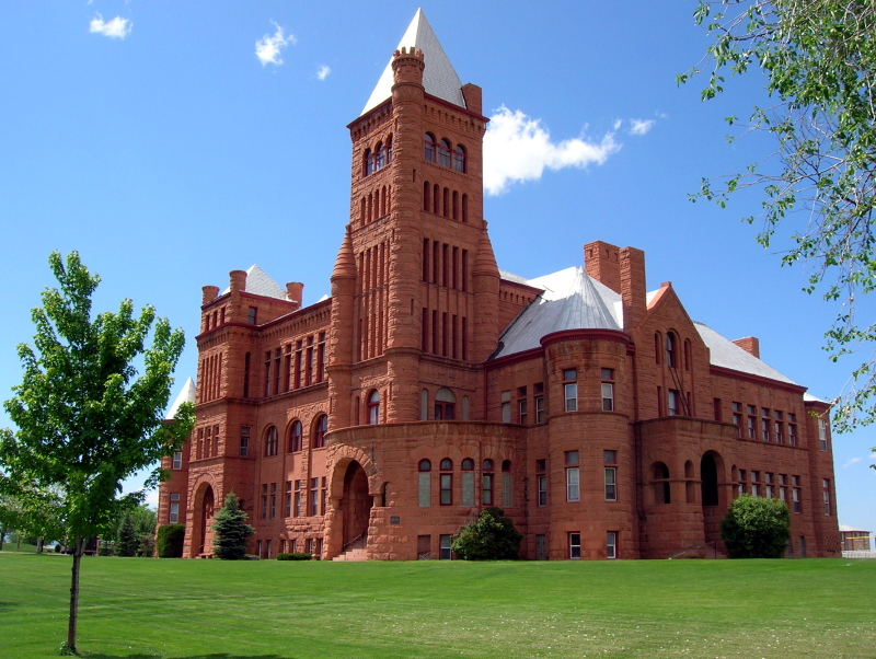
39°49′40″N 105°01′56″W / 39.827778°N 105.032222°WWestminster 13 Westminster University 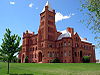
August 10, 1979 3455 W. 83rd Ave.
39°50′50″N 105°01′53″W / 39.847222°N 105.031389°WWestminster Red sandstone college building designed by E.B. Gregory and Stanford White. See also Westminster University 14 Blanche A. Wilson House 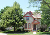
November 7, 1996 1671 Galena St.
39°44′38″N 104°52′09″W / 39.743889°N 104.869167°WAurora See also
- List of National Historic Landmarks in Colorado
- National Register of Historic Places listings in Colorado
References
- ^ The latitude and longitude information provided in this table was derived originally from the National Register Information System, which has been found to be fairly accurate for about 99% of listings. For about 1% of NRIS original coordinates, experience has shown that one or both coordinates are typos or otherwise extremely far off; some corrections may have been made. A more subtle problem causes many locations to be off by up to 150 yards, depending on location in the country: most NRIS coordinates were derived from tracing out latitude and longitudes off of USGS topographical quadrant maps created under the North American Datum of 1927, which differs from the current, highly accurate WGS84 GPS system used by Google maps. Chicago is about right, but NRIS longitudes in Washington are higher by about 4.5 seconds, and are lower by about 2.0 seconds in Maine. Latitudes differ by about 1.0 second in Florida. Some locations in this table may have been corrected to current GPS standards.
- ^ "National Register of Historic Places: Weekly List Actions". National Park Service, United States Department of the Interior. Retrieved on November 10, 2011.
- ^ Numbers represent an ordering by significant words. Various colorings, defined here, differentiate National Historic Landmark sites and National Register of Historic Places Districts from other NRHP buildings, structures, sites or objects.
- ^ "National Register Information System". National Register of Historic Places. National Park Service. . http://nrhp.focus.nps.gov/natreg/docs/All_Data.html.
- ^ Location derived from its GNIS feature record; the NRIS lists the site as "Address Restricted".
U.S. National Register of Historic Places Topics Lists by states Alabama • Alaska • Arizona • Arkansas • California • Colorado • Connecticut • Delaware • Florida • Georgia • Hawaii • Idaho • Illinois • Indiana • Iowa • Kansas • Kentucky • Louisiana • Maine • Maryland • Massachusetts • Michigan • Minnesota • Mississippi • Missouri • Montana • Nebraska • Nevada • New Hampshire • New Jersey • New Mexico • New York • North Carolina • North Dakota • Ohio • Oklahoma • Oregon • Pennsylvania • Rhode Island • South Carolina • South Dakota • Tennessee • Texas • Utah • Vermont • Virginia • Washington • West Virginia • Wisconsin • WyomingLists by territories Lists by associated states Other Municipalities and communities of Adams County, Colorado Cities Arvada‡ | Aurora‡ | Brighton‡ | Commerce City | Federal Heights | Northglenn‡ | Thornton‡ | Westminster‡
Towns CDPs Berkley | Derby | North Washington | Sherrelwood | Strasburg‡ | Todd Creek | Twin Lakes | Watkins‡ | Welby
Unincorporated
communitiesAdams City | Dupont | Eastlake | Henderson | Reunion
Footnotes ‡This populated place also has portions in an adjacent county or counties
Categories:- National Register of Historic Places in Colorado by county
- Adams County, Colorado
-


Wikimedia Foundation. 2010.