- National Register of Historic Places listings in Mecklenburg County, North Carolina
-

This list includes properties and districts listed on the National Register of Historic Places in Mecklenburg County, North Carolina. Click the "Map of all coordinates" link to the right to view a Google map of all properties and districts with latitude and longitude coordinates in the table below.[1]
-
- This National Park Service list is complete through NPS recent listings posted November 10, 2011.[2]
[3] Landmark name[4] Image Date listed Location City or Town Summary 1 Addison Apartments August 23, 1990 831 E. Morehead St.
35°12′50″N 80°50′41″W / 35.21389°N 80.84472°WCharlotte 2 Hezekiah Alexander House 
April 17, 1970 3500 Shamrock Dr.
35°13′55″N 80°46′0″W / 35.23194°N 80.766667°WCharlotte 3 Neal Somers Alexander House May 7, 2008 5014 N. Sharon Amity Rd.
35°13′37.69″N 80°44′48.65″W / 35.2271361°N 80.7468472°WCharlotte 4 William T. Alexander House January 15, 2003 Mallard Cr. Church Rd., .1 mi W. of Jct. with US 29
35°19′23″N 80°44′5″W / 35.32306°N 80.73472°WCharlotte 5 Barringer Hotel August 29, 2011 426 N. Tryon St.
35°13′48″N 80°50′19″W / 35.23°N 80.83861°WCharlotte 6 Beaver Dam Plantation House March 19, 1979 SE of Davidson on NC 73
35°28′32″N 80°49′4″W / 35.47556°N 80.81778°WDavidson 7 Biddle Memorial Hall, Johnson C. Smith University October 14, 1975 Beatties Ford Rd. and W. Trade St.
35°14′36″N 80°51′26″W / 35.24333°N 80.85722°WCharlotte 8 Billingsville School November 12, 1999 3100 Leroy St.
35°11′46″N 80°48′30″W / 35.19611°N 80.80833°WCharlotte 9 Chairman Blake House August 25, 2004 318 Chairman Blake Ln.
35°29′52″N 80°50′54″W / 35.49778°N 80.84833°WDavidson 10 James A. Blakeney House June 18, 1998 West side NC 3629, .5 mi S of jct NC 3626
35°2′24″N 80°49′5″W / 35.04°N 80.81806°WProvidence 11 Philip Carey Building March 1, 1984 301 E. 7th St.
35°13′39″N 80°50′23″W / 35.2275°N 80.83972°WCharlotte 12 Carolina School Supply Company Building (Former) April 12, 2001 1023 W. Morehead St.
35°13′41″N 80°51′38″W / 35.22806°N 80.86056°WCharlotte 13 Carolina Transfer and Storage Company Building, (Former) November 30, 1999 1230 W. Morehead St.
35°13′44″N 80°51′42″W / 35.22889°N 80.86167°WCharlotte 14 John Price Carr House October 22, 1980 200-206 N. McDowell St.
35°13′16″N 80°50′0″W / 35.22111°N 80.833333°WCharlotte 15 Cedar Grove February 1, 1972 3 miles W of Huntersville off U.S. 21
35°23′40″N 80°53′55″W / 35.39444°N 80.89861°WHuntersville 16 Charlotte Coca-Cola Bottling Company Plant, Former February 26, 1998 1401-1409 W. Morehead St.
35°13′43″N 80°51′52″W / 35.22861°N 80.86444°WCharlotte 17 Charlotte Supply Company Building March 1, 1984 500 S. Mint St.
35°13′35″N 80°51′2″W / 35.22639°N 80.85056°WCharlotte Demolished June 1991[5] 18 Commercial Building at 500 North Tryon Street November 20, 1992 500 N. Tryon St.
35°13′48″N 80°50′18″W / 35.23°N 80.83833°WCharlotte 19 Crane Company Building (Former) May 8, 2001 1307 W. Morehead St.
35°13′42″N 80°51′50″W / 35.22833°N 80.86389°WCharlotte 20 Dr. Walter Pharr Craven House January 31, 1991 7648 Mt. Holly-Huntersville Rd.
35°20′47″N 80°53′47″W / 35.34639°N 80.89639°WCharlotte 21 Croft Historic District June 10, 1999 Jct. of NC 115 and NC 2483
35°20′44″N 80°49′23″W / 35.34556°N 80.82306°WCharlotte 22 Benjamin W. Davidson House April 26, 1976 W of Huntersville on SR 2138
35°23′45″N 80°52′34″W / 35.39583°N 80.87611°WHuntersville 23 Davidson Historic District June 1, 2009 Bounded by N. Main and Beaty Sts., Catawba Ave., Mocks and Concord Rds., Pat Stough and Dogwood Lns., Davidson College
35°29′58″N 80°50′55″W / 35.49944°N 80.84861°WDavidson 24 Dilworth Historic District April 9, 1987 Roughly bounded by Myrtle, Morehead, Berkeley, Dilworth Rd. W, Charlotte, Park, Tremont, Cleveland and Renssalaer; also the eastern side of the 2000 block of Euclid Ave. and both sides of the 2000 block of Lyndhurst Ave.
35°12′28″N 80°51′0″W / 35.20778°N 80.85°WCharlotte Second set of boundaries represents a boundary increase of December 7, 2000 25 James Buchanan Duke House 
January 20, 1978 400 Hermitage Rd.
35°12′5″N 80°49′39″W / 35.20139°N 80.8275°WCharlotte 26 East Avenue Tabernacle Associated Reformed Presbyterian Church January 20, 2005 927 Elizabeth St.
35°13′10″N 80°50′4″W / 35.21944°N 80.83444°WCharlotte 27 Elizabeth Historic District January 3, 1989 Roughly bounded by Central Ave., Seaboard Coast Line Railroad, E. 5th St., Kenmore Ave., Park Dr., and E. Independence
35°12′51″N 80°49′5″W / 35.21417°N 80.81806°WCharlotte 28 Eumenean Hall, Davidson College April 13, 1972 Davidson College campus
35°30′0″N 80°50′51″W / 35.5°N 80.8475°WDavidson 29 John F. Ewart Farm February 4, 1991 12920 Huntersville-Concord Rd.
35°24′45″N 80°49′26″W / 35.4125°N 80.82389°WHuntersville 30 Fire Station No. 2 October 22, 1980 1212 South Blvd.
35°13′0″N 80°51′7″W / 35.216667°N 80.85194°WCharlotte 31 First Presbyterian Church November 12, 1982 200 W. Trade St.
35°13′44″N 80°50′38″W / 35.22889°N 80.84389°WCharlotte 32 Frederick Apartments April 5, 2001 515 N. Church St.
35°13′54″N 80°50′22″W / 35.23167°N 80.83944°WCharlotte 33 Thomas and Latitia Gluyas House July 11, 2001 7314 Mount Holly-Huntersville Rd.
35°20′39″N 80°54′3″W / 35.34417°N 80.90083°WHuntersville 34 Grace A.M.E. Zion Church May 15, 2008 219-223 S. Brevard St.
35°13′23.65″N 80°50′30.87″W / 35.2232361°N 80.8419083°WCharlotte 35 Sidney and Ethel Grier House August 23, 2006 4747 Grier Farm Ln.
35°3′44″N 80°45′44″W / 35.06222°N 80.76222°WCharlotte 36 Grier-Rea House August 30, 2010 6701 Providence Rd.
35°7′2″N 80°46′46″W / 35.11722°N 80.77944°WCharlotte Rural Mecklenburg County MPS 37 Grinnell Company-General Fire Extinquisher Company Complex December 10, 2003 1431 W. Morehead St.
35°13′42″N 80°52′0″W / 35.22833°N 80.866667°WCharlotte 38 Hayes-Byrum Store and House January 31, 1991 NC 160 S of jct. with Shopton Rd.
35°10′12″N 80°57′48″W / 35.17°N 80.96333°WCharlotte 39 Highland Park Manufacturing Company Mill No. 3 October 20, 1988 2901 N. Davidson St.
35°14′44″N 80°48′35″W / 35.24556°N 80.80972°WCharlotte 40 Eugene Wilson Hodges Farm February 21, 1991 2900 Rocky River Church Rd.
35°16′21″N 80°42′17″W / 35.2725°N 80.70472°WCharlotte 41 Holly Bend March 24, 1972 W of Huntersville on SR 2720
35°23′3″N 80°57′51″W / 35.38417°N 80.96417°WHuntersville 42 Home Federal Building January 30, 2008 139 S. Tryon St.
35°13′35″N 80°50′37″W / 35.22639°N 80.84361°WCharlotte 43 Hopewell Presbyterian Church and Cemetery March 1, 1996 10500 Beatties Ford Rd.
35°21′55″N 80°53′54″W / 35.36528°N 80.89833°WHuntersville 44 Hoskins Mill October 5, 1988 201 S. Hoskins Rd.
35°15′49″N 80°53′11″W / 35.26361°N 80.88639°WCharlotte 45 Huntersville Colored High School August 20, 2009 302 Holbrooks Rd.
35°23′54″N 80°50′9″W / 35.39833°N 80.83583°WHuntersville 46 Hotel Charlotte July 2, 1979 327 W. Trade St.
35°13′43″N 80°50′44″W / 35.22861°N 80.84556°WCharlotte Demolished November 6, 1988[5] 47 Independence Building September 18, 1978 100-102 W. Trade St.
35°13′39″N 80°50′35″W / 35.2275°N 80.84306°WCharlotte Demolished September 1981[5] 48 Charles R. Jonas Federal Building 
June 7, 1978 401 W. Trade St.
35°13′49″N 80°50′49″W / 35.23028°N 80.84694°WCharlotte 49 Hamilton C. Jones III House May 2, 2002 201 Cherokee Rd.
35°12′5″N 80°49′18″W / 35.20139°N 80.82167°WCharlotte 50 Bishop John C. Kilgo House January 22, 2009 2100 The Plaza
35°13′48.75″N 80°48′28.65″W / 35.2302083°N 80.8079583°WCharlotte 51 Latta Arcade October 29, 1975 320 S. Tryon St.
35°13′32″N 80°50′45″W / 35.22556°N 80.84583°WCharlotte 52 Latta House March 16, 1972 6 miles S of Huntersville on SR 2125
35°21′16″N 80°55′53″W / 35.35444°N 80.93139°WHuntersville 53 Elizabeth Lawrence House and Garden September 14, 2006 348 Ridgewood Ave.
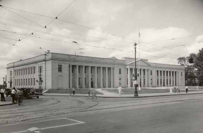
35°10′47.52″N 80°50′36.31″W / 35.1798667°N 80.8434194°WCharlotte 54 Liddell-McNinch House December 12, 1976 511 N. Church St.
35°13′53″N 80°50′23″W / 35.23139°N 80.83972°WCharlotte 55 Matthews Commercial Historic District 
August 22, 1996 157-195 and 156-196 N. Trade St., 118 E. Charles St.
35°6′59″N 80°43′20″W / 35.11639°N 80.72222°WMatthews 56 Mayes House August 5, 1993 435 E. Morehead St.
35°11′26″N 80°50′54″W / 35.19056°N 80.84833°WCharlotte 57 Albert McCoy Farm November 2, 2000 10401 McCoy Rd.
35°22′1″N 80°53′10″W / 35.36694°N 80.88611°WHuntersville 58 Samuel J. McElroy House February 21, 1991 10915 Beatties Ford Rd.
35°22′11″N 80°54′9″W / 35.36972°N 80.9025°WHuntersville 59 John Washington McKinney House February 21, 1991 7332 Providence Rd. W.
35°3′39″N 80°48′17″W / 35.06083°N 80.80472°WCharlotte Destroyed[5] 60 Frank Ramsay McNinch House June 3, 1999 2727 Sharon Ln.
35°9′39″N 80°49′9″W / 35.16083°N 80.81917°WCharlotte 61 Mecklenburg County Courthouse May 10, 1979 E. Trade, Alexander, and E. 4th Sts.
35°13′16″N 80°50′15″W / 35.22111°N 80.8375°WCharlotte 62 Mecklenburg Investment Company Building August 19, 1982 233 S. Brevard St.
35°13′22″N 80°50′32″W / 35.22278°N 80.84222°WCharlotte 63 Merchants and Farmers National Bank Building March 1, 1984 123 E. Trade St.
35°13′36″N 80°50′32″W / 35.22667°N 80.84222°WCharlotte 64 Green Morris Farm February 21, 1991 West side of NC 3628 approx. 1 miles S of jct. with Providence Rd. W.
35°2′56″N 80°47′56″W / 35.04889°N 80.79889°WCharlotte Destroyed[5] 65 Morrocroft November 28, 1983 2525 Richardson Dr.
35°9′35″N 80°49′22″W / 35.15972°N 80.82278°WCharlotte 66 Myers Park Historic District August 10, 1987 Roughly bounded by NC 16, E and W Queens Rd., and Lillington Ave.
35°11′33″N 80°49′59″W / 35.1925°N 80.83306°WCharlotte 67 Nebel Knitting Mill, Former September 5, 1991 101 W. Worthington Ave.
35°12′41″N 80°51′38″W / 35.21139°N 80.86056°WCharlotte 68 North Charlotte Historic District March 16, 1990 Roughly bounded by the Southern Railroad, Herrin St., Spencer St., and Charles Ave.
35°14′44″N 80°48′19″W / 35.24556°N 80.80528°WCharlotte 69 Orient Manufacturing Company-Chadwick-Hoskins No. 3 August 15, 2006 311 E. Twelfth St.
35°12′12″N 80°49′53″W / 35.20333°N 80.83139°WCharlotte 70 Overcarsh House July 21, 1983 326 W. 8th St.
35°13′58″N 80°50′30″W / 35.23278°N 80.84167°WCharlotte 71 Palmer Fire School August 25, 2004 2601 E. Seventh St.
35°12′20.92″N 80°48′37.42″W / 35.2058111°N 80.8103944°WCharlotte 72 Parks-Cramer Company Complex, Former March 7, 1994 2000 South Blvd.
35°12′35″N 80°51′40″W / 35.20972°N 80.86111°WCharlotte 73 Pharrsdale Historic District February 20, 2002 Bounded by Biltmore Dr. Cherokee Rd., Providence Rd. an Scotland Ave.
35°11′28″N 80°49′20″W / 35.19111°N 80.82222°WCharlotte 74 Philanthropic Hall, Davidson College April 13, 1972 Davidson College campus
35°29′57″N 80°50′47″W / 35.49917°N 80.84639°WDavidson 75 Pineville Commercial Historic District August 5, 2011 310-333 Main St. & 105-109 Dover St.
35°5′9″N 80°53′29″W / 35.08583°N 80.89139°WPineville 76 Pineville Mill Village Historic District August 8, 2011 Roughly bounded by Dover, Price & Hill Sts., Lakeview Dr. & Eden Ct.
35°4′50″N 80°53′44″W / 35.08056°N 80.89556°WPineville NRHP # 011000511 77 Potts Plantation January 5, 1998 South of Davidson and southwest of Cornelius, between NC 2693 and NC 115
35°28′45″N 80°50′13″W / 35.47917°N 80.83694°WCornelius 78 Providence Presbyterian Church and Cemetery 
June 1, 1982 10140 Providence Rd.
35°4′11″N 80°46′18″W / 35.06972°N 80.77167°WMatthews 79 Ramah Presbyterian Church and Cemetery February 21, 1991 NC 2439 .3 miles N of jct. with NC 2426
35°26′22″N 80°48′10″W / 35.43944°N 80.80278°WHuntersville 80 Robinson Rock House Ruin and Plantation Site January 22, 2009 Reedy Creek Park-2900 Rocky River Rd.
35°16′34.92″N 80°43′3.05″W / 35.2763667°N 80.7175139°WCharlotte 81 Rosedale September 11, 1972 3427 N. Tryon St.
35°15′26″N 80°47′36″W / 35.25722°N 80.79333°WCharlotte 82 Edward M. Rozzell House January 20, 2005 11647 Rozzelles Ferry Rd.
35°20′11″N 80°57′54″W / 35.33639°N 80.965°WCharlotte 83 Seaboard Air Line Railroad Passenger Station October 24, 1980 1000 N. Tyron St.
35°14′2″N 80°49′59″W / 35.23389°N 80.83306°WCharlotte 84 Fritz Seifart House December 20, 2006 421 Hempstead Place
35°12′2″N 80°48′56″W / 35.20056°N 80.81556°WCharlotte 85 Siloam School September 28, 2007 West side of Mallard Highlands Dr, Approx. 0.25 miles S from jct. of John Adams Rd.
35°20′10″N 80°44′20″W / 35.33611°N 80.73889°WCharlotte 86 Southern Asbestos Company Mills January 30, 2008 1000 Seaboard St.
35°14′21″N 80°50′41″W / 35.23917°N 80.84472°WCharlotte 87 St. Mark's Episcopal Church March 1, 1984 SR 2004; also the southern side of NC 2004 east of its junction with NC 2074
35°20′52″N 80°52′51″W / 35.34778°N 80.88083°WHuntersville Second location represents a boundary increase of February 21, 1991 88 Steele Creek Presbyterian Church and Cemetery February 21, 1991 7407 Steele Creek Rd.
35°11′3″N 80°57′23″W / 35.18417°N 80.95639°WCharlotte 89 Joseph Sykes Brothers Company Building May 1, 2003 1445 S. Mint St.
35°13′9″N 80°51′38″W / 35.21917°N 80.86056°WCharlotte 90 Textile Mill Supply Company Building February 5, 1999 1300 S. Mint St.
35°13′17″N 80°51′31″W / 35.22139°N 80.85861°WCharlotte 91 Thrift Mill, Former August 26, 1994 8300 Moore's Chapel Rd.
35°16′37″N 80°56′40″W / 35.27694°N 80.94444°WCharlotte 92 Daniel A. Tompkins Company Machine Shop, Former May 8, 2001 1900 South Boulevard
35°12′39″N 80°51′36″W / 35.21083°N 80.86°WCharlotte 93 Union Storage and Warehouse Company Building January 11, 2001 1000 W. Morehead St.
35°13′42″N 80°51′31″W / 35.22833°N 80.85861°WCharlotte 94 VanLandingham Estate October 13, 1983 2010 The Plaza
35°13′47″N 80°48′30″W / 35.22972°N 80.80833°WCharlotte 95 Victoria April 11, 1973 1600 The Plaza
35°13′26″N 80°48′37″W / 35.22389°N 80.81028°WCharlotte 96 Wesley Heights Historic District November 29, 1995 Bounded by W. Morehead St., Woodruff Pl., Lela Ave., CSX RR tracks, Tuckaseegee Rd., W. Trade St. and S. Summit Ave.
35°13′58″N 80°51′48″W / 35.23278°N 80.86333°WCharlotte 97 White Oak Plantation February 7, 1978 E of Charlotte on SR 2826
35°14′54″N 80°41′26″W / 35.24833°N 80.69056°WCharlotte See also
- National Register of Historic Places listings in North Carolina
- List of National Historic Landmarks in North Carolina
References
- ^ The latitude and longitude information provided in this table was derived originally from the National Register Information System, which has been found to be fairly accurate for about 99% of listings. For about 1% of NRIS original coordinates, experience has shown that one or both coordinates are typos or otherwise extremely far off; some corrections may have been made. A more subtle problem causes many locations to be off by up to 150 yards, depending on location in the country: most NRIS coordinates were derived from tracing out latitude and longitudes off of USGS topographical quadrant maps created under the North American Datum of 1927, which differs from the current, highly accurate WGS84 GPS system used by Google maps. Chicago is about right, but NRIS longitudes in Washington are higher by about 4.5 seconds, and are lower by about 2.0 seconds in Maine. Latitudes differ by about 1.0 second in Florida. Some locations in this table may have been corrected to current GPS standards.
- ^ "National Register of Historic Places: Weekly List Actions". National Park Service, United States Department of the Interior. Retrieved on November 10, 2011.
- ^ Numbers represent an ordering by significant words. Various colorings, defined here, differentiate National Historic Landmark sites and National Register of Historic Places Districts from other NRHP buildings, structures, sites or objects.
- ^ "National Register Information System". National Register of Historic Places. National Park Service. 2008-04-24. http://nrhp.focus.nps.gov/natreg/docs/All_Data.html.
- ^ a b c d e "North Carolina Listings in the National Register of Historic Places by County". North Carolina State Historic Preservation Office. 22 October 2008. http://www.hpo.ncdcr.gov/nrlist.htm. Retrieved 14 July 2009.
National Register of Historic Places listings in North Carolina by county. Counties - Alamance
- Alexander
- Alleghany
- Anson
- Ashe
- Avery
- Beaufort
- Bertie
- Bladen
- Brunswick
- Buncombe
- Burke
- Cabarrus
- Caldwell
- Camden
- Carteret
- Caswell
- Catawba
- Chatham
- Cherokee
- Chowan
- Clay
- Cleveland
- Columbus
- Craven
- Cumberland
- Currituck
- Dare
- Davidson
- Davie
- Duplin
- Durham
- Edgecombe
- Forsyth
- Franklin
- Gaston
- Gates
- Graham
- Granville
- Greene
- Guilford
- Halifax
- Harnett
- Haywood
- Henderson
- Hertford
- Hoke
- Hyde
- Iredell
- Jackson
- Johnston
- Jones
- Lee
- Lenoir
- Lincoln
- Macon
- Madison
- Martin
- McDowell
- Mecklenburg
- Mitchell
- Montgomery
- Moore
- Nash
- New Hanover
- Northampton
- Onslow
- Orange
- Pamlico
- Pasquotank
- Pender
- Perquimans
- Person
- Pitt
- Polk
- Randolph
- Richmond
- Robeson
- Rockingham
- Rowan
- Rutherford
- Sampson
- Scotland
- Stanly
- Stokes
- Surry
- Swain
- Transylvania
- Tyrrell
- Union
- Vance
- Wake
- Warren
- Washington
- Watauga
- Wayne
- Wilkes
- Wilson
- Yadkin
- Yancey
 Category:National Register of Historic Places in North Carolina •
  Portal:National Register of Historic Places
U.S. National Register of Historic Places Topics Lists by states Alabama • Alaska • Arizona • Arkansas • California • Colorado • Connecticut • Delaware • Florida • Georgia • Hawaii • Idaho • Illinois • Indiana • Iowa • Kansas • Kentucky • Louisiana • Maine • Maryland • Massachusetts • Michigan • Minnesota • Mississippi • Missouri • Montana • Nebraska • Nevada • New Hampshire • New Jersey • New Mexico • New York • North Carolina • North Dakota • Ohio • Oklahoma • Oregon • Pennsylvania • Rhode Island • South Carolina • South Dakota • Tennessee • Texas • Utah • Vermont • Virginia • Washington • West Virginia • Wisconsin • WyomingLists by territories Lists by associated states Other Municipalities and communities of Mecklenburg County, North Carolina City 
Towns Cornelius | Davidson‡ | Huntersville | Matthews | Midland‡ | Mint Hill‡ | Pineville | Stallings‡ | Weddington‡
Unincorporated
communitiesCaldwell | Hopewell
Footnotes ‡This populated place also has portions in an adjacent county or counties
Categories:- Mecklenburg County, North Carolina
- National Register of Historic Places in North Carolina
- Buildings and structures in Mecklenburg County, North Carolina
-


Wikimedia Foundation. 2010.