- Leeds
-
This article is about the city of Leeds in England. For the administrative district, see City of Leeds. For other uses, see Leeds (disambiguation).
Leeds — City and Metropolitan Borough — City of Leeds The Headrow, Leeds city centre at night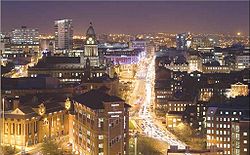
Coat of armsNickname(s): "Knightsbridge of the North"[1] Motto: "Pro rege et lege" "For king and the law" Leeds shown within England
Coordinates: 53°47′59″N 1°32′57″W / 53.79972°N 1.54917°W Sovereign state United Kingdom Constituent country England Region Yorkshire and the Humber Ceremonial county West Yorkshire Admin HQ Leeds city centre Borough Charter 1207 Town Charter 1626 City status 1893 City of Leeds Met. District created 1974 Government – Type Metropolitan borough, City – Governing body Leeds City Council – Lord Mayor Cllr James McKenna (L) – Leader of the Council Cllr Keith Wakefield (L) – Chief Executive Tom Riordan – MPs: Stuart Andrew (C)
Ed Balls (L)
Alec Shelbrooke (C)
Hilary Benn (L)
Fabian Hamilton (L)
George Mudie (L)
Greg Mulholland (LD)
Rachel Reeves (L)Area – Total 213 sq mi (551.72 km2) Elevation 33–1,115 ft (10–340 m) Population (2010 est.) – Total 798,800 (Ranked 2nd) – Density 3,574/sq mi (1,380/km2) – Ethnicity
(2001 census)[2]89.1% White
5.4% Asian or Asian British
2.0% Black or Black British
1.7% Mixed Race
1.8% Chinese and otherDemonym Loiner/Leodensian Time zone Greenwich Mean Time (UTC+0) – Summer (DST) British Summer Time (UTC+1) Postcode LS,part of WF and also part of BD. Area code(s) 0113 (urban core)
01924 (Wakefield nos)
01937 (Wetherby/ Boston Spa)
01943 (Guiseley/ Otley)
01977 (Pontefract nos)ISO 3166-2 GB-LDS ONS code 00DA NUTS 3 UKE42 OS grid reference SE296338 Euro. Parlt. Const. Yorkshire & the Humber Website www.leeds.gov.uk Coordinates: 53°47′59″N 1°32′57″W / 53.79972°N 1.54917°W Leeds (pronounced /ˈliːdz/ (
 listen)) is a city and metropolitan borough in West Yorkshire, England.[3] In 2001 Leeds' main urban subdivision had a population of 443,247,[4] while the entire city had a population of 787,700 (2009 est.)[5] making it the 30th-most populous city in the European Union.
Leeds is the cultural, financial and commercial heart of the West Yorkshire Urban Area,[6][7][8] which at the 2001 census had a population of 1.5 million,[9] and the Leeds city region, an economic area with Leeds at its core, had a population of 2.9 million.[10] Leeds is the UK's largest centre for business, legal, and financial services outside London,[11][12][13][14][15] and its office market is the best in Europe for value.[16]
Historically a part of the West Riding of Yorkshire, Leeds can trace its recorded history to the 5th century when the Kingdom of Elmet was covered by the forest of "Loidis", the origin of the name Leeds. The name has been applied to many administrative entities over the centuries. It changed from being the appellation of a small manorial borough, in the 13th century, through several incarnations, to being the name attached to the present metropolitan borough. In the 17th and 18th centuries Leeds became a major centre for the production and trading of wool. Then, during the Industrial Revolution, Leeds developed into a major industrial centre; wool was still the dominant industry but flax, engineering, iron foundries, printing, and other industries were important.[17] From being a compact market town in the valley of the River Aire in the 16th century Leeds expanded and absorbed the surrounding villages to become a populous urban centre by the mid-20th century.
Public transport, rail and road communications networks in the region are focused on Leeds and there are a number of twinning arrangements with towns and cities in other countries. Its assigned role in the Leeds City Region partnership recognises the city's importance to regional economic development.
Contents
History
Main article: History of LeedsToponymy
The name Leeds derives from "Loidis", the name given to a forest covering most of the Brythonic kingdom of Elmet, which existed during the 5th century into the early 7th century.[18] Bede states in the fourteenth chapter of his Historia ecclesiastica, in a discussion of an altar surviving from a church erected by Edwin of Northumbria, that it is located in "...regione quae vocatur Loidis", the region known as Loidis. An inhabitant of Leeds is locally known as a Loiner, a word of uncertain origin.[19]
Economic development
 The Leeds Corn Exchange opened in 1864.
Leeds developed as a market town in the Middle Ages as part of the local agricultural economy. Prior to the Industrial Revolution it had become a co-ordination centre for the making of woollen cloth; with white broadcloth being traded at the Leeds White Cloth Hall.[20] Leeds was handling one sixth of England's export trade in 1770.[21] Growth, initially in textiles, was accelerated by the building of the Aire and Calder Navigation in 1699 and the Leeds and Liverpool Canal in 1816.[22] The railway network constructed around Leeds, starting with the Leeds and Selby Railway in 1834, provided improved communications with national markets and, significantly for its development, an east-west connection with Manchester and the ports of Liverpool and Hull giving improved access to international markets.[23] Alongside technological advances and industrial expansion, Leeds retained an interest in trading in agricultural commodities, with the Corn Exchange opening in 1864.
Marshall's Mill was one of the first of the many factories that were to be constructed in Leeds from around 1790.[24] In the early years the most significant of the factories were woollen finishing and flax mills; diversifying by 1914 to printing, engineering, chemicals and clothing manufacture.[25] Decline in manufacturing during the 1930s was temporarily reversed by a switch to producing military uniforms and munitions during World War II. However, by the 1970s the clothing industry was in irreversible decline, facing cheap foreign competition.[26] The contemporary economy of Leeds has been shaped by Leeds City Council having the vision of building a '24 hour European city' and a 'capital of the north'.[27] It has developed from the decay of the post-industrial era to become a telephone banking centre, connected to the electronic infrastructure of the modern global economy.[27] There has been growth in the corporate and legal sectors[28] and increased local affluence has led to an expanding retail sector, including the luxury goods market.[29] In 2011 it was announced that Leeds will become an enterprise zone, which will help small businesses in the region to increase economic growth.[30][31]
Local government
Main article: History of local government in YorkshireLeeds (parish) population 1881 160,109 1891 177,523 1901 177,920 1911 259,394 1921 269,665 1931 482,809 1941 war # 1951 505,219 1961 510,676 # no census was held due to war source: UK census[32] Leeds was a manor and township in the large ancient parish of Leeds St Peter, in the Skyrack wapentake of the West Riding of Yorkshire.[33] The Borough of Leeds was created in 1207, when Maurice Paynel, lord of the manor, granted a charter to a small area within the manor, close to the river crossing, in what is now the city centre. Four centuries later, the inhabitants of Leeds petitioned Charles I for a charter of incorporation, which was granted in 1626. The new charter incorporated the entire parish, including all eleven townships, as the Borough of Leeds and withdrew the earlier charter. Improvement commissioners were set up in 1755 for paving, lighting, and cleansing of the main streets, including Briggate; with further powers added in 1790 to improve the water supply.[34]
The borough corporation was reformed under the provisions of Municipal Corporations Act 1835. Leeds Borough Police force was formed in 1836 and Leeds Town Hall was completed by the corporation in 1858. In 1866 Leeds, and each of the other townships in the borough, became a civil parish. The borough became a county borough in 1889, giving it independence from the newly formed West Riding County Council and it gained city status in 1893. In 1904 the Leeds parish absorbed Beeston, Chapel Allerton, Farnley, Headingley cum Burley and Potternewton from within the borough. In the twentieth century the county borough initiated a series of significant territorial expansions, growing from 21,593 acres (87.38 km2) in 1911 to 40,612 acres (164.35 km2) in 1961.[35] In 1912 the parish and county borough of Leeds absorbed Leeds Rural District, consisting of the parishes of Roundhay and Seacroft; and Shadwell, which had been part of Wetherby Rural District. On 1 April 1925 the parish of Leeds was expanded to cover the whole borough.[33]
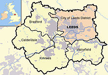
The county borough was abolished on 1 April 1974 and its former area was combined with that of the municipal boroughs of Morley and Pudsey; the urban districts of Aireborough, Horsforth, Otley, Garforth and Rothwell; and parts of the rural districts of Tadcaster, Wetherby and Wharfedale.[36] This area was used to form a new metropolitan district in the county of West Yorkshire; it gained both borough and city status and is known as the City of Leeds. Initially, local government services were provided by Leeds City Council and West Yorkshire County Council. However, the county council was abolished in 1986 and the city council absorbed its functions, with some powers passing to organisations such as the West Yorkshire Passenger Transport Authority. From 1988 two run-down and derelict areas close to the city centre were designated for regeneration and formed the area of responsibility of Leeds Development Corporation, outside the planning remit of the city council.[37] Planning powers were restored to the local authority in 1995 when the development corporation was wound up.
Suburban growth
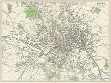 1866 map of Leeds
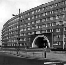 Quarry Hill flats
In 1801, 42% of the population of Leeds lived outside the township, in the wider borough. Cholera outbreaks in 1832 and 1849 caused the borough authorities to address the problems of drainage, sanitation and water supply. Water was originally pumped from the River Wharfe, but by 1860 it was too heavily polluted to be usable. Following the Leeds Waterworks Act of 1867 three reservoirs were built at Lindley Wood, Swinsty and Fewston, to the north of Leeds.[38] Residential growth occurred in Holbeck and Hunslet from 1801 to 1851, but, as these townships became industrialised new areas were favoured for middle class housing.[39] Land to the south of the river was henceforth developed, primarily for industry and secondarily for back-to-back workers' dwellings. The Leeds Improvement Act 1866 sought to improve the quality of working class housing by restricting the number of homes that could be built in a single terrace.[40] Holbeck and Leeds formed a continuous built-up area by 1858, with Hunslet nearly meeting them.[41] In the latter half of the nineteenth century, population growth in Hunslet, Armley and Wortley outstripped that of Leeds itself. When pollution became a problem, the wealthier residents left the small industrial conurbation to live in the northerly villages of Headingley, Potternewton and Chapel Allerton; this led to a 50% increase in the population of Headingley and Burley from 1851 to 1861. The middle class flight from the industrial areas also led to development beyond the borough at Roundhay and Adel.[41] The introduction of the electric tramway led to intensification of development in Headingley and Potternewton and expansion outside the borough into Roundhay.[42]
Two private gas supply companies were taken over by the corporation in 1870 and this new municipal supply was used to provide street lighting and cheaper gas to homes. From the early 1880s the Yorkshire House-to-House Electricity Company supplied electricity to Leeds until it was also purchased by Leeds Corporation and became a municipal supply.[43]
Slum clearance and rebuilding began in Leeds in the Inter-war period when over 18,000 houses were built by the council on 24 estates in places like Cross Gates, Middleton, Gipton, Belle Isle and Halton Moor. The slums of Quarry Hill were replaced by the innovative Quarry Hill flats, which were demolished in 1975. Another 36,000 houses were built by private sector builders, creating the suburbs of Gledhow, Moortown, Alwoodley, Roundhay, Colton, Whitkirk, Oakwood, Weetwood and Adel. After 1949 a further 30,000 sub-standard houses were demolished by the council to be replaced by a total of 151 medium-rise and high-rise blocks of council flats in estates like Seacroft, Armley Heights, Tinshill and Brackenwood.[44]
Recently, Leeds has seen great local expenditure on regenerating the city, attracting in investments and flagship projects,[45] as found in Leeds city centre. Many buildings have already been built, boasting luxurious penthouse apartments,[46] very close to the city centre.
Geography
 Map of Leeds in West Yorkshire
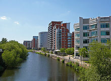 River Aire in Leeds
At 53°47′59″N 1°32′57″W / 53.79972°N 1.54917°W (53.799°, −1.549°), and 190 miles (310 km) north-northwest of central London, the central area of Leeds is located on the River Aire in a narrow section of the Aire Valley, which is in the eastern foothills of the Pennines. The city centre lies at about 206 feet (63 m) above sea level while the district ranges from 1,115 feet (340 m) in the far west on the slopes of Ilkley Moor to about 33 feet (10 m) where the rivers Aire and Wharfe cross the eastern boundary. The centre of Leeds is part of a continuously built-up area extending to Pudsey, Bramley, Horsforth, Alwoodley, Seacroft, Middleton and Morley.[47] Leeds has the second highest population of any local authority district in the UK (after Birmingham), and the second greatest area of any English metropolitan district (after Doncaster), extending 15 miles (24 km) from east to west, and 13 miles (21 km) from north to south. The northern boundary follows the River Wharfe for several miles but crosses the river to include the section of Otley which lies north of the river. Over 65% of the Leeds district is green belt land and the city centre is less than twenty miles (32 km) from the Yorkshire Dales National Park,[48] which offers some of the most spectacular scenery and countryside in the UK.[49] Inner and southern areas of Leeds lie on a layer of coal measure sandstones. To the north parts are built on older sand and gritstones and to the east it extends into the magnesian limestone belt.[24][50] The land use in the central areas of Leeds is overwhelmingly urban.[47]
Attempts to define the exact geographic meaning of Leeds lead to a variety of concepts of its extent, varying by context; they include the area of the city centre, the urban sprawl, the administrative boundaries, and the functional region.[51]
“ Leeds is much more a generalised concept place name in inverted commas, it is the city, but it is also the commuter villages and the region as well. ” —A History of Modern Leeds, Brian Thompson[51]
Leeds city centre is contained within the Leeds Inner Ring Road, formed from parts of the A58 road, A61 road, A64 road, A643 road and the M621 motorway. Briggate, the principal north-south shopping street, is pedestrianised and Queen Victoria Street, a part of the Victoria Quarter, is enclosed under a glass roof. Millennium Square is a significant urban focal point. The Leeds postcode area covers most of the City of Leeds[52] and is almost entirely made up of the Leeds post town.[53] Otley, Wetherby, Tadcaster, Pudsey and Ilkley are separate post towns within the postcode area.[53] Aside from the built up area of Leeds itself, there are a number of suburbs and exurbs within the district.
Climate
 Sunny day at Park Square
Leeds has a climate that is oceanic, greatly influenced by the Atlantic and the Pennines. Summers are usually mild, with plenty of rain, while winters are chilly, cloudy with occasional snow and frost. Spring and autumn are mild but snow and frost are not unheard of.
July is the hottest month, with a mean temperature of 16 °C (61 °F), while the coldest month is January, with a mean temperature of 3 °C (37 °F). Temperatures above 27 °C and below −10 °C are not very common but can happen occasionally. Temperatures at Leeds Bradford Airport fell to −12.6 °C (9.3 °F) in December 2010[54] and reached 31.8 °C (89.2 °F) at Leeds city centre in August 2003.[55]
Being located on the eastern side of the Pennines, Leeds is amongst the driest cities in the United Kingdom, with an annual rainfall of 660 mm (25.98 in). Snowfall is common, but increases with altitude. Most snow falls in the months of December, January and February but can also fall in November, March and April. Frost is common, and usually occurs from November until April but can occur in October, June and September. Fog mainly occurs in autumn and winter, and Leeds can be susceptible to fog from the North Sea.
Extreme weather in Leeds is a relatively rare occurrence. Thunderstorms, blizzards, gale force winds and even tornadoes have struck the city on numerous occasions, though the latter are very rare, and the last reported tornado occurred on 14 September 2006, causing trees to uproot and signal failures at Leeds City railway station.[56]
Climate data for Leeds Month Jan Feb Mar Apr May Jun Jul Aug Sep Oct Nov Dec Year Average high °C (°F) 5.8
(42.4)5.9
(42.6)8.7
(47.7)11.3
(52.3)15.0
(59.0)18.2
(64.8)19.9
(67.8)19.9
(67.8)17.3
(63.1)13.4
(56.1)8.8
(47.8)6.7
(44.1)12.58
(54.64)Daily mean °C (°F) 3.0
(37.4)3.0
(37.4)5.1
(41.2)7.2
(45.0)10.2
(50.4)13.5
(56.3)15.5
(59.9)15.2
(59.4)13
(55)9.8
(49.6)5.8
(42.4)3.8
(38.8)8.76
(47.76)Average low °C (°F) 0.3
(32.5)0.2
(32.4)1.6
(34.9)3.1
(37.6)5.5
(41.9)8.5
(47.3)10.4
(50.7)10.5
(50.9)8.7
(47.7)6.3
(43.3)2.9
(37.2)1.2
(34.2)4.93
(40.88)Precipitation mm (inches) 61
(2.4)45
(1.77)52
(2.05)48
(1.89)54
(2.13)54
(2.13)51
(2.01)65
(2.56)57
(2.24)55
(2.17)57
(2.24)61
(2.4)660
(25.98)Avg. precipitation days 17.5 14.2 14.8 13.5 13.7 12.2 11.7 13.2 12.9 15.1 16.5 17.0 172.3 Source: [57] Demography
Urban subdivision
Leeds compared Leeds urban subdivision within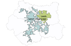
the West Yorkshire urban area2001
UK CensusLeeds
USDLeeds
districtWest
Yorks UAEngland Population 443,247 715,402 1,499,465 49,138,831 White 88.4% 91.9% 85.5% 90.9% Asian 6.4% 4.5% 11.2% 4.6% Black 2.2% 1.4% 1.3% 2.3% Source: Office for National Statistics[58][59] At the time of the United Kingdom Census 2001, the Leeds urban subdivision occupied an area of 109 square kilometres (42 sq mi) and had a population of 443,247; making it the fourth most populous urban subdivision within England and the fifth largest within the United Kingdom. The population density was 4,066 inhabitants per square kilometre (10,530 /sq mi), slightly higher than the rest of the West Yorkshire Urban Area. It accounts for 20% of the area and 62% of the population of the City of Leeds. The population of the urban subdivision had a 100 to 93.1 female–male ratio.[60] Of those over 16 years old, 39.4% were single (never married) and 35.4% married for the first time.[61] The urban subdivision's 188,890 households included 35% one-person, 27.9% married couples living together, 8.8% were co-habiting couples, and 5.7% single parents with their children. Leeds is the largest component of the West Yorkshire Urban Area[47] and is counted by Eurostat as part of the Leeds-Bradford Larger Urban Zone. The Leeds travel to work area in 2001 included all of the City of Leeds, a northern strip of the City of Bradford, the eastern part of Kirklees, and a section of southern North Yorkshire; it occupies 751 square kilometres (290 sq mi).
Metropolitan district
As of the 2001 UK census, the district had a total population of 715,402.[62] Of the 301,614 households in Leeds, 33.3% were married couples living together, 31.6% were one-person households, 9.0% were co-habiting couples and 9.8% were lone parents, following a similar trend to the rest of England.[63] The population density was 1,967 /km2 (5,090 /sq mi)[63] and for every 100 females, there were 93.5 males.
The majority of people in Leeds identify themselves as Christian.[64] The proportion of Muslims (3.0% of the population) is average for the country.[64] Leeds has the third-largest Jewish community in the United Kingdom, after those of London and Manchester. The areas of Alwoodley and Moortown contain sizeable Jewish populations.[65] 16.8% of Leeds residents in the 2001 census declared themselves as having "no religion", which is broadly in line with the figure for the whole of the UK (also 8.1% "religion not stated"). The crime rate in Leeds is well above the national average, like many other English major cities.[66][67] In July 2006, the think tank Reform calculated rates of crime for different offences and has related this to populations of major urban areas (defined as towns over 100,000 population). Leeds was 11th in this rating (excluding London boroughs, 23rd including London boroughs).[68] The table below details the population of the current area of the district since 1801, including the percentage change since the last available census data.
Population growth in City of Leeds since 1801 Year 1801 1811 1821 1831 1841 1851 1861 1871 1881 1891 1901 1911 1921 1931 1941 1951 1961 1971 1981 1991 2001 Population 94,421 108,459 137,476 183,015 222,189 249,992 311,197 372,402 433,607 503,493 552,479 606,250 625,854 646,119 668,667 692,003 715,260 739,401 696,732 716,760 715,404 % change – +14.87 +26.75 +33.13 +21.40 +12.51 +24.48 +19.67 +16.44 +16.12 +9.73 +9.73 +3.23 +3.24 +3.49 +3.49 +3.36 +3.38 −5.77 +2.87 −0.19 Source: Vision of Britain[69] Government
 Leeds Civic Hall is the seat of local government
City of Leeds is the local government district covering Leeds and the local authority is Leeds City Council. The council is composed of 99 councillors, three for each of the city's wards. Elections are held three years out of four, on the first Thursday of May. One third of the councillors are elected, for a four year term, in each election. In 2004 all seats were up for election due to boundary changes. The council is currently controlled by Labour. West Yorkshire does not have a county council, so Leeds City Council is the primary provider of local government services for the city. The district is in the Yorkshire and the Humber region of England, and consists of an unparished area and 31 civil parishes. These are the lowest tier of local government[70] and absorb some limited functions from Leeds City Council in their areas. The councils of Horsforth, Morley, Otley and Wetherby are town councils.[71] There are 27 other civil parishes in the district.
The district is represented by eight MPs, for the constituencies of Elmet and Rothwell (Alec Shelbrooke, Conservative); Leeds Central (Hilary Benn, Labour); Leeds East (George Mudie, Labour); Leeds North East (Fabian Hamilton, Labour); Leeds North West (Greg Mulholland, Lib Dem); Leeds West (Rachel Reeves, Labour); Morley and Outwood (constituency shared with City of Wakefield) (Ed Balls, Labour); and Pudsey (Stuart Andrew, Conservative). Leeds is within the Yorkshire and the Humber European constituency, which is represented by two Conservative, one Labour, one UKIP, one Liberal Democrat and one BNP MEPs. The voting figures for Leeds in the European Parliament election in June 2009 were: Conservative 22.6%, Labour 21.4%, UKIP 15.9%, Lib Dem 13.8%, BNP 10.0%, Green 9.4%.[72]
Economy
Main article: Economy of Leeds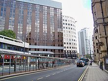 Leeds' Financial District
Leeds has a diverse economy with employment in the service sector now far exceeding that in the traditional manufacturing industries. In 2002, 401,000 employees were registered in the Leeds district. Of these 24.7% were in public administration, education and health, 23.9% were in banking, finance and insurance and 21.4% were in distribution, hotels and restaurants. It is in the banking, finance and insurance sectors that Leeds differs most from the financial structure of the region and the nation.[73] The city is the location of one of the largest financial centres in England outside London.[11][15][74][75][76][77] Tertiary industries such as retail, call centres, offices and media have contributed to a high rate of economic growth. The city also hosts the only subsidiary office of the Bank of England in the UK. In 2006 GVA for city was recorded at £16.3 billion,[78] with the entire Leeds City Region generating an economy of £46 billion.[79]
The extensive retail area of Leeds is identified as the principal regional shopping centre for the whole of the Yorkshire and the Humber region and approximately 3.2 million people live within its catchment area.[80] There are a number of indoor shopping centres in the middle of the city, including the Merrion Centre, Leeds Shopping Plaza, St John's Centre, Headrow Centre, the Victoria Quarter, The Light and the Corn Exchange. In total there are approximately 1,000 retail stores, with a combined floorspace of 2,264,100 square feet (210,340 m2).[80] Of the 40,000 people who work in retailing in Leeds 75% work in places which are not located in the city centre. There are additional shopping centres located in the many villages that became part of the county borough and in the towns that were incorporated in the City of Leeds in 1974.[81]
Office developments, also traditionally located in the inner area, have expanded south of the River Aire and total 11,000,000 square feet (1,000,000 m2) of space.[80] In the period from 1999 to 2008 £2.5bn of property development was undertaken in central Leeds; of which £711m has been offices, £265m retail, £389m leisure and £794m housing. Manufacturing and distribution uses accounts for £26m of new property development in the period. There are 130,100 jobs in the city centre, accounting for 31% of all jobs in the wider district. In 2007, 47,500 jobs were in finance and business, 42,300 in public services, and 19,500 in retail and distribution. 43% of finance sector jobs in the district are contained in Leeds city centre and 44% of those employed in the city centre live more than nine kilometres away.[80] Tourism is important to the Leeds economy, in 2009 Leeds was the 8th most visited city in England by UK visitors.[82] and the 13th most visited city by overseas visitors.[83]
In January 2011, Leeds was named as one of five "cities to watch" in a report published by Centre for Cities.[84] The report shows that the average resident in Leeds earns £471 per week,[85] seventeenth nationally, 30.9% of Leeds residents had NVQ4+ high level qualifications,[86] fifteenth nationally, and Leeds' employment rate stands at 70.4% in 2010, twenty-fifth nationally, but was the only major city, along with Bristol, to have an employment rate at or above the national average.[87] It also shows that Leeds will be the least effected major city by welfare cuts in 2014/2015, with welfare cuts of -£125 per capita predicted, compared to -£192 in Liverpool and -£175 in Glasgow.[88] Yet despite the affluence of Leeds, much of the city retains a strongly working class tradition, and the economic progress of recent decades has also been accompanied by poverty: much of inner city Leeds remains deprived, with areas like Gipton, Middleton, Belle-Isle, Harehills, Burmantofts, Bramley, Armley, Kirkstall and Seacroft containing streets and areas of council housing that are among the poorest and most deprived areas in the whole of the UK.
Landmarks
Leeds displays a variety of natural and built landmarks. Natural landmarks include such diverse sites as the gritstone outcrop of Otley chevin and the Fairburn Ings RSPB reserve. The city's parks at Roundhay and Temple Newsam have long been owned and maintained by the council for the benefit of ratepayers and among the open spaces in the centre of Leeds are Millennium Square, Leeds City Square, Park Square and Victoria Gardens. This last is the site of the central city war memorial: there are 42 other war memorials in the suburbs, towns and villages in the district.[89]
The built environment embraces edifices of civic pride like Morley Town Hall and the trio of buildings in Leeds, Leeds Town Hall, Corn Exchange and Leeds City Museum by the architect Cuthbert Brodrick. The two startlingly white buildings on the Leeds skyline are the Parkinson building of Leeds University and the Civic Hall, with golden owls adorning the tops of its twin spires.[90] Armley Mills, Tower Works, with its campanile-inspired towers, and the Egyptian-style Temple Works hark back to the city's industrial past, while the site and ruins of Kirkstall Abbey display the beauty and grandeur of Cistercian architecture. Notable churches are Leeds Parish Church, St George's Church and Leeds Cathedral, in the city centre, and the Church of St John the Baptist, Adel and Bardsey Parish Church in quieter locations.
The 112 metres (367 ft) tower of Bridgewater Place, also known as The Dalek, is part of a major office and residential development and the region's tallest building; it can be seen for miles around.[91] Among other tower blocks the 37-storey Sky Plaza to the north of the city centre stands on higher ground so that its 106 metres (348 ft) is higher than Bridgewater Place.
Elland Road (football) and Headingley Stadium (cricket and rugby) are well known to sports enthusiasts and the White Rose Centre is a well known retail outlet.
 The Leeds skyline viewed from the south
Transport
Main article: Transport in LeedsLeeds is the starting-point of the A62, A63, A64, A65 and A660 roads, and is also situated on the A58 and A61. The M1 and M62 intersect to its south and the A1(M) passes to the east. Leeds is one of the principal hubs of the northern motorway network. Additionally, there is an urban motorway network; the radial M621 takes traffic into central Leeds from the M62 and M1. There is an Inner Ring Road with part motorway status and an Outer Ring Road. Part of the city centre[92] is pedestrianised, and is encircled by the clockwise-only Loop Road.
 Leeds City Station
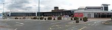 The terminal of Leeds Bradford International Airport.
Public transport in the Leeds area is coordinated and developed by West Yorkshire Metro,[93] with service information provided by Leeds City Council[94] and West Yorkshire Metro. The primary means of public transportation in Leeds are the bus services. The main provider is First Leeds and Arriva Yorkshire serves routes to the south of the city. Leeds City bus station is at Dyer Street and is used by bus services to towns and cities in Yorkshire, plus a small number of local services. Adjacent to it is the coach station for National Express coach services. Buses out of the city are mainly provided by FirstBus and Arriva Yorkshire. Harrogate & District provides a service to Harrogate and Ripon. Keighley & District provides a service to Shipley, Bingley and Keighley. The Yorkshire Coastliner service runs from Leeds to Bridlington, Filey, Scarborough and Whitby via York and Malton. Stagecoach provides a service to Hull via Goole.
From Leeds railway station at New Station Street, MetroTrains operated by Northern Rail run to Leeds' suburbs and onwards to all parts of Leeds City Region. The station is one of the busiest in England outside London, with over 900 trains and 50,000 passengers passing through every day.[95] It provides national and international connections as well as services to local and regional destinations. The station itself has 17 platforms, making it the largest in England outside London.[96]
Leeds Bradford International Airport is located in Yeadon, about 10 miles (16 km) to the north-west of the city centre, and has both charter and scheduled flights to destinations within Europe plus Egypt, Pakistan, Turkey and the USA. There are connections to the rest of the world via London Gatwick Airport, Paris Charles de Gaulle Airport and Amsterdam Schiphol Airport.There is a direct rail service from Leeds to Manchester Airport. Robin Hood Airport Doncaster Sheffield is 40 miles (64 km) south-east of Leeds. Leeds has connections by road, rail and coach to Hull, only an hour away, from where it is possible to travel to Rotterdam and Zeebrugge by ferry services run by P&O Ferries.
Walking
The Leeds Country Way is a waymarked circular walk of 62 miles (100 km) through the rural outskirts of the city, never more than 7 miles (11 km) from City Square. The Meanwood Valley Trail leads from Woodhouse Moor along Meanwood Beck to Golden Acre Park. The Leeds extension of the Dales Way follows the Meanwood Valley Trail before it branches off to head towards Ilkley and Windermere. Leeds is on the northern section of the Trans Pennine Trail for walkers and cyclists, and the towpath of the Leeds and Liverpool Canal is another popular walking route. In addition, there are many parks and public footpaths in both the urban and rural parts of Leeds, and the Ramblers' Association, YHA and other walking organisations offer sociable walks. The Ramblers' Association publish various booklets of walks in and around Leeds.[97]
Education
Schools
At the time of the 2001 census Leeds had a population of 183,000 young people aged 0–19 of whom 110,000 were attending local authority schools.[98] In 2008 Education Leeds, a non-profit company owned by Leeds City Council, provided for 220 primary schools, 39 secondary schools and 6 special inclusive learning centres.[99] Under the government Building Schools for the Future initiative, Leeds secured £260m, to transform 13 secondary schools into high achieving, e-confident, inclusive schools. The first three of these schools at Allerton High School, Pudsey Grangefield School and Rodillian School, were opened in September 2008.[100] Because Leeds has a falling birth rate, the council has come under pressure in recent years to reduce the number of school places resulting in the merger and closure of some schools. The city's oldest and largest private school is The Grammar School at Leeds, which was legally re-created in 2005 following the merger of Leeds Grammar School, established 1552, and Leeds Girls' High School, established 1857. Other independent schools in Leeds include faith schools serving the Jewish[101] and Muslim[102] communities.
Further and higher education
Further education in Leeds is provided by Leeds City College (formed by a merger in 2009 and having over 60,000 students), Leeds College of Building and Notre Dame Catholic Sixth Form College. The city has two universities: the University of Leeds – which received its charter in 1904 having developed from the Yorkshire College which was founded in 1874 and the Leeds School of Medicine of 1831, and Leeds Metropolitan University became a university in 1992 but can trace its roots to the Mechanics Institute of 1824. The University of Leeds has a total of about 31,000 students, of which 21,500 are full-time or sandwich undergraduate degree students,[103] Leeds Metropolitan University has a total of 52,000 students of which 12,000 are full time or sandwich undergraduate degree students and 2,100 full time or sandwich HND students.[104] Other higher education establishments are:Leeds Trinity University College with just under 3,000 students,[105] Leeds College of Art, Leeds College of Music and Northern School of Contemporary Dance. The city was voted the Best UK University Destination by a survey in The Independent newspaper.[106] The combined totals of learners give Leeds one of the largest student populations in the country with over 250,000 students.[107]
Culture
See also: Culture of LeedsMedia
See also: Category:Television shows set in Leeds and Category:Films set in Leeds BBC Yorkshire studios
Yorkshire Post Newspapers Ltd, owned by Johnston Press plc, is based in the city, and produces a daily morning broadsheet, the Yorkshire Post, and an evening paper, the Yorkshire Evening Post (YEP). The YEP has a website which includes a series of community pages which focus on specific areas of the city.[108] The Wetherby News covers mainly areas within the north eastern sector of the district, and the Wharfedale & Airedale Observer, published in Ilkley, covers the north west, both appearing weekly. Both of the universities have student newspapers, the weekly Leeds Student from the University of Leeds and the monthly The Met from Leeds Metropolitan University. The Leeds Guide is a fortnightly listings magazine, established in 1997. Free publications include the Leeds Weekly News, produced by Yorkshire Post Newspapers in four geographic versions and distributed to households in the main urban area of the city,[109] and the regional version of Metro which is distributed on buses and at railway stations.
Regional television and radio stations have bases in the city; BBC Television and ITV both have regional studios and broadcasting centres in Leeds. ITV Yorkshire, formerly Yorkshire Television, broadcasts from The Leeds Studios on Kirkstall Road. There are a number of independent film production companies, including the not-for-profit cooperative Leeds Animation Workshop, founded in 1978; community video producers Vera Media and several small commercial production companies. BBC Radio Leeds, Radio Aire, Magic 828, Capital Yorkshire, Real Radio and Yorkshire Radio broadcast from the city. LSRfm.com, is based in Leeds University Union, and regularly hosts outside broadcasts around the city. Many communities within Leeds now have their own local radio stations, such as East Leeds FM and Tempo FM for Wetherby and the surrounding areas. Leeds also has its own privately owned television station: Leeds Television is run by volunteers and supported by professionals in the media industry.[citation needed]
Museums
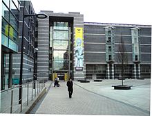 Royal Armouries Museum
A new Leeds City Museum opened in 2008[110] in Millennium Square. Abbey House Museum is housed in the former gatehouse of Kirkstall Abbey, and includes walk-through Victorian streets and galleries describing the history of the abbey, childhood, and Victorian Leeds. Armley Mills Industrial Museum is housed in what was once the world's largest woollen mill,[111] and includes industrial machinery and railway locomotives. This museum also shows the first known moving pictures in the world which were taken in the city, by Louis Le Prince, of a Roundhay Garden Scene and of Leeds Bridge in 1888. Thwaite Mills Watermill Museum is a fully restored 1820s water-powered mill on the river Aire to the east of the city centre. The Thackray Museum is a museum of the history of medicine, featuring topics such as Victorian public health, pre-anaesthesia surgery, and safety in childbirth. It is housed in a former workhouse next to St James's hospital. The Royal Armouries Museum opened in 1996 in a dramatic modern building when this part of the national collection was transferred from the Tower of London. Leeds Art Gallery reopened in June 2007 after a major renovation, and houses important collections of traditional and contemporary British art. Smaller museums in Leeds include Otley Museum, Horsforth Village Museum,[112] the University of Leeds Textile Archive (ULITA),[113] and the museum at Fulneck Moravian Settlement.
Music, theatre and dance
Main articles: Music in Leeds and List of bands originating in LeedsLeeds is home to the Grand Theatre where Opera North is based, this establishment seats 1,500 people and has recently undergone a £31.5m refurbishment. The City Varieties Music Hall, which hosted performances by Charlie Chaplin and Harry Houdini and was also the venue of the BBC television programme The Good Old Days, and West Yorkshire Playhouse.[114][115][116]
Leeds is also home to Phoenix Dance Theatre, who were formed in the Harehills area of the city in 1981, and Northern Ballet Theatre.[117] In autumn 2010 the two companies moved into a purpose-built dance centre which is the largest space for dance outside of London. It is also the only space for dance to house a national classical and a national contemporary dance company alongside each another.[118]
Construction of the Leeds Arena[119] is currently under way in the city centre. Due for completion in 2013, the 13,500 seater stadium will become the city's number one venue for live music, indoor sports and many other events. Concerts are currently held at the O2 Academy, Elland Road and at both universities. Roundhay Park in north Leeds has seen some of the world's biggest artists including Michael Jackson, Madonna and Robbie Williams among others.
Popular musical acts originating from Leeds include The Pigeon Detectives, The Wedding Present, Soft Cell, The Sunshine Underground, The Sisters of Mercy, Hadouken!, Kaiser Chiefs, Corinne Bailey Rae, Gang of Four, The Rhythm Sisters, Utah Saints and Melanie B of the Spice Girls.[120][121][122][123][124][125]
Carnivals and festivals
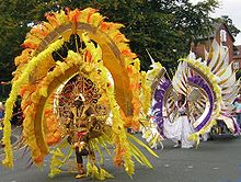 Leeds carnival procession
Leeds Carnival is Western Europe's oldest West Indian Carnival, and the UK's second largest after Notting Hill Carnival.[126][127] It attracts around 100,000 people over 3 days to the streets of Chapeltown and Harehills. There is a large procession that finishes at Potternewton Park, where there are stalls, entertainment and refreshments. The Leeds Festival, featuring some of the biggest names in rock and indie music, takes place every year in Bramham Park. The Leeds Asian Festival, formerly the Leeds Mela, is held in Roundhay Park.[128] The Otley Folk Festival (patron: Nic Jones),[129] Walking Festival,[130] Carnival[131] and Victorian Christmas Fayre[132] are annual events. Light Night Leeds takes place each October,[133] and many venues in the city are open to the public for Heritage Open Days in September.[134] The Leeds International Pianoforte Competition, established in 1963 by Fanny Waterman and Marion Stein, has been held in the city every three years since 1963 and has launched the careers of many major concert pianists. The Leeds International Concert Season, which includes orchestral and choral concerts in Leeds Town Hall and other events, is the largest local authority music programme in the UK.[135]
The Leeds International Film Festival is the largest film festival in England outside London[136] and shows films from around the world. It incorporates the highly successful Leeds Young People's Film Festival, which features exciting and innovative films made both for and by children and young people.[137] Garforth is host to the fortnight long festival The Garforth Arts Festival which has been an annual event since 2005. Leeds Festival Fringe is a week long music festival created in 2010 to showcase local talent in the week prior to Leeds Festival.
Nightlife
Main article: Nightlife in Leeds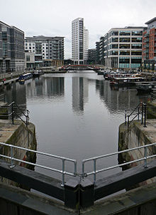 Clarence Dock has many new restaurants and bars.
Leeds has a very large student population, resulting in a large number of pubs, bars, nightclubs and restaurants, as well as a multitude of venues for live music. The full range of music tastes is catered for in Leeds. It includes the original home of the club nights Back 2 Basics and Speedqueen.[138] Morley was the location of techno club The Orbit.[139] Leeds has number of large 'super-clubs' and there is a selection of independent clubs such as Mission and Mint Club, which was voted as the 24th best club in the world by DJ Magazine.[140]
Leeds has a well established gay nightlife scene. The Bridge Inn and The New Penny, both on Call Lane, have long been gay night spots.[141]
Towards Millennium Square and the Civic or Northern Quarter, is a growing entertainment district providing for both students and weekend visitors. The square has many bars and restaurants and a large outdoor screen mounted on the side of the Civic Theatre. Millennium Square is a venue for large seasonal events such as a Christmas market, gigs and concerts, citywide parties and the Rhythms of the City Festival. It is adjacent to the Mandela Gardens, which were opened by Nelson Mandela in 2001. A number of public art features, fountains, a canal and greenery can be found here as an oasis amongst the city centre excitement.
Yorkshire has a great history of real ale,[142] but several bars near the railway station are fusing traditional beers with a modern bar. Popular bars such as this include; The Hop, The Cross Keys and The Brewery Tap.
Sports
Main articles: Sport in Leeds and Football in Leeds Elland Road Stadium
The city has teams representing all the major national sports. Leeds United A.F.C. is the city's main football club. Leeds Rhinos (Rugby League), Leeds Carnegie (Rugby Union) and Yorkshire County Cricket Club are also based in the city.
Leeds United was formed in 1919 and plays at the 40,000 capacity Elland Road stadium in Beeston. The team plays in The Championship but has been English league champions three times and has FA Cup, Football League Cup and UEFA Cup honours to its name.
Leeds Rhinos are the most successful rugby league team in Leeds. In 2009 they became first club to be Super League champions three seasons running, giving them their fourth Super League title.[143] They play their home games at the Headingley Carnegie Stadium. Hunslet Hawks, based at the John Charles Centre for Sport play in Co-Operative Championship One. Bramley Buffaloes and Leeds Akkies are members of the Rugby League Conference.
Leeds Carnegie, formerly known as Leeds Tykes, are the foremost rugby union team in Leeds and they play at Headingley Carnegie Stadium. They play in National League 1 having been relegated from The Guinness Premiership at the end of the 2010–11 season. Otley R.U.F.C. are a rugby union club based to the north of the city and also compete in National Division One, whilst Morley R.F.C., located in Morley currently play in National Division Three North.
Leeds United L.F.C. are the best-placed women's football team in Leeds, competing at the highest level in England, the FA Women's Premier League National Division. Leeds City Athletic Club competes in the British Athletics League and UK Women's League as well as the Northern Athletics League.
The city has a wealth of sports facilities including the Elland Road football stadium, a host stadium during the 1996 European Football Championship; the Headingley Carnegie Stadiums, adjacent stadia world famous for both cricket and rugby league and the John Charles Centre for Sport with an Olympic sized pool in its Aquatics Centre[144] and includes a multi-use stadium. Other facilities include the Leeds Wall (climbing) and Yeadon Tarn sailing centre. In 1929 the first Ryder Cup of Golf to be held on British soil was competed for at the Moortown Golf club in Leeds and Wetherby has a National Hunt racecourse.[145] In the period 1928 to 1939 speedway racing was staged in Leeds on a track at the greyhound stadium in Elland Road. The track entered a team in the 1931 Northern league.
Leeds teams
Club League Venue Location Established Top flight championships Leeds United AFC Football League Championship Football Elland Road Stadium Beeston, Leeds 1919 3 Leeds Rhinos Super League Rugby League Headingley Stadium Headingley, Leeds 1870 8 Hunslet Hawks Championship One Rugby League John Charles Centre for Sport Hunslet, West Yorkshire 1883 2 Leeds Carnegie RFU Championship Rugby Union Headingley Stadium Headingley, Leeds 1991 0 Yorkshire County Cricket Club County Championship Cricket Headingley Stadium Headingley, Leeds 1863 31 Religion
The majority of people in Leeds identify themselves as Christian.[64] Leeds does not have a Church of England Cathedral because Leeds is part of the Anglican Diocese of Ripon and Leeds and the Cathedral for this Diocese is in Ripon; the Bishop's residence has been in Leeds since 2008. The most important Anglican church is the Leeds Parish Church, although St. George's has the largest congregation by far.[citation needed] Leeds has a Roman Catholic Cathedral, the Episcopal seat of the Roman Catholic Diocese of Leeds. Many other Christian denominations and new religious movements are established in Leeds, including Assembly of God, Baptist, Christian Scientist, Church of Jesus Christ of Latter-day Saints ("LDS Church", see also Mormon), Community of Christ, Greek Orthodox, Jehovah's Witnesses, Jesus Army, Lutheran, Methodist, Nazarene, Newfrontiers network, Pentecostal, Salvation Army, Seventh-Day Adventist, Society of Friends ("Quakers"), Unitarian, United Reformed, Vineyard, Wesleyan Church, an ecumenical Chinese church, and several independent churches.[146][147]
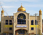 Sikh Temple, Chapeltown Road
 Leeds Jamia Mosque
The proportion of Muslims in Leeds is average for the country.[64] Mosques can be found throughout the city, serving Muslim communities in Chapeltown, Harehills, Hyde Park and parts of Beeston. The largest mosque is Leeds Grand Mosque in Hyde Park. The Sikh community is represented by Gurudwaras (Temples) spread across the city, the largest being in Chapeltown. There is also a colourful religious annual procession, called the Nagar Kirtan, into Millennium Square in the city centre around 13–14 April to celebrate Baisakhi – the Sikh New Year and the birth of the religion. It is estimated that around 3,000 Sikhs in Leeds take part in this annual event.
Leeds has the third-largest Jewish community in the United Kingdom, after those of London and Manchester. The areas of Alwoodley and Moortown contain sizeable Jewish populations.[65] There are eight active synagogues in Leeds.[148] The small Hindu community in Leeds has a temple (mandir) at Hyde Park.[149] The temple has all the major Hindu deities and is dedicated to the Lord Mahavira of the Jains.[150] Various Buddhist traditions are represented in Leeds,[151] including: Soka Gakkai, Theravada, Tibetan, Triratna Buddhist Community and Zen. The Buddhist community (sangha) comes together to celebrate the major festival of Wesak in May. There is also a community of the Bahai Faith in Leeds.[152]
Public services
Water supply and sewerage in Leeds is provided by Yorkshire Water, part of the Kelda Group. Prior to 1973 it had been provided by the Leeds Corporation. Leeds City Council has a target of 11MW of renewable energy from onshore wind by 2010 and an aspirational target of 75MW by 2020. There are currently no operational wind farms in Leeds.[153]
 West Yorkshire Archive Service, Leeds site
The area is policed by the West Yorkshire Police. The force has eight divisions, three of which cover Leeds: AA "North West Leeds Division" covering north and west Leeds with a station at Weetwood; BA "North East Leeds Division", covering north east Leeds with stations at Stainbeck near Chapel Allerton and Killingbeck; CA "City and Holbeck Division" covering central and south Leeds with stations at Millgarth (city centre) and Holbeck. Fire and rescue services are provided by the West Yorkshire Fire and Rescue Service. The fire stations in Leeds are: Cookridge, Gipton, Hunslet, Swarcliffe, Moortown, and the "Leeds" fire station (near city centre, on Kirkstall Road).
Health services are provided by the Leeds Teaching Hospitals NHS Trust, Leeds Primary Care Trust[154] and Leeds Partnerships NHS Foundation Trust[155] which provides mental health services. Leeds General Infirmary ("LGI") is a listed building with more recent additions and is in the city centre. St James's University Hospital, Leeds, known locally as "Jimmy's"[156][157] is to the north east of the city centre and is the largest teaching hospital in Europe. Other NHS hospitals are Chapel Allerton Hospital, Seacroft Hospital, Wharfedale Hospital in Otley, and Leeds Dental Institute. The new NHS Leeds Website provides information on NHS services in Leeds.[158]
West Yorkshire Joint Services provides analytical, archaeological, archives, ecology, materials testing and trading standards services in Leeds and the other four districts of West Yorkshire. It was created following the abolition of the county council in 1986 and expanded in 1997, and is funded by the five district councils, pro rata to their population. The Leeds site of the archives service is in the former public library at Sheepscar, Leeds.[159]
Leeds City Council is responsible for over 50 public libraries across the whole city, including 5 mobile libraries. The main Central Library is located on the Headrow in the city centre.
Twin towns
The City has several twinning or partnership arrangements:
The city also has "strong contacts" with the following cities "for the purposes of ongoing projects":[162]
 Stockholm, Sweden
See also
References and notes
- ^ Veronica Garbutt. "Leeds Travel Information and Travel Guide – England". Lonely Planet. http://www.lonelyplanet.com/england/yorkshire/leeds. Retrieved 5 August 2011.
- ^ National Statistics: Neighbourhood Statistics. "Leeds (Local Authority): Key Figures for People and Society: Population and Migration". http://www.neighbourhood.statistics.gov.uk/dissemination/LeadKeyFigures.do?a=3&b=276810&c=leeds&d=13&e=13&g=382985&i=1001x1003x1004&m=0&r=1&s=1206488787312&enc=1. Retrieved 25 March 2008.
- ^ "About Leeds". Leeds City Council. http://www.leeds.gov.uk/About_Leeds.aspx. Retrieved 22 July 2009.
- ^ National Statistics. "KS01 Usual resident population: Census 2001, Key Statistics for urban areas". http://www.statistics.gov.uk/StatBase/ssdataset.asp?vlnk=8271&Pos=2&ColRank=1&Rank=240. Retrieved 14 October 2008.
- ^ "2009 Mid Year Estimates – Table 9 ONS". http://www.statistics.gov.uk/statbase/Product.asp?vlnk=15106. Retrieved 9 September 2010.. It should be noted that this figure includes the whole area included in the city. Some population figures, for example those given at List of English cities by population use just the urban core of the city and therefore are lower.
- ^ "Leeds Tourism". Planet Ware Travel Guide. http://www.planetware.com/england/leeds-eng-wy-lee.htm. Retrieved 1 February 2009.
- ^ "Leeds stakes it claim to financial hub". www.yorkshirepost.co.uk. http://www.yorkshirepost.co.uk/businessnews/Leeds-stakes-its-claim-to.1864465.jp. Retrieved 1 February 2009.
- ^ "About Leeds". www.bookinghime.com. http://www.bookinghome.com/en/United_Kingdom/England/Leeds-Hotels.html. Retrieved 1 February 2009.
- ^ National Statistics (2005). "Focus on people and migration: chapter 3 The UK's major urban areas". p. 47. http://www.statistics.gov.uk/downloads/theme_compendia/fom2005/03_FOPM_UrbanAreas.pdf. Retrieved 20 October 2007.
- ^ "Leeds City Region". leedscityregion.gov.uk. http://www.leedscityregion.gov.uk/aboutus.aspx. Retrieved 22 January 2009.
- ^ a b "Leeds leading the way". Yorkshire Evening Post. http://www.yorkshireeveningpost.co.uk/news/We39re-leading-the-way-in.2034867.jp. Retrieved 25 January 2009.
- ^ "NOMIS Official Labour Market Statistics". NOMIS. https://www.nomisweb.co.uk/reports/lmp/la/2038432031/report.aspx?town=leeds#tabjobs. Retrieved 25 January 2010.
- ^ "Zurich UK Financial Services Locations". Zurich. http://www.zurich.co.uk/home/careers/workingforzurich/wherewework/wherewework.htm. Retrieved 25 January 2010.
- ^ "Leeds Legal Services". Financial Times. http://www.ft.com/cms/s/0/77eaffe6-ef2a-11dc-8a17-0000779fd2ac.html. Retrieved 25 January 2009.
- ^ a b "Leeds Legal Review". Law Gazette. http://www.lawgazette.co.uk/features/ltbgtyorkshire-gritltbgt. Retrieved 25 January 2009.
- ^ http://www.europeancitiesmonitor.eu/wp-content/uploads/2010/10/ECM-2010-Full-Version.pdf
- ^ Burt and Grady 1994, p. 92
- ^ Fletcher, J. S. (1919). The Story of English Towns: Leeds. London: Society for Promoting Christian Knowledge. OCLC 221589888. http://www.archive.org/details/storyoftheenglis027638mbp. Retrieved 22 July 2009.
- ^ "Loiners of the world unite!". BBC. 22 August 2005. http://www.bbc.co.uk/leeds/content/articles/2005/01/06/voices2005_loiner_feature.shtml. Retrieved 27 September 2009.
- ^ S.A. Caunce (2003). "Houses as Museums: The Case of the Yorkshire Wool Textile Industry". Transactions of the RHS Royal Historical Society (Royal Historical Society) 13: 329–343.
- ^ Burt and Grady 1994, p. 57
- ^ Fraser 1982, p. 143
- ^ Russ Haywood (2007). "Britain's national railway network: fit for purpose in the 21st century?". Journal of Transport Geography (Elsevier) 15 (3): 198–216. doi:10.1016/j.jtrangeo.2006.02.015.
- ^ a b Fraser 1982, p. 144
- ^ Fraser 1982, p. 155
- ^ Katrina Honeyman (2000). Well suited: a history of the Leeds clothing industry, 1850–1990. Oxford University Press. ISBN 0199202370.
- ^ a b Tony Harcup (2000). "Re-imaging a post-industrial city". City (Carfax) 4 (2).
- ^ "Legal services: Law firms have solid local roots and global ambitions". Financial Times. 11 March 2008. http://www.ft.com/cms/s/77eaffe6-ef2a-11dc-8a17-0000779fd2ac.html. Retrieved 26 September 2009.
- ^ Leeds, Live it, Love it. "Sectors: Retail". Marketing Leeds. http://www.leedsliveitloveit.com/retail. Retrieved 26 September 2009.
- ^ "Leeds City Region". leedscityregion.gov.uk. 2011 [last update]. http://www.leedscityregion.gov.uk/news.aspx?id=1869. Retrieved 28 July 2011.
- ^ "The Plan for Growth: Four new Enterprise Zones set up to boost local growth – HM Treasury". hm-treasury.gov.uk. 2011 [last update]. http://www.hm-treasury.gov.uk/press_90_11.htm. Retrieved 28 July 2011.
- ^ Vision of Britain - Leeds parish population. Retrieved on 25 September 2009.
- ^ a b Vision of Britain - Leeds parish. Retrieved on 16 September 2009.
- ^ "Briggate: Improvement Acts". Discovering Leeds. Leeds City Council. http://www.leodis.net/discovery/discovery.asp?page=2003218_676159084&topic=2003218_372249783&subsection=200342_125637234. Retrieved 27 September 2009.
- ^ Vision of Britain - Leeds MB/CB (historic map). Retrieved on 16 September 2009.
- ^ Fraser 1982, p. 459
- ^ "Impact of Urban Development Corporations in Leeds, Bristol & Central Manchester". Department of the Environment, Transport and the Regions. 18 November 1998. http://www.communities.gov.uk/archived/general-content/citiesandregions/impacturban/. Retrieved 25 September 2009.[dead link]
- ^ Burt and Grady 1994, p. 163
- ^ Fraser 1982, p. 96
- ^ "The Working Classes: Housing". Discovering Leeds. Leeds City Council. http://www.leodis.net/discovery/discovery.asp?page=2003218_676159084&topic=2003218_372249783&subsection=200342_125637234. Retrieved 26 September 2009.
- ^ a b Fraser 1982, p. 98
- ^ Fraser 1982, p. 57
- ^ Burt and Grady 1994, p. 193
- ^ Unsworth and Stillwell 2004, p. 77
- ^ "Light Shines on Leeds Skyscraper Bids". http://www.skyscrapernews.com. http://www.skyscrapernews.com/news.php?ref=565. Retrieved 24 May 2010.
- ^ "City Living Leeds". http://www.one-uk.co.uk. http://one-uk.co.uk/index.php?id=52. Retrieved 24 May 2010.
- ^ a b c Office for National Statistics (2001). "Census 2001:Key Statistics for urban areas in the North; Map 6" (PDF). United Kingdom Census 2001. statistics.gov.uk. http://www.statistics.gov.uk/downloads/census2001/ks_urban_north_part_8.pdf. Retrieved 27 September 2009.
- ^ "Leeds – the facts". Yorkshire Forward Government agency. http://www.yorkshire-forward.com/our-wonderful-region/our-cities/Leeds-the-facts. Retrieved 22 January 2009.
- ^ "Leeds – The Yorkshire Dales". Visit Britain (National UK Tourist Agency). http://www.visitbritain.co.uk/destinations/England/englands-north-country/Yorkshire-Dales.aspx. Retrieved 22 January 2009.
- ^ Kendall, Percy Fry; Wroot,Herbert (1972). Geology of Yorkshire Part II. East Ardsley, Wakefield: EP Publishing Ltd. pp. 672–673. ISBN 0 85409 762 7.
- ^ a b Fraser 1982, p. 456
- ^ "Leeds Metropolitan District – Post Codes". Leeds City Council. http://www.leeds.gov.uk/maps/leeds_pc.html. Retrieved 26 September 2009.
- ^ a b Royal Mail (2004). Address Management Guide. Royal Mail Group.
- ^ "Huddersfield temperature verified at −11 in Waterloo last night – plus forecast for the weekend – Local West Yorkshire News – News – Huddersfield Examiner". Examiner.co.uk. http://www.examiner.co.uk/news/local-west-yorkshire-news/2010/12/03/huddersfield-temperature-verified-at-11-in-waterloo-last-night-plus-forecast-for-the-weekend-86081-27762073/. Retrieved 5 August 2011.
- ^ "CLIMATE LEEDS WEATHER CTR – Historical August 2003 – Weather". Tutiempo.net. http://www.tutiempo.net/en/Climate/LEEDS_WEATHER_CTR/08-2003/33470.htm. Retrieved 5 August 2011.
- ^ "UK | England | West Yorkshire | Tornado hits during freak storm". BBC News. 14 September 2006. http://news.bbc.co.uk/1/hi/england/west_yorkshire/5347064.stm. Retrieved 5 August 2011.
- ^ "Leeds average weather data.". http://worldweather.wmo.int. http://wunderground.com. Retrieved 14 November 2010.
- ^ "KS06 Ethnic Group: Census 2001, Key Statistics for urban areas". National Statistics. http://www.statistics.gov.uk/statbase/ssdataset.asp?vlnk=8283&More=Y. Retrieved 16 February 2009.
- ^ "KS06 Ethnic group: Key Statistics for urban areas, summary results for local authorities". National Statistics. http://www.statistics.gov.uk/statbase/ssdataset.asp?vlnk=8296&More=Y. Retrieved 16 February 2009.
- ^ "KS01 Usual resident population: Census 2001, Key Statistics for urban areas". Office for National Statistics. 7 February 2005. http://www.statistics.gov.uk/statbase/ssdataset.asp?vlnk=8271&More=Y. Retrieved 24 September 2009.
- ^ "KS04 Marital status: Census 2001, Key Statistics for urban areas". Office for National Statistics. 2 February 2005. http://www.statistics.gov.uk/statbase/ssdataset.asp?vlnk=8276&More=Y. Retrieved 24 September 2009.
- ^ "Leeds Metropolitan Borough ethnic group". Office for National Statistics. http://neighbourhood.statistics.gov.uk/dissemination/LeadTableView.do?a=7&b=276810&c=Leeds&d=13&e=16&g=382985&i=1001x1003x1004&o=1&m=0&r=1&s=1231357883004&enc=1&dsFamilyId=87. Retrieved 22 July 2009.
- ^ a b "Leeds Metropolitan Borough household composition (households)". Office for National Statistics. http://neighbourhood.statistics.gov.uk/dissemination/LeadTableView.do?a=7&b=276810&c=Leeds&d=13&e=16&g=382985&i=1001x1003x1004&o=1&m=0&r=1&s=1231357883004&enc=1&dsFamilyId=165. Retrieved 22 July 2009.
- ^ a b c d "Leeds Census 2001". http://www.statistics.gov.uk/census2001/profiles/00DA-A.asp.
- ^ a b M. Freedman (1988) "The Leeds Jewish Community" pp. 161–174 in L. S. Tate (ed) Aspects of Leeds ISBN 1-871647-38-X
- ^ "Crime figures in Leeds". http://www.upmystreet.com/local/police-crime/figures/l/Leeds-4292.html.
- ^ "Crime Statistics for Leeds Apr 2005 – Mar 2006". Home Office. http://www.crimestatistics.org.uk/tool/Default.asp?region=7&force=28&cdrp=106&l1=0&l2=0&l3=0&sub=0&v=36.
- ^ "Urban Crime Rankings". July 2006. Archived from the original on 8 March 2008. http://web.archive.org/web/20080308195432/http://www.reform.co.uk/filestore/pdf/Urban+crime+rankings,+Reform,+July+2006.pdf.
- ^ "Leeds District: total population". Vision of Britain. http://www.visionofbritain.org.uk/data_cube_table_page.jsp?data_theme=T_POP&data_cube=N_TPop&u_id=10057140&c_id=10001043&add=N. Retrieved on 19 December 2008.
- ^ "Parish and Town Councils". Leeds City Council. http://www.leeds.gov.uk/Council_and_democracy/Councillors_democracy_and_elections/Parish_and_town_councils.aspx. Retrieved 1 April 2009.
- ^ "Leeds civil parish map 2008". Leeds City Council. http://www.leeds.gov.uk/maps/leeds_mpb.html. Retrieved 1 April 2009.
- ^ Rogers, Simon (10 June 2009). "Exactly how well did the BNP do where you live?". Guardian: Data Blog (London). http://www.guardian.co.uk/news/datablog/table/2009/jun/09/european-elections-elections-2009. Retrieved 14 July 2009.
- ^ Unsworth and Stillwell 2004, p. 169
- ^ "Leeds Financial Facts and Figures". http://www.leedsfinancialservices.org.uk/. http://www.leedsfinancialservices.org.uk/. Retrieved 25 January 2009.
- ^ "Northern Star". FDI Magazine. http://www.fdimagazine.com/news/fullstory.php/aid/2512/Northern_star.html. Retrieved 25 January 2009.
- ^ "Leeds Services". Financial Times. http://www.ft.com/cms/s/77eaffe6-ef2a-11dc-8a17-0000779fd2ac.html. Retrieved 25 January 2009.
- ^ "Live the Leeds Lifestyle". Legal Week Magazine. http://www.legalweek.com/Articles/1146376/Live+the+Leeds+lifestyle.html. Retrieved 25 January 2009.
- ^ "Microsoft Word - Regional GVA FINAL.doc" (PDF). http://www.statistics.gov.uk/pdfdir/gva1208.pdf. Retrieved 5 August 2011.
- ^ "Leeds Relocation & Business in Leeds Premises Search". Locate In Leeds. 20 July 2011. http://locateinleeds.com/financial-services. Retrieved 5 August 2011.
- ^ a b c d "The City Centre". Leeds Economy Handbook. Leeds City Council. http://www.leeds.gov.uk/files/Internet2007/2011/23/14%20city%20centre.pdf. Retrieved 2 July 2011.
- ^ Unsworth and Stillwell 2004, p. 245
- ^ "Top 20 Most visited English Cities and Towns in 2009 by UK Residents". http://www.enjoyengland.com/Images/top%20towns%202009_tcm21-190501.pdf. Retrieved 7 September 2010
- ^ "Top 20 Most Popular UK Cities for International Visiteors". http://gouk.about.com/od/getawaysandshorthops/qt/top20.htm. Retrieved 7 September 2010
- ^ "Cities Outlook 2011: Annual index reveals UK cities best placed to create jobs and drive economic recovery". Centre for Cities. 24 January 2011. http://www.centreforcities.org/cities-outlook-2011-annual-index-reveals-uk-cities-best-placed-to-create-jobs-and-drive-economic-recovery.html. Retrieved 5 August 2011.
- ^ http://www.centreforcities.org/assets/files/Cities%20Outlook%202011/11-01-31%20Earnings%20Cities%20Outlook%202011.pdf
- ^ http://www.centreforcities.org/assets/files/Cities%20Outlook%202011/11-01-31%20High%20level%20quals%20Cities%20Outlook%202011.pdf
- ^ http://www.centreforcities.org/assets/files/Cities%20Outlook%202011/11-01-31%20Employment%20rate%20Cities%20Outlook%202011.pdf
- ^ http://www.centreforcities.org/assets/files/Cities%20Outlook%202011/11-01-31%20Welfare%20cuts%20Cities%20Outlook%202011.pdf
- ^ "War memorials". Leeds City Council. http://www.leeds.gov.uk/Leisure_and_culture/Local_history_and_heritage/Memorial__maintenance.aspx. Retrieved 6 November 2009.
- ^ "Leodis – a photographic archive of Leeds – Display". Leeds City Council. Leodis. http://www.leodis.net/display.aspx?resourceIdentifier=20031021_1594179&DISPLAY=FULL. Retrieved 6 November 2009.
- ^ "Bridgewater Place, Leeds – Building No. 734". skyscrapernews.com. http://www.skyscrapernews.com/buildings.php?id=734. Retrieved 5 November 2009.
- ^ http://www.leedsliveitloveit.com/downloads/maps/leeds_city_centre_map.pdf
- ^ "What is Metro". Wymetro.com. http://www.wymetro.com/aboutmetro/whatwedo/WhatisMetro.htm. Retrieved 10 February 2009.
- ^ "Leeds Travel Info". http://www.leedstravel.info. Retrieved 10 February 2009.
- ^ "Station usage – : Office of Rail Regulation". Rail-reg.gov.uk. http://www.rail-reg.gov.uk/server/show/nav.1529. Retrieved 14 October 2008.
- ^ "A guide to Leeds. Leeds facilities, schools, general information, West Yorkshire". Information-britain.co.uk. http://www.information-britain.co.uk/county97/townguideLeeds/. Retrieved 14 October 2008.
- ^ "RA website with walking booklets". http://www.ramblersyorkshire.org/publications.html.
- ^ Unsworth and Stillwell 2004, p. 148
- ^ "School Population Tables 2008.pdf". Education Leeds. http://www.educationleeds.co.uk/documents/viewdoc.aspx?cid=16632. Retrieved 1 November 2009.
- ^ "Building Schools for the Future – BSF in Leeds". www.educationleeds.co.uk. http://www.educationleeds.co.uk/bsf/bsfinleeds.html. Retrieved 21 April 2009.
- ^ "Leeds Menorah School". Ofsted. http://www.ofsted.gov.uk/oxedu_providers/full/(urn)/108110. Retrieved 1 November 2009.
- ^ "New Horizons School". Ofsted. http://www.ofsted.gov.uk/oxedu_providers/full/(urn)/130274. Retrieved 1 November 2009.
- ^ "University of Leeds". UCAS. http://www.ucas.ac.uk/instit/i/l23.html. Retrieved 5 March 2009.[dead link]
- ^ "LeedsMetropolitan University". UCAS. http://www.ucas.ac.uk/instit/i/l27.html. Retrieved 5 March 2009.[dead link]
- ^ "About us". Leeds Trinity University College. http://www.leedstrinity.ac.uk/ABOUTUS/Pages/default.aspx. Retrieved 28 September 2009.
- ^ "The Complete University Guide". The Complete University Guide. http://www.thecompleteuniversityguide.co.uk/single.htm?ipg=6537. Retrieved 5 August 2011.
- ^ Unsworth and Stillwell 2004, p. 149
- ^ Yorkshire Evening Post. "Local pages". http://www.yorkshireeveningpost.co.uk/custompages/CustomPage.aspx?pageID=71724. Retrieved 28 April 2008.
- ^ "Leeds Weekly News". British Newspapers Online. http://www.britishpapers.co.uk/england-yorks/leeds-weekly-news/. Retrieved 29 October 2009.
- ^ "Leeds City Museum website". http://www.leeds.gov.uk/cityMuseum/.
- ^ "Museum homepage, hosted on Leeds City Council website". http://www.leeds.gov.uk/armleymills/.
- ^ "Horsforth Village Museum". Culture 24. http://www.culture24.org.uk/yh000070. Retrieved 29 October 2009.
- ^ "ULITA". University of Leeds International Textiles Archive. http://ulita.leeds.ac.uk/. Retrieved 29 October 2009.
- ^ "Leeds Grand Theatre". Leeds City Council. 2009. http://www.leeds.gov.uk/page.aspx?pageidentifier=3B5842A8B7FDADC980256E200033B9E1. Retrieved 13 December 2009.
- ^ "City Varieties – About the Music Hall". City Varieties. 2009. http://www.cityvarieties.co.uk/information.asp. Retrieved 13 December 2009.
- ^ "WYPlayhouse: About us". West Yorkshire Playhouse. 2009. http://www.wyp.org.uk/content/the_playhouse/about_us.asp. Retrieved 13 December 2009.
- ^ "Northern Ballet Theatre : History". Northern Ballet Theatre. 2009. http://www.northernballettheatre.co.uk/history.aspx. Retrieved 13 December 2009.
- ^ "Building Momentum". Building Momentum. http://www.building-momentum.co.uk. Retrieved 26 March 2010.
- ^ "Leeds Arena". Arenaleeds.com. http://www.arenaleeds.com/. Retrieved 5 August 2011.
- ^ "The making of Soft Cell's Tainted Love". www.stereosociety.com. 2009. http://www.stereosociety.com/taintedlove.html. Retrieved 13 December 2009.[dead link]
- ^ "Tim Jonze on the retro games renaissance". The Guardian (UK). 8 December 2006. http://www.guardian.co.uk/technology/2006/dec/09/games.theguide1. Retrieved 3 March 2010.
- ^ "BBC – South Yorkshire – Entertainment – Kaiser Chiefs interview". BBC. http://www.bbc.co.uk/southyorkshire/content/articles/2005/04/14/kaiser_chiefs_interview.shtml. Retrieved 13 December 2009.
- ^ Chiu, David (30 December 2004). "Gang of Four Return". Rolling Stone. Jann Wenner. http://www.rollingstone.com/news/story/6803009/gang_of_four_return. Retrieved 12 March 2010.
- ^ "The Rhythm Sisters – biography, band news and reviews. (2967)". Leeds Music Scene. 2009. http://www.leedsmusicscene.net/article/6869/. Retrieved 13 December 2009.
- ^ "Biography " Melanie Brown". Melanie Brown. 2009. http://www.melaniebrown.com/about-2/. Retrieved 13 December 2009.[dead link]
- ^ "Leeds Get-together – Leeds West Indian Carnival". BBC. http://www.bbc.co.uk/leeds/features/get_together/carnival/2003_review.shtml. Retrieved 22 July 2009.
- ^ "Leeds West Indian Carnival". Leedscarnival.co.uk. 7 August 2005. http://www.leedscarnival.co.uk/. Retrieved 22 July 2009.
- ^ McTaggart, Susan (6 August 2009). "Roundhay Park hosts Leeds Asian Festival". Yorkshire Evening Post. http://www.roundhaytoday.co.uk/roundhaypark/Roundhay-Park-hosts-Leeds-Asian.5531416.jp. Retrieved 2 November 2009.
- ^ "Otley Folk Festival website". http://www.otleyfolkfestival.com/. Retrieved 2 November 2009.
- ^ "Otley Walking Festival". Chevin Trek. http://www.chevintrek.co.uk/index.asp?function=WEBPAGE&page=3. Retrieved 2 November 2009.
- ^ "Otley Carnival". Otley Town Council. http://www.otley.co.uk/Carnival/index.htm. Retrieved 2 November 2009.
- ^ Jack, Jim (16 Octrober 2009). "Otley Victorian Fayre gets injection of new blood". Wharfedale & Airedale Observer. http://www.wharfedaleobserver.co.uk/news/4683577.Otley_Victorian_Fayre_gets_injection_of_new_blood/. Retrieved 2 November 2009.
- ^ "Light Night Leeds website". http://www.lightnight.co.uk/leeds/index.php. Retrieved 2 November 2009.
- ^ "Heritage Open Days". Leeds Civic Trust. http://www.leedscivictrust.org.uk/view.aspx?id=34. Retrieved 2 November 2009.
- ^ "Leeds International Concert Season website". Leedsconcertseason.com. http://www.leedsconcertseason.com/view.aspx?id=42. Retrieved 5 August 2011.
- ^ "Lights, camera, action". BBC. September 2003. http://www.bbc.co.uk/leeds/films/2003/09/film_fest.shtml. Retrieved 22 July 2009.
- ^ "Leeds Film". http://www.leedsfilm.com/.
- ^ "Leeds City Guide: Clubbing & Nightlife in Leeds". http://www.leeds-city-guide.com/clubs.
- ^ "UK Techno – Notorious North". www.realtimeart.net. http://www.realtimeart.net/NN/notorious.html. Retrieved 17 September 2009.[dead link]
- ^ DJmag.com. "DJmag.com". Top 100 clubs. http://www.top100clubs.com/. Retrieved 5 August 2011.
- ^ "Leeds City Guide: Leeds Gay Scene". http://www.leeds-city-guide.com/gay.
- ^ "Yorkshire and Humberside". Real Ale Pubs. http://www.realalepubs.co.uk/area.asp?aid=3. Retrieved 5 August 2011.
- ^ "St Helens 10–18 Leeds Rhinos". BBC News. 10 October 2009. http://news.bbc.co.uk/sport1/hi/rugby_league/8290503.stm. Retrieved 4 April 2010.
- ^ "Leeds City Council – John Charles Centre for Sport – Swim". http://www.leeds.gov.uk/page.aspx?pageidentifier=92E3BE57BD5C06CD80256E1A00424F70#swim. Retrieved 30 July 2009.
- ^ "Wetherby Racing – Horseracing, Hospitality, Conference Venue, Yorkshire". www.wetherbyracing.co.uk. http://www.wetherbyracing.co.uk/. Retrieved 30 October 2009.
- ^ Universities chaplaincy in Leeds. "Student Guide to Churches in Leeds". http://www.leeds.ac.uk/chaplaincy/events/worship/churches1.php. Retrieved 6 December 2007.
- ^ Yahoo. "Churches in Leeds". http://uk.local.yahoo.com/West_Yorkshire/Leeds/Churches/uk100006150-s-26042.html. Retrieved 7 December 2007.
- ^ "JCR-UK – Leeds Jewish Community and Synagogues". Jewishgen.org. http://www.jewishgen.org/jcr-uk/Leeds.htm. Retrieved 14 October 2008.
- ^ "Leeds Hindu Mandir – Welcome". Leedsmandir.org.uk. http://www.leedsmandir.org.uk. Retrieved 22 July 2009.
- ^ "Home". Yjf.org.uk. http://www.yjf.org.uk. Retrieved 14 October 2008.
- ^ "Buddhist organisations in: Leeds/Bradford areas P2". Communigate.co.uk. http://www.communigate.co.uk/brad/leedsbuddhistgroup/page2.phtml. Retrieved 14 October 2008.
- ^ "Leeds". Bahai Community of the UK. http://www.bahai.org.uk/leeds/index.htm. Retrieved 14 July 2009.
- ^ "Banks Developments : Hook Moor Wind Farm". Banks Developments. http://www.banksdevelopments.com/energy/sites/renewable/midlands_and_yorkshire/hook_moor_wind_farm/. Retrieved 31 October 2009.[dead link]
- ^ "The Leeds PCT – Welcome to the Leeds PCT". Leedspct.nhs.uk. http://www.leedspct.nhs.uk/. Retrieved 14 October 2008.
- ^ "Leeds Mental Health – Teaching NHS Trust". Leedsmentalhealth.nhs.uk. http://www.leedsmentalhealth.nhs.uk/. Retrieved 14 October 2008.
- ^ In the background section of page, additional text.
- ^ Gray, Nick (31 January 2010). ""Jimmy's": the rise of the docusoap and the fall of YTV" (PDF). "No Such" Research. http://www.nosuch-research.co.uk/pdfs/PaperJimmys.pdf. Retrieved 17 June 2010. "What is "Jimmy's"? It’s the local nickname of a hospital in Leeds, actually called St. James’s University Hospital ..." (paper by Deviser/Producer/Director of TV series)
- ^ "Welcome to NHS Leeds". Leeds.nhs.uk. http://www.leeds.nhs.uk/. Retrieved 21 January 2010.
- ^ "West Yorkshire Joint Services". http://www.wyjs.org.uk/. Retrieved 28 March 2009.
- ^ "Leeds – Brno partnership". Leeds.gov.uk. http://www.leeds.gov.uk/page.aspx?pageidentifier=74bb3508-0d14-45f3-b7d7-ec8a267c27be. Retrieved 14 October 2008.
- ^ "Brno – Partnerská města" (in Czech). 2006–2009 City of Brno. http://www.brno.cz/index.php?nav02=1985&nav01=34&nav03=1010&nav04=1016&nav05=1249&nav06=1272. Retrieved 17 July 2009.
- ^ a b "International relations". Leeds.gov.uk. http://www.leeds.gov.uk/About_Leeds/international_relations.aspx. Retrieved 14 October 2008.
- ^ "Leeds – Dortmund partnership". Leeds.gov.uk. http://www.leeds.gov.uk/Advice_and_benefits/Tourism_and_travel/Town_twinning/Leeds__Dortmund_partnership.aspx. Retrieved 14 October 2008.
- ^ "List of Twin Towns in the Ruhr District". 2009 Twins2010.com. http://www.twins2010.com/fileadmin/user_upload/pic/Dokumente/List_of_Twin_Towns_01.pdf?PHPSESSID=2edd34819db21e450d3bb625549ce4fd. Retrieved 28 October 2009.
- ^ "Leeds – Durban partnership". Leeds.gov.uk. http://www.leeds.gov.uk/page.aspx?pageidentifier=6555f52e-1de9-499b-8eda-7b86bf24ac8c. Retrieved 14 October 2008.
- ^ "Leeds – Hangzhou partnership". Leeds.gov.uk. http://www.leeds.gov.uk/page.aspx?pageidentifier=32283a2b-11e6-4257-b018-ca6f95567d1a. Retrieved 14 October 2008.
- ^ "Leeds – Lille partnership". Leeds.gov.uk. http://www.leeds.gov.uk/page.aspx?pageidentifier=ac0a4504-f720-4eff-9376-5bff2a4576a0. Retrieved 14 October 2008.
- ^ "Leeds – Louisville partnership". Leeds.gov.uk. http://www.leeds.gov.uk/page.aspx?pageidentifier=f665edae-e44d-495b-b4e3-0385a941082f. Retrieved 14 October 2008.
- ^ "Leeds – Siegen partnership". Leeds.gov.uk. http://www.leeds.gov.uk/Advice_and_benefits/Tourism_and_travel/Town_twinning/Leeds__Siegen_partnership.aspx. Retrieved 14 October 2008.
- Bibliography
- Burt and Grady (1994). The Illustrated History of Leeds. Breedon Books. ISBN 1 873626 35 5.
- Fraser, Derek (1982). A History of Modern Leeds. Manchester University Press. ISBN 9780719007811.
- Unsworth and Stillwell (2004). Twenty-First Century Leeds: Geographies of a Regional City. Leeds: Leeds University Press. ISBN 0853162425.
External links
- Leeds travel guide from Wikitravel
- 'Leeds Initiative' Leeds Initiative city partnership.
- Leeds City Council Leeds City Council.
- Leodis Leeds Library & Information Service photograph archive.
- 'Leeds Chamber of Commerce & Industry' Leeds Chamber of Commerce & Industry
- The ancient parish of Leeds: historical and genealogical information at GENUKI (see Genuki's index or map of West Riding parishes for places outside this parish)
Leeds Topics Culture Places List of towns, villages, areas and suburbsGovernment City of Leeds • Leeds City CouncilPeople Ceremonial county of West Yorkshire Metropolitan districts Major settlements - Batley
- Bingley
- Bradford
- Brighouse
- Castleford
- Cleckheaton
- Denholme
- Dewsbury
- Elland
- Farsley
- Featherstone
- Garforth
- Guiseley
- Halifax
- Hebden Bridge
- Hebden Royd
- Heckmondwike
- Hemsworth
- Holmfirth
- Horsforth
- Huddersfield
- Ilkley
- Keighley
- Knottingley
- Leeds
- Meltham
- Mirfield
- Morley
- Mytholmroyd
- Normanton
- Ossett
- Otley
- Pontefract
- Pudsey
- Rothwell
- Shipley
- Silsden
- South Elmsall
- Sowerby Bridge
- Todmorden
- Wakefield
- Warley Town
- Wetherby
- Yeadon
See also: List of civil parishes in West Yorkshire
Topics - Parliamentary constituencies
- West Yorkshire Joint Services
- Monastic houses
- Museums
- Windmills
 25 largest settlements in the UK by urban core population*
- London: 7,172,091
- Birmingham: 970,892
- Glasgow: 629,501
- Liverpool: 469,017
- Leeds: 443,247
- Sheffield: 439,866
- Edinburgh: 430,082
- Bristol: 420,556
- Manchester: 394,269
- Leicester: 330,574
- Coventry: 303,475
- Kingston-upon-Hull: 301,416
- Bradford: 293,717
- Cardiff: 292,150
- Belfast: 276,459
- Stoke-on-Trent: 259,252
- Wolverhampton: 251,462
- Nottingham: 249,584
- Plymouth: 243,795
- Southampton: 234,224
- Reading: 232,662
- Derby: 229,407
- Dudley: 194,619
- Newcastle upon Tyne: 189,863
- Northampton: 189,474
*Based on 2001 Census data.Categories:- Leeds
- Leeds City Region
- University towns in the United Kingdom
- Market towns in West Yorkshire
- Towns in West Yorkshire
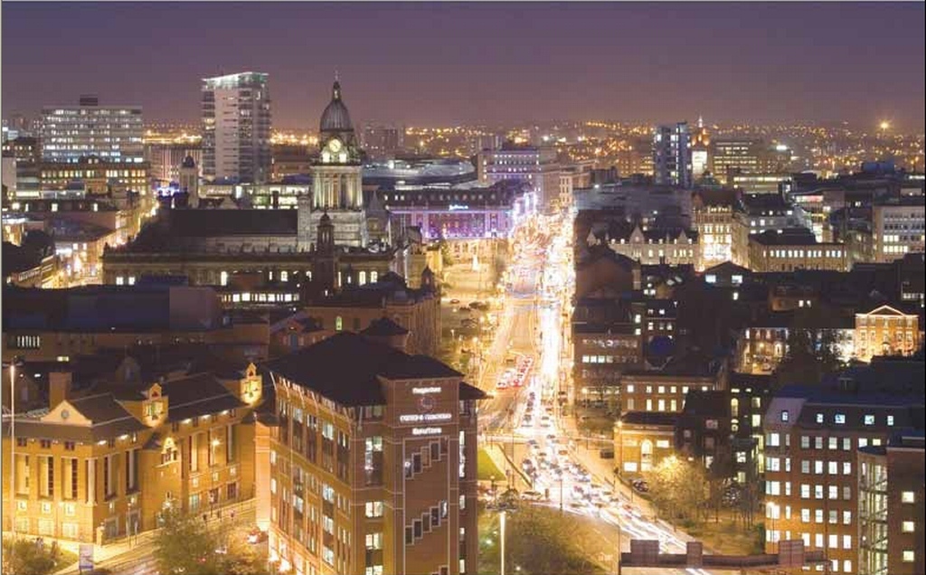
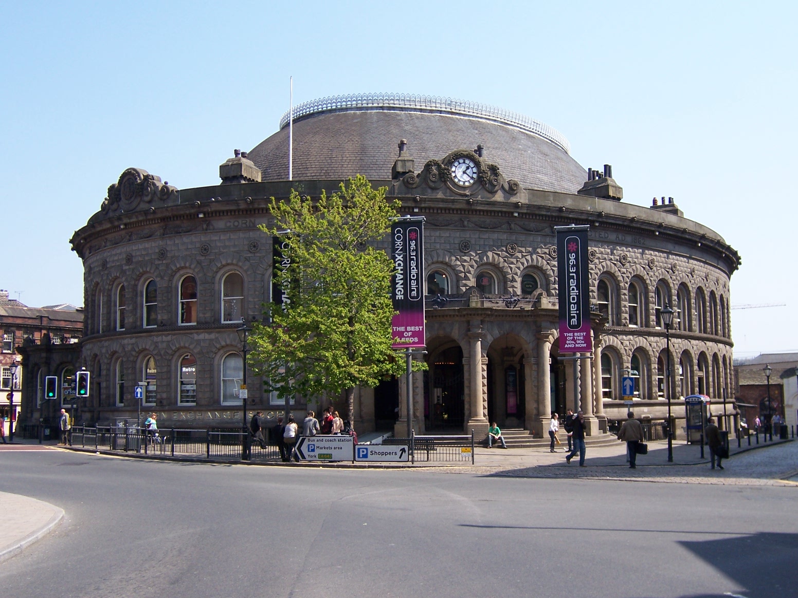
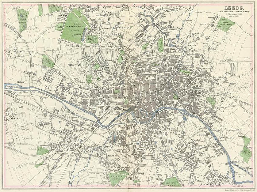

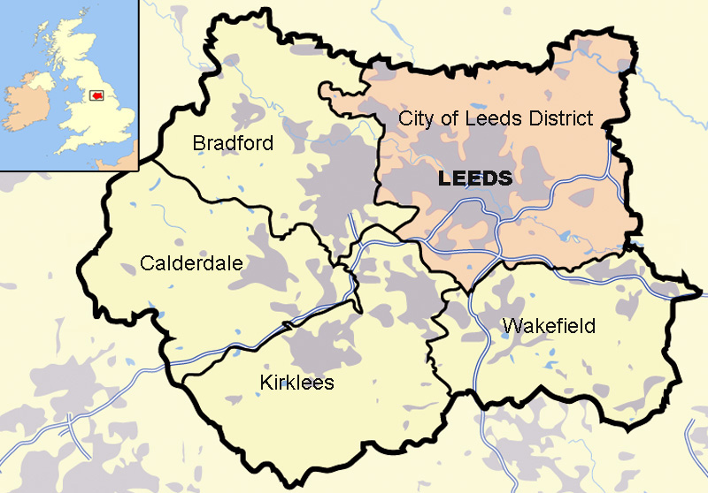
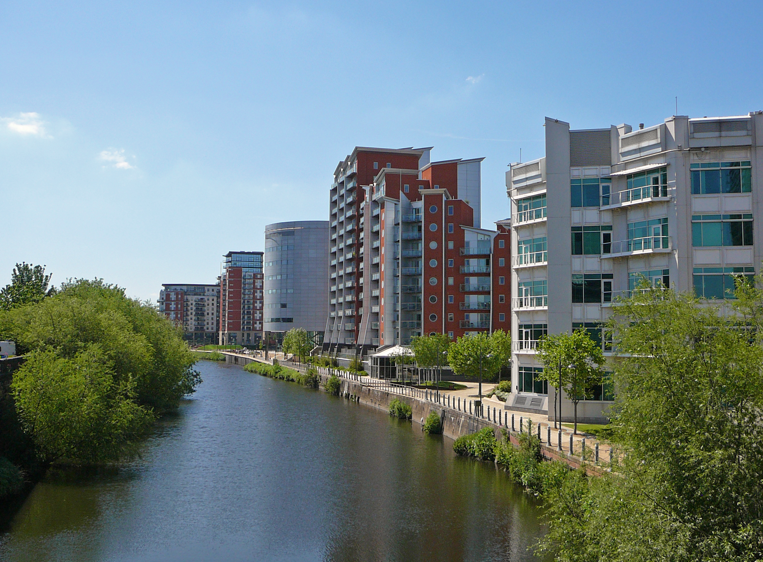

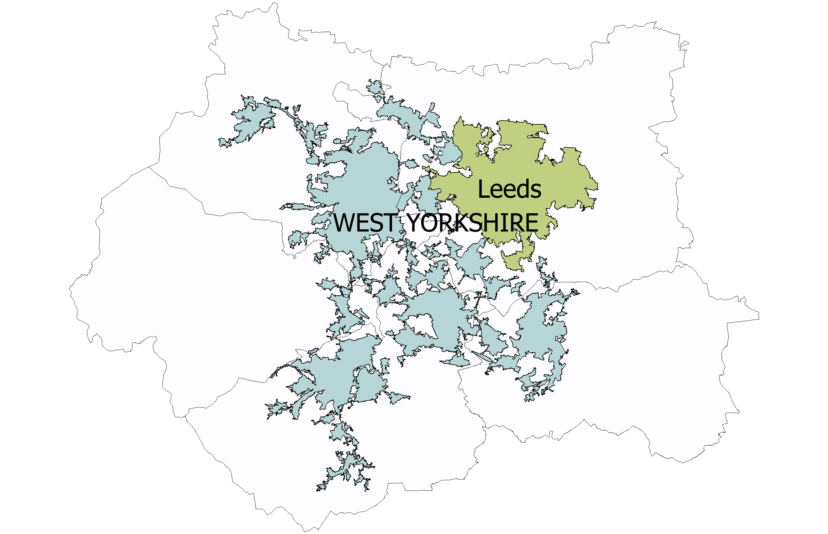
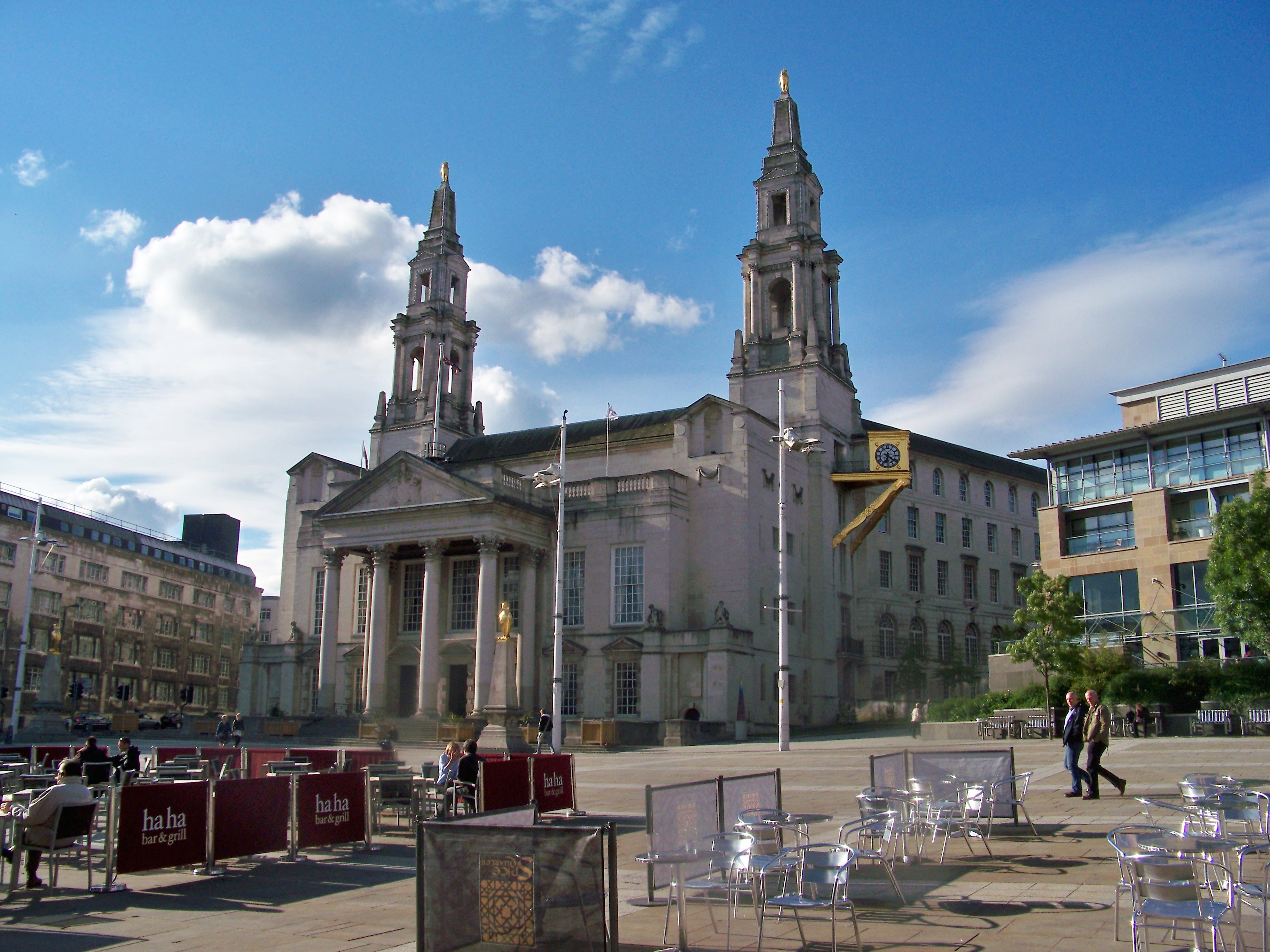
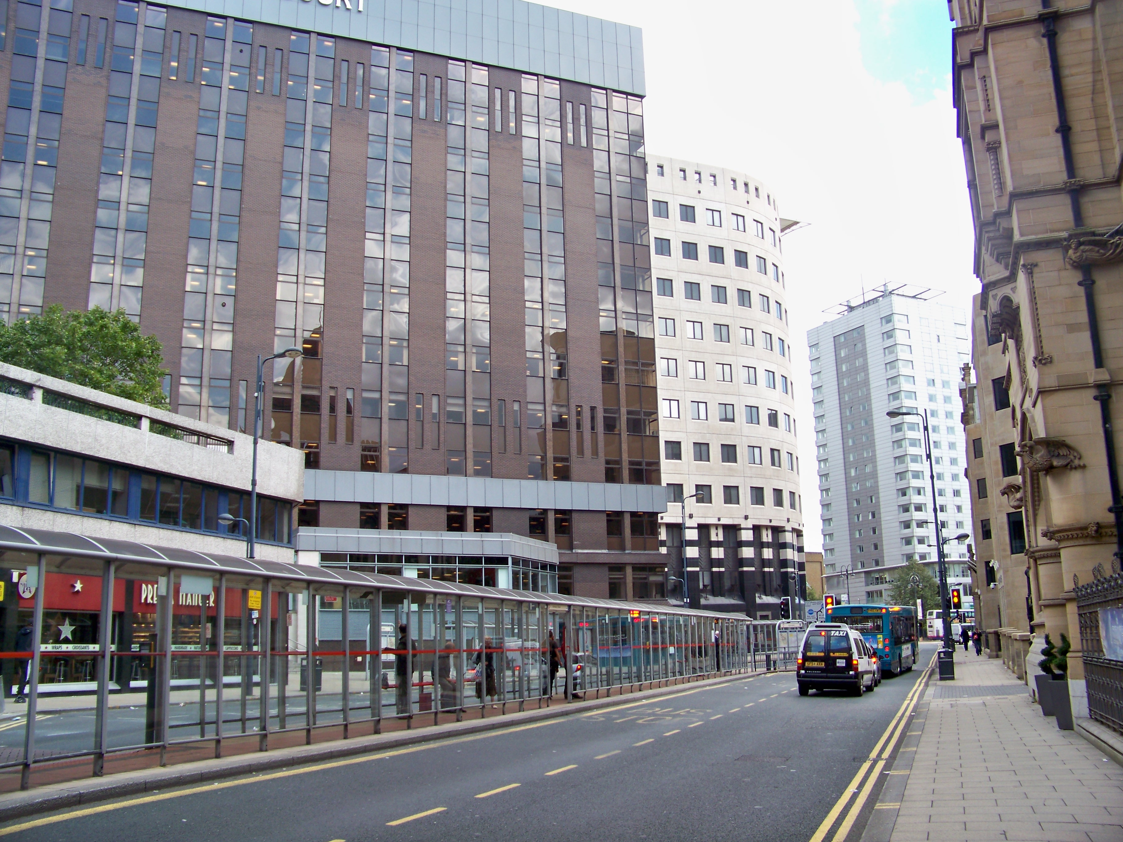
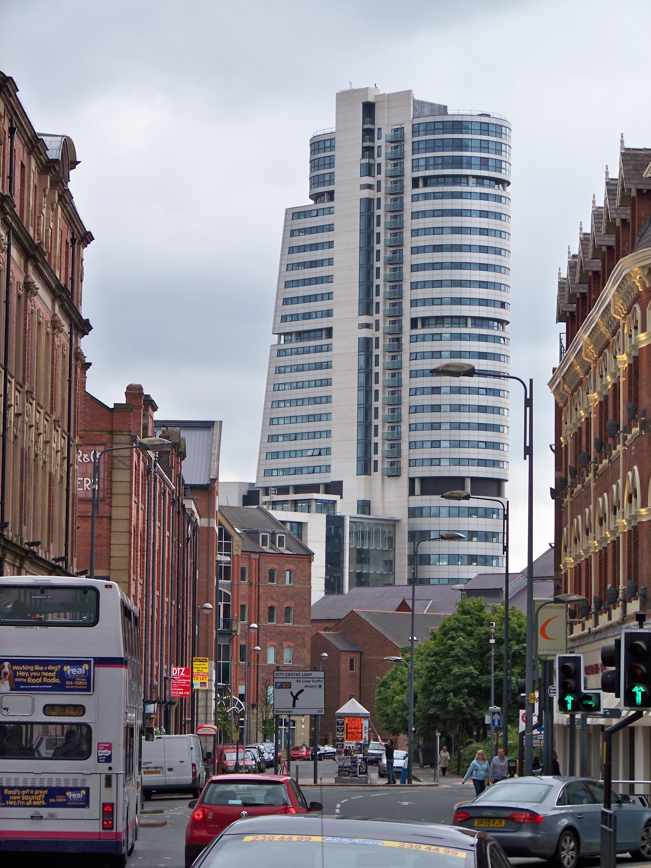
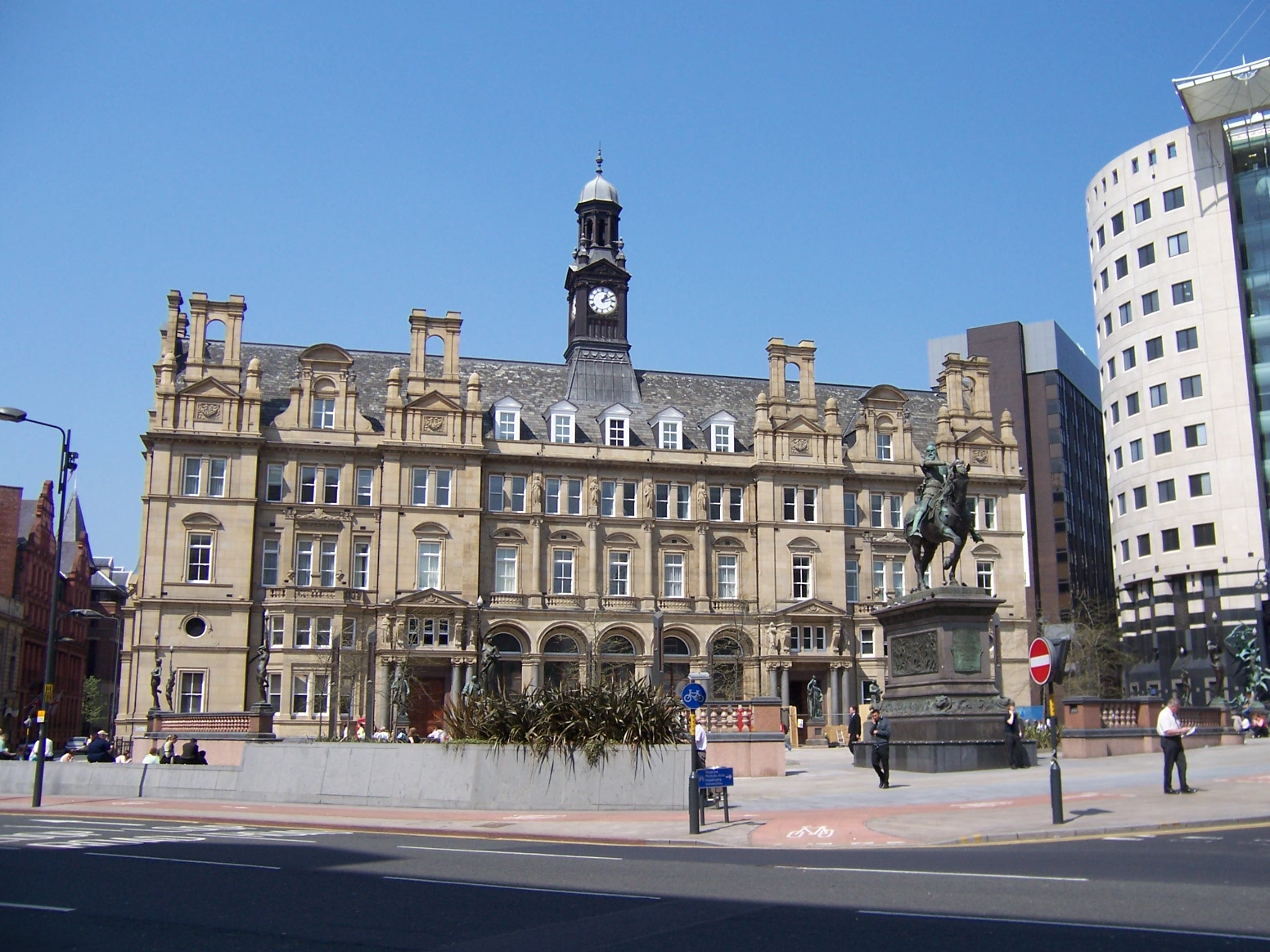

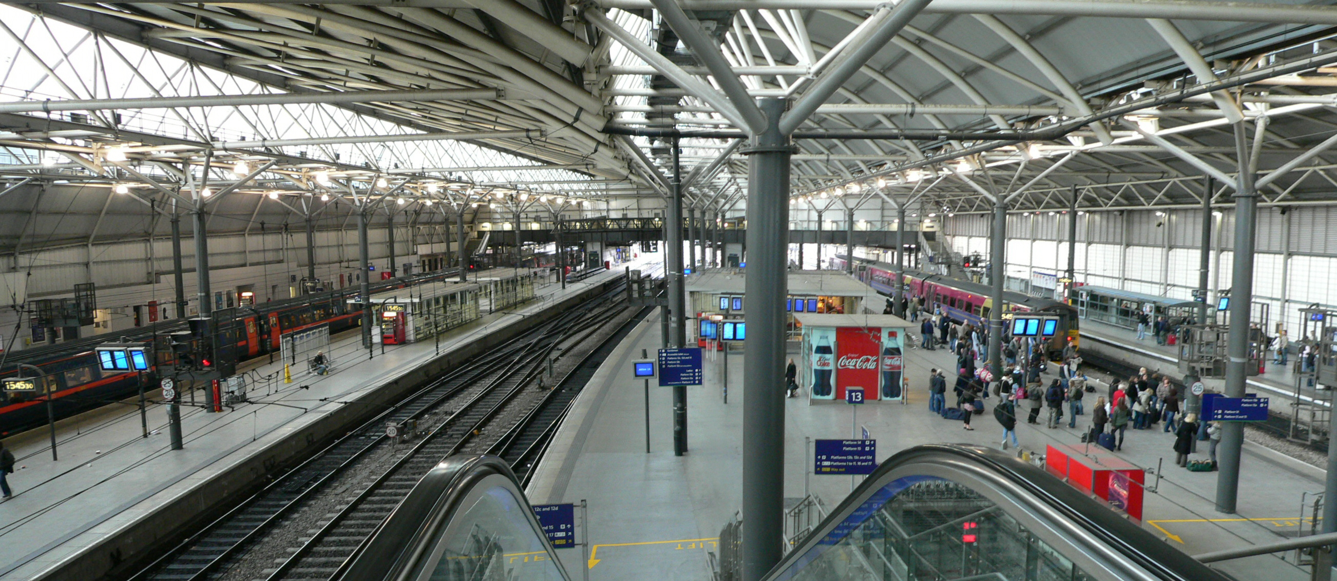
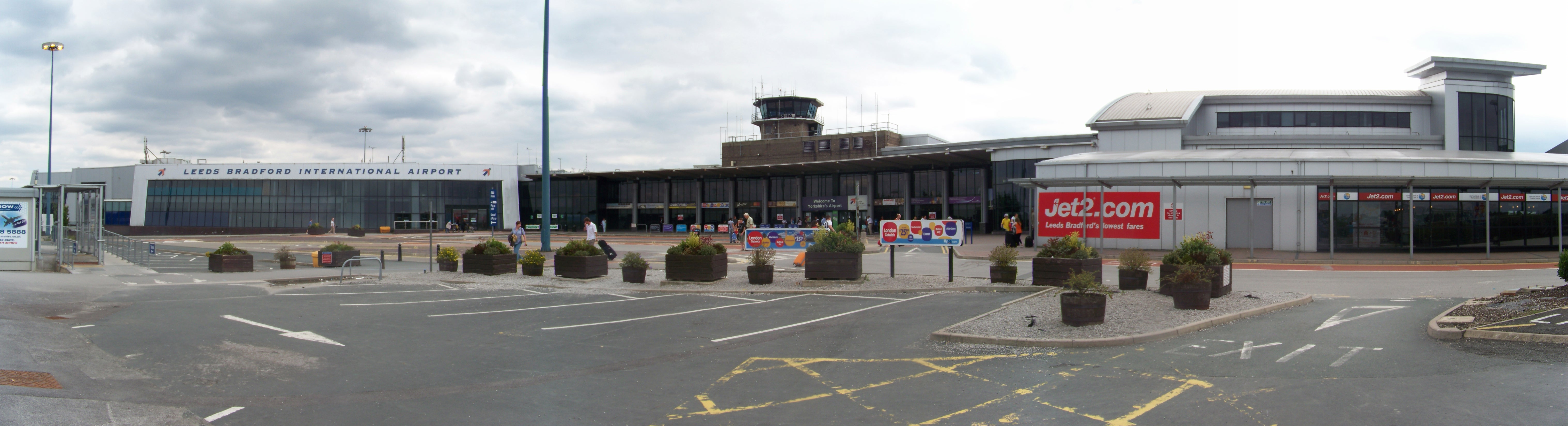

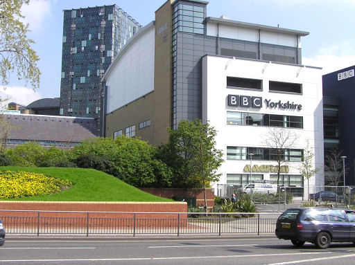
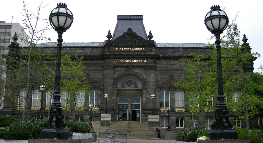
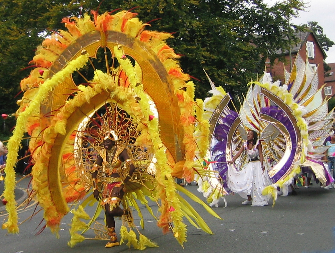

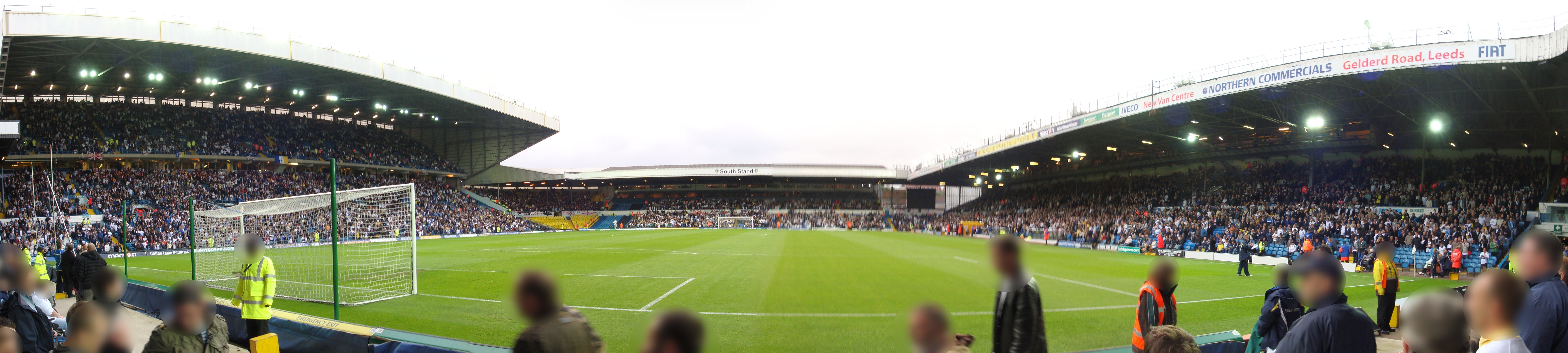
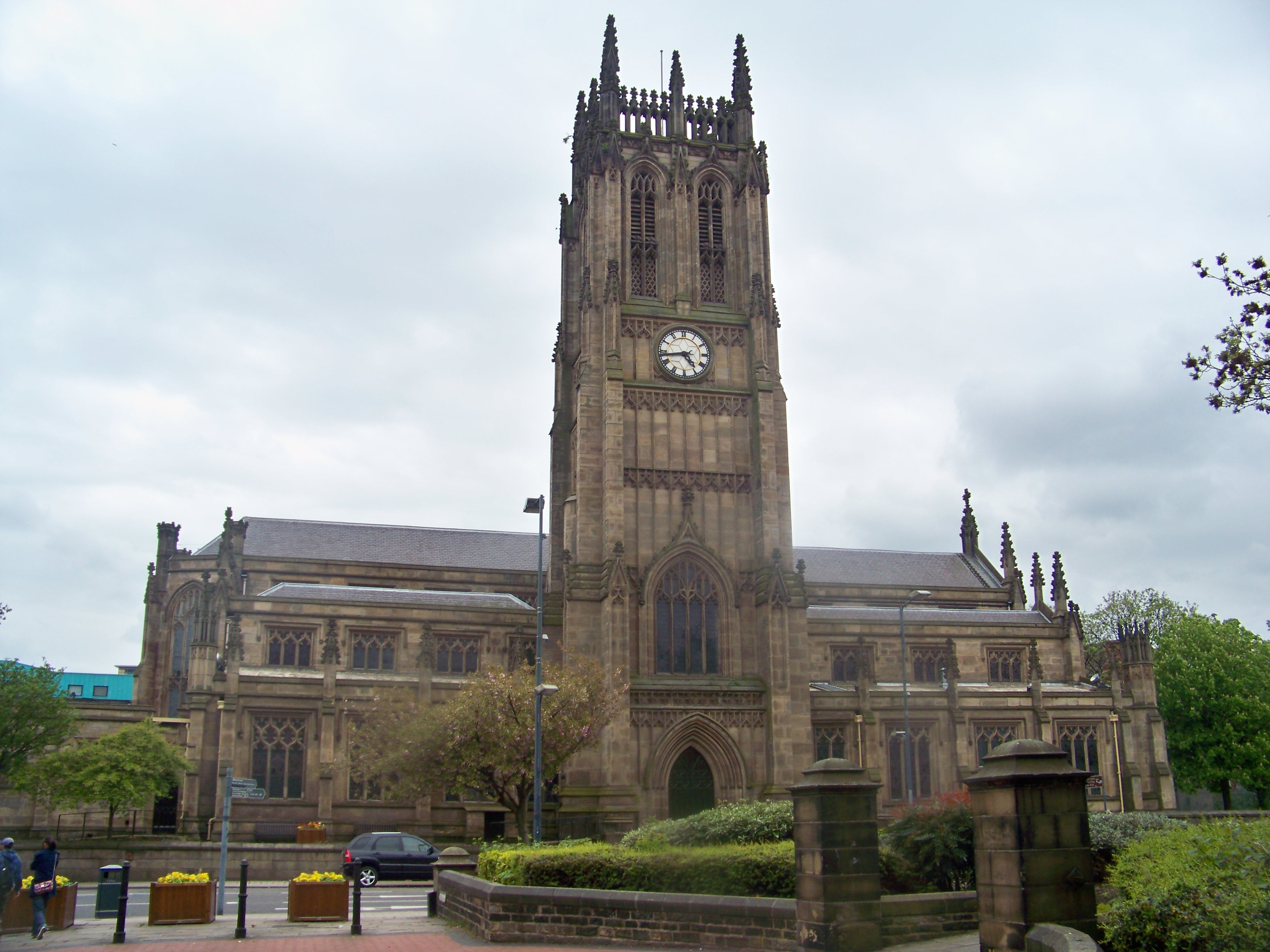
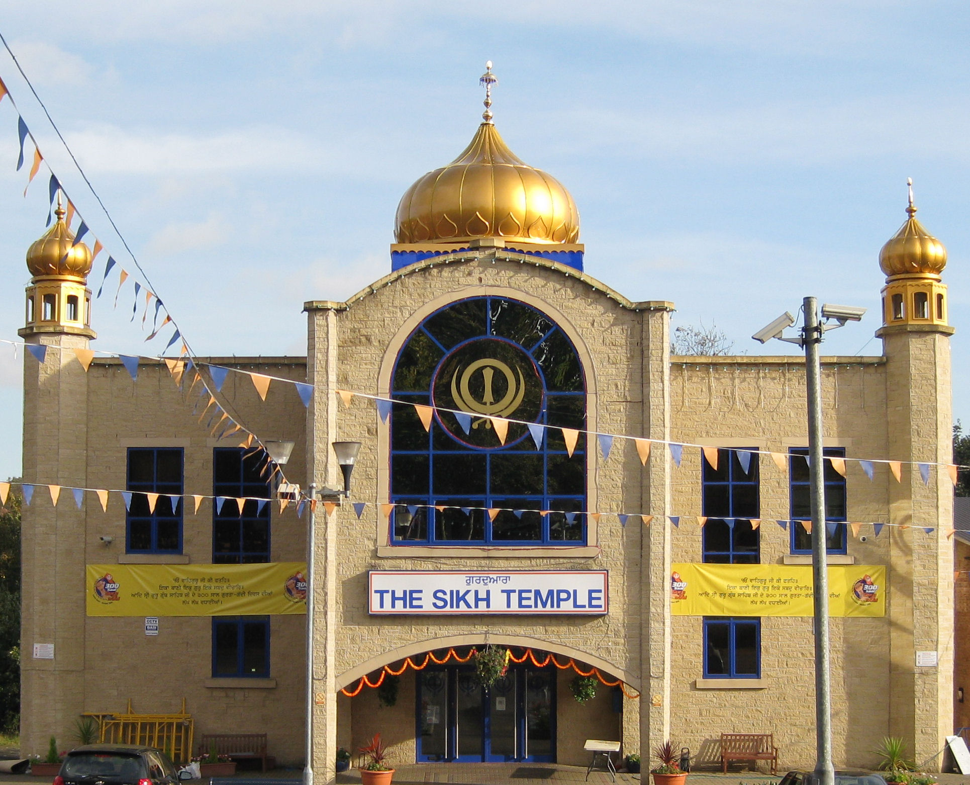

Wikimedia Foundation. 2010.