- Morganton, North Carolina
-
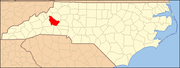
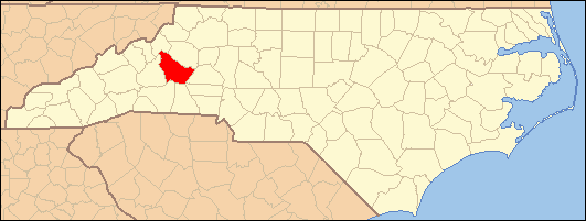
Morganton, North Carolina — City — 
Coordinates: 35°44′33″N 81°41′32″W / 35.7425°N 81.69222°WCoordinates: 35°44′33″N 81°41′32″W / 35.7425°N 81.69222°W Country United States State North Carolina County Burke Founded 1777 Incorporated 1784 Government – Mayor Mel L. Cohen Area – Total 19.23 sq mi (47 km2) – Land 18.2 sq mi (47.0 km2) – Water 0.0 sq mi (0.0 km2) Elevation 1,161 ft (354 m) Population (2000) – Total 17,310 – Density 953.0/sq mi (368.0/km2) Time zone Eastern (UTC-5) – Summer (DST) Eastern (UTC-4) ZIP codes 28655, 28680 Area code(s) 828 FIPS code 37-44400[1] GNIS feature ID 0990244[2] Website www.ci.morganton.nc.us Morganton is a city in Burke County, North Carolina, United States. Reader's Digest included Morganton in its list of top ten places to raise a family. The town was recently profiled in The 50 Best Small Southern Towns. The population was 17,310 at the 2000 census. It is the county seat of Burke County[3].
Morganton is one of the principal cities in the Hickory-Lenoir-Morganton, NC Metropolitan Statistical Area.
Near the city is the significant archaeological and historic site of Joara, a regional chiefdom of Mississippian culture and the location where the Spanish built Fort San Juan in 1567. It was settled by the Mississippian culture by 1000 CE. It was also the first European colonial settlement in the interior of the United States, built more than 40 years before the English settled Jamestown, Virginia.[4]
Contents
Geography
Morganton is located at 35°44′33″N 81°41′32″W / 35.7425°N 81.69222°W (35.742585, -81.692360).[5]
According to the United States Census Bureau, the city has a total area of 19.23 square miles (49.8 km2).
Demographics
As of the census[1] of 2000, there were 17,310 people, 6,829 households, and 4,117 families residing in the city. The population density was 953.0 people per square mile (368.0/km²). There were 7,313 housing units at an average density of 402.6 per square mile (155.5/km²). The racial composition of the city was: 75.67% White, 12.76% Black or African American, 11.16% Hispanic or Latino American, 1.99% Asian American, 0.55% Native American, 0.81% Native Hawaiian or Other Pacific Islander, 6.64% some other race, and 1.58% two or more races.
There were 6,829 households out of which 26.8% had children under the age of 18 living with them, 43.1% were married couples living together, 12.9% had a female householder with no husband present, and 39.7% were non-families. 34.5% of all households were made up of individuals and 14.4% had someone living alone who was 65 years of age or older. The average household size was 2.31 and the average family size was 2.92.
In the city the population was spread out with 21.1% under the age of 18, 8.5% from 18 to 24, 29.3% from 25 to 44, 22.5% from 45 to 64, and 18.5% who were 65 years of age or older. The median age was 39 years. For every 100 females there were 95.2 males. For every 100 females age 18 and over, there were 92.0 males.
The median income for a household in the city was $34,678, and the median income for a family was $42,687. Males had a median income of $29,118 versus $24,723 for females. The per capita income for the city was $20,906. About 9.7% of families and 13.6% of the population were below the poverty line, including 17.0% of those under age 18 and 11.9% of those age 65 or over.
Media
- Big Dawg 92.1 WMNC-FM--#1 for Hot New Country
- Classic Hits Country 1430 WMNC-AM
- BigDawg92Fm.com
- The Morganton News-Herald, the daily newspaper (circulation 12,000)
Education
Colleges and universities
- Western Piedmont Community College
- Appalachian State University Branch
Public schools
- Freedom High School
- East Burke High School
- Robert Logan Patton High School
- Draughn High School
- Table Rock Middle School
- Liberty Middle School
- Walter R. Johnson Middle School
- Glen Alpine Elementary School
- Mountain View Elementary School
- Chesterfield Elementary School
- W. A. Young Elementary School
- Burke Alternative School
- College Street Academy
- Morganton Christian Academy
- North Carolina School for the Deaf
Notable people
- Etta Baker, guitarist and singer of the Piedmont Blues.
- Johnny Bristol, musician and Motown producer.
- Joe Cheves, professional golfer and member of the North Carolina Sports Hall of Fame
- Alfreda Gerald, vocalist, recording artist.
- Samuel James Ervin Jr., United States Senator who led the Watergate hearings
- Leon Johnson, former NFL running back
- Bill Leslie, TV anchor WRAL News, New Age recording artist.
- Billy Joe Patton, amateur golfer who almost won the 1954 Masters Tournament, member of the North Carolina Sports Hall of Fame
- Frankie Silver, the first woman hanged in North Carolina
- Paige Summers, Penthouse 1998 Pet of the Year
- Kerri Gardin, WNBA Player (Connecticut Sun)
- Aaron Ramsey, mandolin and singer for bluegrass band Mountain Heart
Synthron plant explosion
On January 31, 2006 an explosion occurred at Synthron Inc, a paint additive chemical manufacturer's plant in Morganton. Workers at Synthron reported hearing a loud hiss minutes before the explosion. Most were able to escape the building before the blast, but even some who were outside were thrown as far as 20 feet. The explosion was heard and felt as far away as 50 miles. A leaky chemical reactor was blamed for the explosion.
In the end, 14 people were injured in the blast, of whom one man later died. In addition, at least 300 fish died due to the leaking of chemicals into a creek behind the Synthron plant which leads into the Catawba River.
Joara archeological site
The oldest known European inland (non-coastal) settlement in the United States has been identified at Joara, a former Mississippian culture village near Morganton. Fort San Juan, built there by Spanish explorers in 1567 and occupied for 18 months, is being excavated.[6][7][8]
Recreation
15 miles outside of Morganton is Lake James, which is surrounded by the Blue Ridge Mountains. There are also multiple ski areas located approximately an hour from Morganton.
Golf courses
- Quaker Meadows Golf Course
- Mimosa Hills Golf and Country Club
- Silver Creek Plantation.
Life in literature
Morganton is the setting for the Jules Verne novel The Master of the World. The book provides a description of the town when Verne visited it in the 19th century. In the Verne novel, Morganton is the place where people see the great machine that can travel four different ways (air, above water, below water, and land). They first spot the machine over a mountain referred to as "the Great Eyrie" in Morganton. The mountain is described as a flat-topped mountain, which most local residents believe stands for Table Rock.
Morganton is also mentioned several times in John Ehle's novel The Land Breakers, where it is identified as the nearest established settlement at the time and the one that the characters of the novel go to for supplies.
Morganton and surrounding areas including Charlotte, Marion, Asheville, and Black Mountain (where the book is based) are also mentioned in the fictional book, "One Second After" by William R. Forstchen where it talks about the state mental hospital.
Leon Fink's history The Maya of Morganton: Work and Community in the Nuevo New South provides an account of the efforts of Guatemalan-born workers in Morganton to organize a union at the Case Farms poultry plant during the 1990s. As Fink argues, the plight of immigrant workers in Morganton is emblematic of how labor and factory work have changed in the "Nuevo" South, and the relationship between globalization and the creation of new immigrant communities in the US.
Citations
- ^ a b "American FactFinder". United States Census Bureau. http://factfinder.census.gov. Retrieved 2008-01-31.
- ^ "US Board on Geographic Names". United States Geological Survey. 2007-10-25. http://geonames.usgs.gov. Retrieved 2008-01-31.
- ^ "Find a County". National Association of Counties. http://www.naco.org/Counties/Pages/FindACounty.aspx. Retrieved 2011-06-07.
- ^ Constance E. Richards, "Contact and Conflict", American Archaeologist, Spring 2008, accessed 26 Jun 2009
- ^ "US Gazetteer files: 2010, 2000, and 1990". United States Census Bureau. 2011-02-12. http://www.census.gov/geo/www/gazetteer/gazette.html. Retrieved 2011-04-23.
- ^ "Spain Makes a Stand", Smithsonian Magazine, March 2006. Accessed 2007-08-02.
- ^ "Joara and Fort San Juan", Antiquity, March 2004.
- ^ Archaeological site, Warren Wilson College
References
- Gerald W. Sweitzer and Kathy Fields, The 50 Best Small Southern Towns, Atlanta: Peachtree Publishing Co., 2001 (ISBN 1-56145-253-X)
External links
Municipalities and communities of Burke County, North Carolina County seat: MorgantonCities Hickory‡ | Morganton
Towns Connellys Springs | Drexel | Glen Alpine | Hildebran | Long View‡ | Rhodhiss‡ | Rutherford College | Valdese
CDPs Unincorporated
communitiesJonas Ridge | Linville Falls‡ | Petersburg
Townships Drexel | Icard | Jonas Ridge | Linville | Lovelady | Lower Creek | Lower Fork | Morganton | Quaker Meadows | Silver Creek | Smoky Creek | Upper Creek | Upper Fork | Valdese
Footnotes ‡This populated place also has portions in an adjacent county or counties
Categories:- Populated places in Burke County, North Carolina
- Cities in North Carolina
- County seats in North Carolina
- Spanish colonization of the Americas
- Native American history
- The Unifour

Wikimedia Foundation. 2010.