- National Register of Historic Places listings in Northwest Philadelphia
-
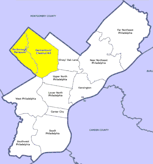
 Location of Northwest Philadelphia in Philadelphia
This is a list of the National Register of Historic Places listings in Northwest Philadelphia.
This is intended to be a complete list of the properties and districts on the National Register of Historic Places in Northwest Philadelphia, Pennsylvania, United States. The locations of National Register properties and districts for which the latitude and longitude coordinates are included below, may be seen in a Google map.[1]
There are 532 properties and districts listed on the National Register in Philadelphia, including 67 National Historic Landmarks. Northwest Philadelphia includes 69 of these properties and districts, including 6 National Historic Landmarks; the city's remaining properties and districts are listed elsewhere. One site is split between Northwest Philadelphia and other parts of the city, and is thus included on multiple lists.
Current listings
[2] Landmark name[3] Image Date listed Location Neighborhood[4] Summary 1 Alden Park Manor 
August 15, 1980 School House Lane and Wissahickon Avenue
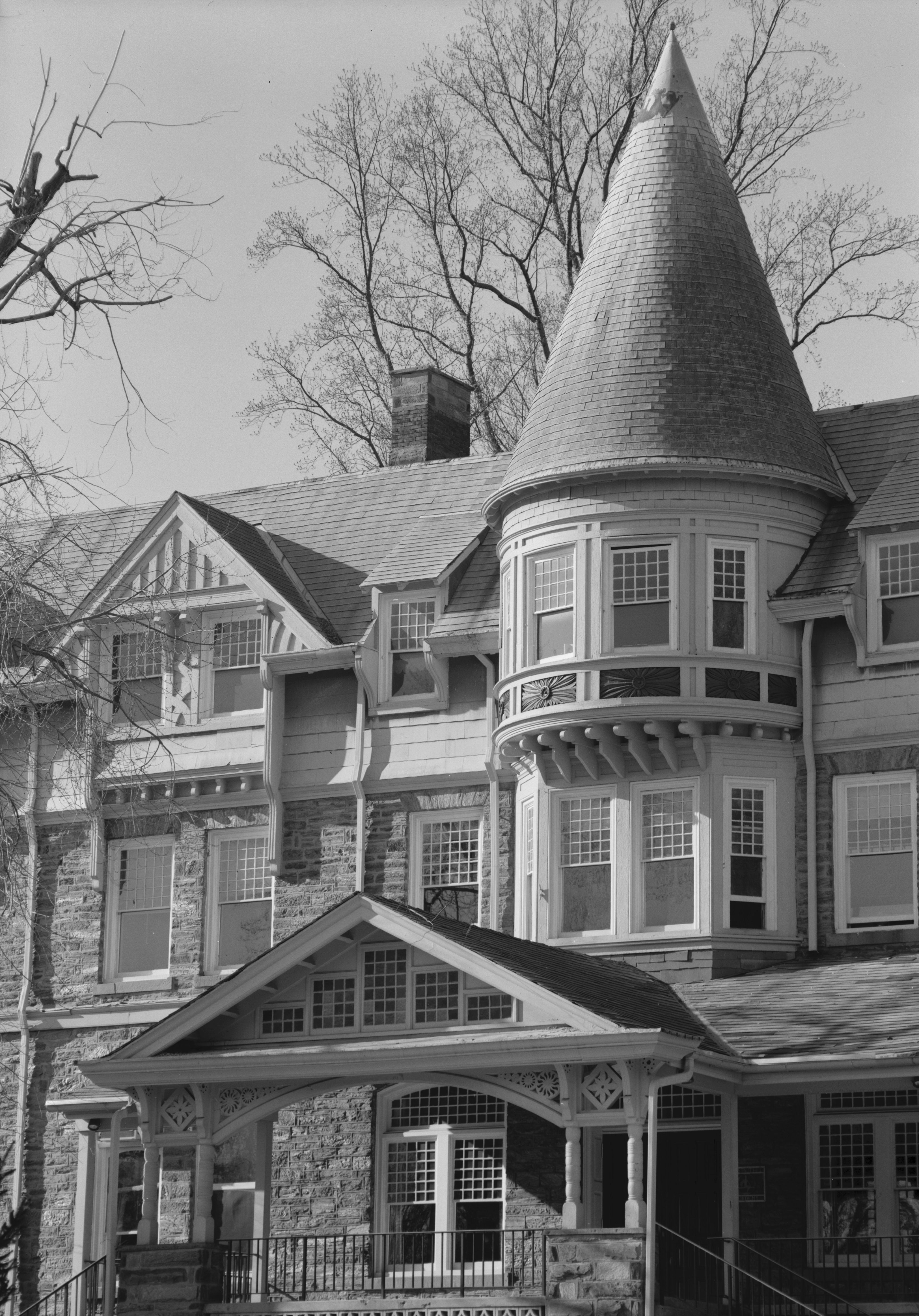
40°1′34″N 75°11′10″W / 40.02611°N 75.18611°WGermantown 2 The Anglecot 
April 19, 1982 Evergreen and Prospect Streets
40°4′51″N 75°12′14″W / 40.08083°N 75.20389°WChestnut Hill 3 Awbury Historic District 
May 2, 2001 Roughly bounded by Chew Avenue, Avonhoe Road, Devon Place, Haines and Ardleigh Streets and the Arboretum boundary
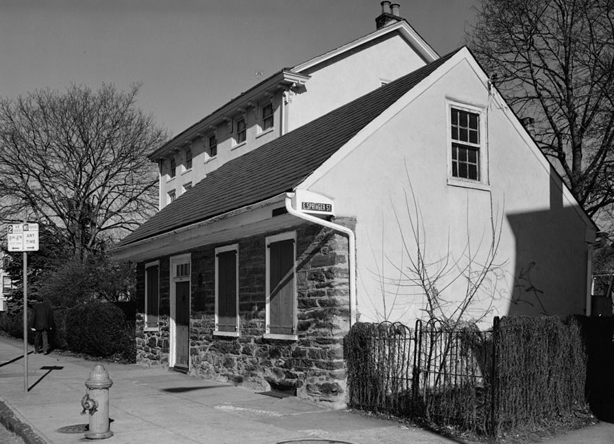
40°3′6″N 75°10′14″W / 40.05167°N 75.17056°WEast Germantown 4 Beggarstown School 
November 23, 1971 6669 Germantown Avenue
40°3′5″N 75°11′6″W / 40.05139°N 75.185°WMount Airy 5 Daniel Billmeyer House 
December 13, 1971 6504 Germantown Avenue
40°2′55″N 75°11′3″W / 40.04861°N 75.18417°WMount Airy 6 Michael Billmeyer House 
January 13, 1972 6505–6507 Germantown Avenue
40°2′54″N 75°11′2″W / 40.04833°N 75.18389°WMount Airy 7 Chestnut Hill Historic District 
June 20, 1985 Roughly bounded by Fairmount Park and the Montgomery County line
40°4′18″N 75°12′47″W / 40.07167°N 75.21306°WChestnut Hill 8 Clarkson-Watson House 
April 2, 1973 5275–5277 Germantown Avenue
40°1′56″N 75°10′8″W / 40.03222°N 75.16889°WWister 9 Cliveden 
October 15, 1966 6401 Germantown Avenue
40°2′50″N 75°10′54″W / 40.04722°N 75.18167°WMount Airy 10 Colonial Germantown Historic District 
October 15, 1966 Germantown Avenue between Windrim Avenue and Upsal Street; also the 6500–7600 blocks of Germantown Avenue from the Fort Washington branch of the Pennsylvania Railroad to Sharpnack Street
40°2′11″N 75°10′29″W / 40.03639°N 75.17472°WGermantown and Mount Airy 11 Compton and Bloomfield 
December 22, 1978 9414 Meadowbrook Avenue
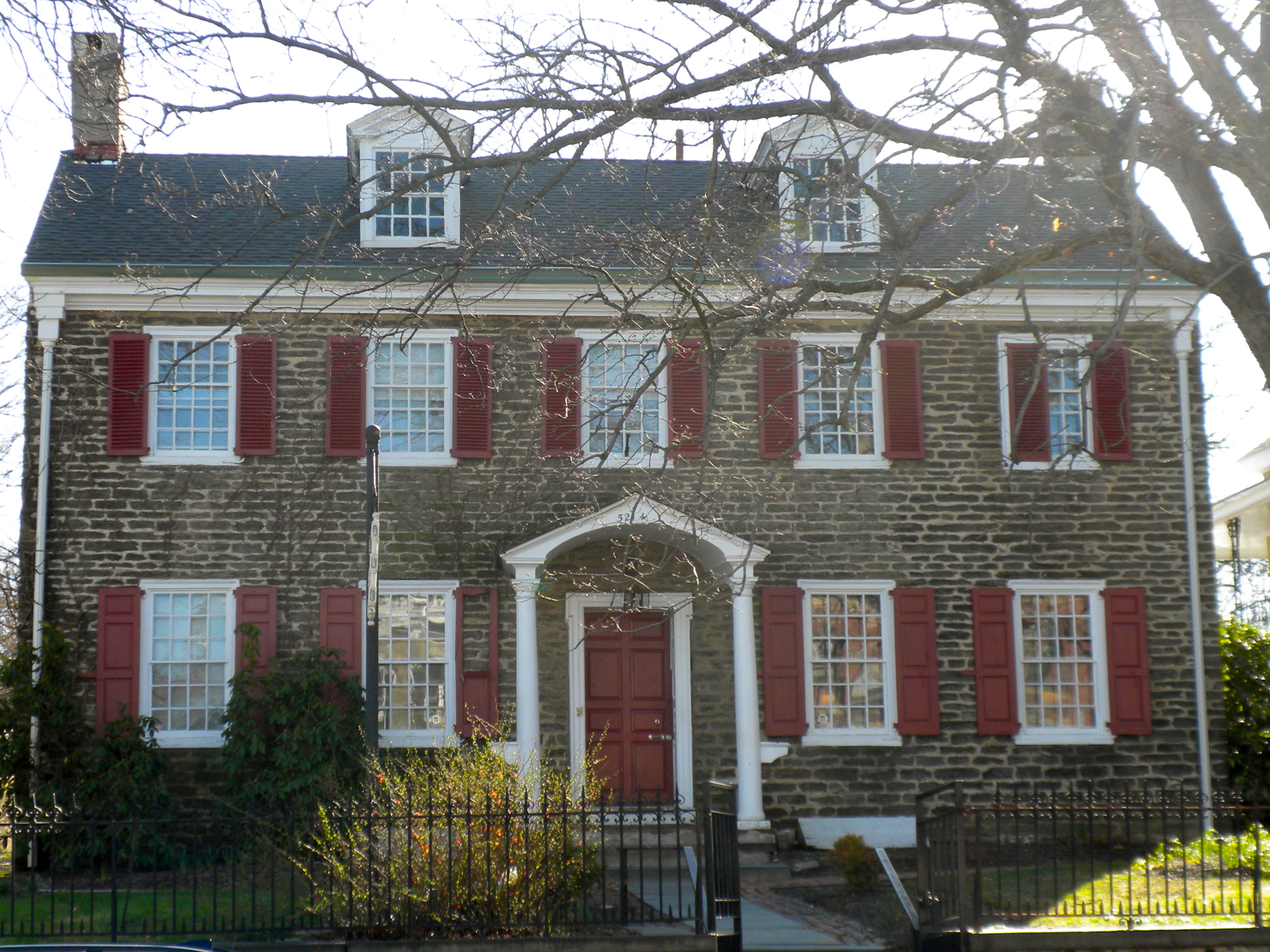
40°5′21″N 75°13′29″W / 40.08917°N 75.22472°WChestnut Hill Extends into Montgomery County 12 Conyngham-Hacker House 
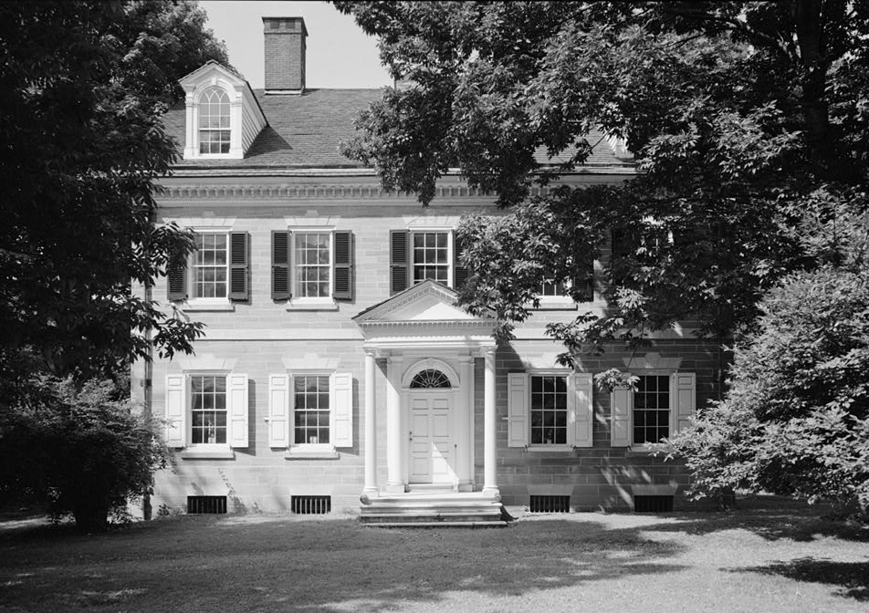
January 13, 1972 5214 Germantown Avenue
40°1′52″N 75°10′4″W / 40.03111°N 75.16778°WGermantown 13 Delmar Apartments 
November 14, 1982 319 West Chelton Avenue
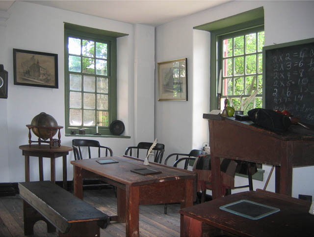
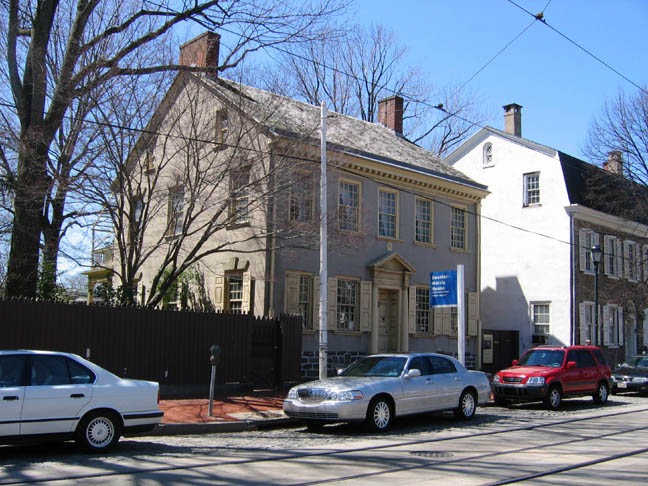
40°1′47″N 75°10′54″W / 40.02972°N 75.18167°WGermantown 14 Deshler-Morris House 
January 13, 1972 5442 Germantown Avenue
40°2′1″N 75°10′22″W / 40.03361°N 75.17278°WGermantown 15 James Dobson School 
November 18, 1988 4665 Umbria Street
40°1′52″N 75°13′50″W / 40.03111°N 75.23056°WManayunk 16 Druim Moir Historic District 
December 11, 1979 Bounded by Fairmount Park, Cherokee Street, Hartwell Lane, and Valley Green Drive
40°3′33″N 75°12′52″W / 40.05917°N 75.21444°WChestnut Hill 17 Eleanor Cope Emlen School of Practice 
November 18, 1988 6501 Chew Street
40°3′15″N 75°10′42″W / 40.05417°N 75.17833°WMount Airy 18 Fairmount Park 
February 7, 1972 Both banks of the Schuylkill River and the Wissahickon Creek, from Spring Garden Street to Northwestern Avenue
40°1′15″N 75°12′46″W / 40.02083°N 75.21278°WFairmount Park Extends into North and West Philadelphia 19 Fisher's Lane 
February 20, 1980 39–92 East Logan Street
40°1′46″N 75°9′40″W / 40.02944°N 75.16111°WWister 20 Fitler School 
December 4, 1986 Southeast corner of Seymour and Knox Streets
40°1′33″N 75°10′0″W / 40.02583°N 75.166667°WGermantown 21 Robert Fulton School 
December 4, 1986 60–68 East Haines Street
40°2′24″N 75°10′36.5″W / 40.04°N 75.176806°WMorton 22 Germantown Cricket Club 
February 27, 1987 5140 Morris Street
40°1′25″N 75°10′24″W / 40.02361°N 75.17333°WGermantown 23 Germantown Grammar School 
December 1, 1986 McCallum and Haines Streets
40°2′16″N 75°10′41″W / 40.03778°N 75.17806°WGermantown 24 Grace Church, Mt. Airy 
January 15, 1998 224 East Gowen Avenue
40°3′57″N 75°11′19.5″W / 40.06583°N 75.18875°WMount Airy 25 Graver's Lane Station 
November 7, 1977 Gravers Lane and Reading Railroad line
40°4′38.5″N 75°12′7″W / 40.077361°N 75.20194°WChestnut Hill 26 Grumblethorpe 
March 16, 1972 5267 Germantown Avenue
40°1′55.5″N 75°10′6.5″W / 40.032083°N 75.168472°WWister 27 Grumblethorpe Tenant House 
June 19, 1972 5269 Germantown Avenue
40°1′55.5″N 75°10′7″W / 40.032083°N 75.16861°WWister 28 Charles Wolcott Henry School 
November 18, 1988 601–645 Carpenter Lane
40°2′46″N 75°11′47″W / 40.04611°N 75.19639°WMount Airy 29 Robert M. Hogue House 
January 16, 1986 100 Pelham Road
40°3′7″N 75°11′15.5″W / 40.05194°N 75.187639°WMount Airy 30 Henry H. Houston School 
April 10, 1989 135 West Allen's Lane
40°3′32″N 75°11′42″W / 40.05889°N 75.195°WMount Airy 31 Howell House 
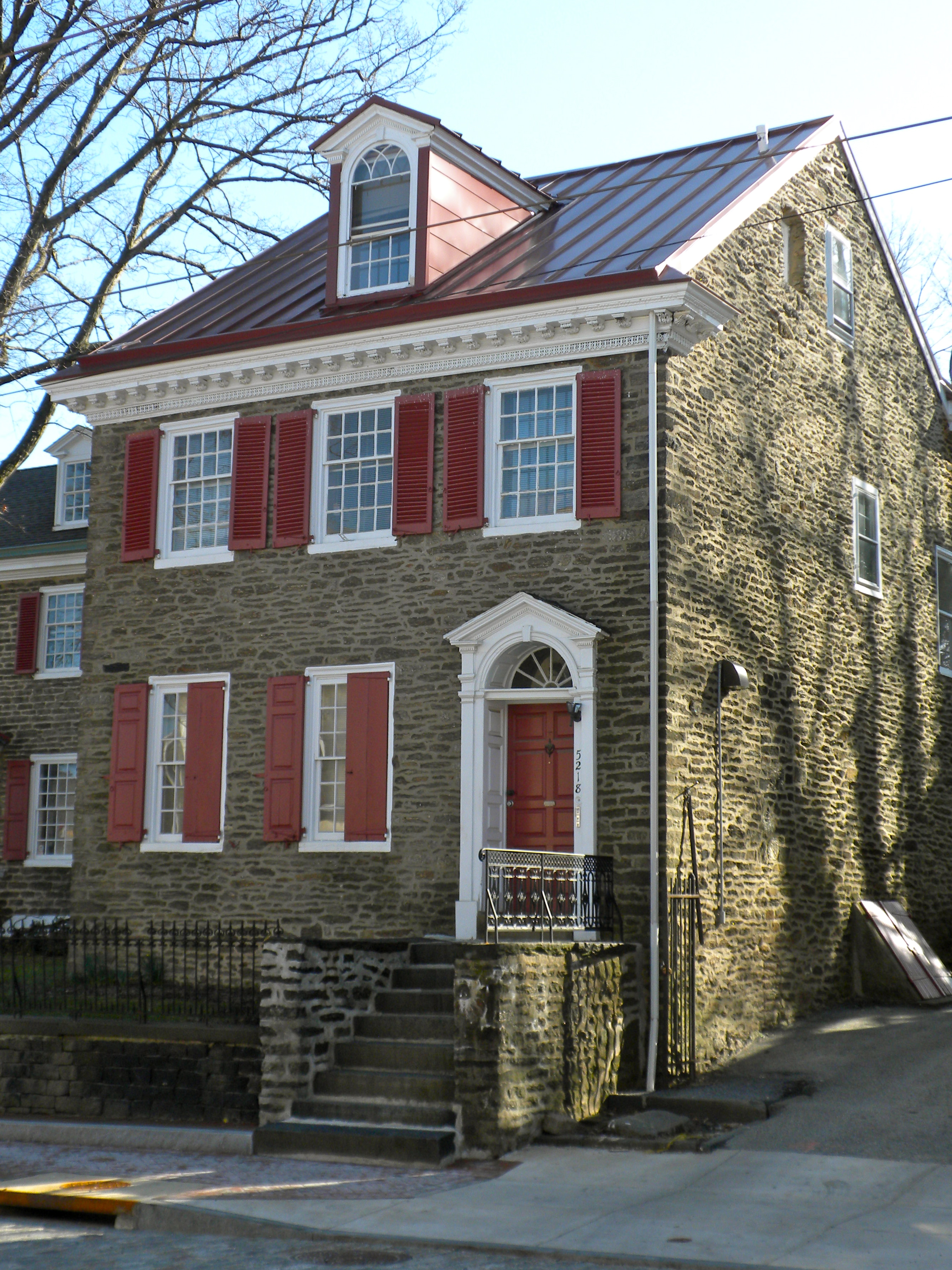
January 13, 1972 5218 Germantown Avenue
40°1′53″N 75°10′4″W / 40.03139°N 75.16778°WGermantown 32 Ivy Lodge 
February 1, 1972 29 East Penn Street
40°1′59.5″N 75°10′7.5″W / 40.033194°N 75.16875°WWister 33 John Story Jenks School 
November 18, 1988 8301–8317 Germantown Avenue
40°4′29.5″N 75°12′11.5″W / 40.074861°N 75.203194°WChestnut Hill 34 John Johnson House 
January 13, 1972 6306 Germantown Avenue
40°2′36″N 75°10′52″W / 40.04333°N 75.18111°WGermantown 35 William Levering School 
November 18, 1988 5938 Ridge Avenue
40°1′51″N 75°12′46″W / 40.03083°N 75.21278°WRoxborough 36 Malvern Hall 
August 25, 1983 6655 McCallum Street
40°2′45.5″N 75°11′28″W / 40.045972°N 75.19111°WMount Airy 37 Manayunk Main Street Historic District 
March 18, 1983 Roughly bounded by the Reading Railroad, Flat Rock Dam, Schuylkill River, and Lot 4025 on Main Street
40°2′0″N 75°14′13″W / 40.033333°N 75.23694°WManayunk 38 Ebenezer Maxwell House 
February 24, 1971 200 West Tulpehocken Street
40°2′17.5″N 75°11′1″W / 40.038194°N 75.18361°WGermantown 39 Mayfair House 
April 7, 1982 401 West Johnson Street
40°2′14″N 75°11′30″W / 40.03722°N 75.19167°WGermantown Destroyed.[5] Photo shows empty lot with Connie Mack's house in background. 40 McCallum Manor 
May 9, 1985 6653 McCallum Avenue
40°2′43.5″N 75°11′28.5″W / 40.045417°N 75.19125°WMount Airy 41 Thomas Meehan School 
November 18, 1988 5347–5353 Pulaski Street
40°1′39″N 75°10′30″W / 40.0275°N 75.175°WGermantown 42 Mennonite Meetinghouse 
July 23, 1973 6119 Germantown Avenue
40°2′28.3″N 75°10′44.8″W / 40.041194°N 75.179111°WMorton 43 Thomas Mifflin School 
November 18, 1988 3500 Midvale Avenue
40°0′48.5″N 75°11′29.5″W / 40.013472°N 75.191528°WEast Falls 44 The Monastery 
March 16, 1972 Kitchen's Lane at Wissahickon Creek
40°2′10″N 75°12′13″W / 40.03611°N 75.20361°WFairmount Park 45 Mt. Airy Station 
September 22, 1977 119 East Gowen Avenue
40°3′54.7″N 75°11′28″W / 40.065194°N 75.19111°WMount Airy 46 Nugent Home for Baptists 
August 30, 2006 221 West Johnson Street
40°2′32.5″N 75°11′11″W / 40.042361°N 75.18639°WMount Airy 47 Violet Oakley Studio 
September 13, 1977 627 St. George's Road
40°3′11.5″N 75°12′18.9″W / 40.053194°N 75.20525°WMount Airy 48 Old Germantown Academy and Headmasters' Houses 
January 13, 1972 Schoolhouse Lane and Greene Street
40°1′59.5″N 75°10′29″W / 40.033194°N 75.17472°WGermantown 49 Pennsylvania Institute for the Deaf and Dumb 
May 9, 1985 7500 Germantown Ave.
40°3′49″N 75°11′47″W / 40.06361°N 75.19639°WChestnut Hill 50 Presser Home for Retired Music Teachers 
November 8, 2006 101–121 W. Johnson St.
40°2′37.5″N 75°11′6.5″W / 40.04375°N 75.185139°WMount Airy 51 Ridge Avenue Bridge in Philadelphia 
June 22, 1988 Ridge Avenue over the Wissahickon Creek
40°0′53.5″N 75°12′24″W / 40.014861°N 75.20667°WWissahickon 52 RittenhouseTown Historic District 
April 27, 1992 206–210 Lincoln Drive
40°1′43″N 75°11′28″W / 40.02861°N 75.19111°WFairmount Park 53 Theodore Roosevelt Junior High School 
November 18, 1988 430 East Washington Lane
40°2′54″N 75°10′31″W / 40.04833°N 75.17528°WMorton 54 St. Peter's Episcopal Church of Germantown 
September 5, 1985 6000 Wayne Avenue
40°2′23″N 75°11′1″W / 40.03972°N 75.18361°WGermantown 55 Charles Schaeffer School 
December 4, 1986 Germantown Avenue and Abbottsford Road
40°1′37″N 75°9′37″W / 40.02694°N 75.16028°WGermantown 56 Edward B. Seymour House 
November 5, 1987 260 West Johnson Street
40°2′27.5″N 75°11′13″W / 40.040972°N 75.18694°WMount Airy 57 William C. Sharpless House 
December 29, 1983 5446 Wayne Avenue
40°1′47″N 75°10′34″W / 40.02972°N 75.17611°WGermantown 58 Smyser and English Pharmacy 
February 20, 2002 245–247 West Chelten Avenue
40°1′50″N 75°10′49.5″W / 40.03056°N 75.180417°WGermantown 59 Thomas Mill Covered Bridge 
December 1, 1980 Thomas Mill Road
40°4′19″N 75°13′32″W / 40.07194°N 75.22556°WFairmount Park 60 Tulpehocken Station Historic District 
November 26, 1985 Roughly bounded by McCallum Street, West Walnut Lane, Penn Central railroad tracks, and West Tulpehocken Street
40°2′17″N 75°10′58″W / 40.03806°N 75.18278°WGermantown 61 Upper Roxborough Historic District 
May 2, 2001 Roughly bounded by Shawmont Avenue, Hagy's Mill Road, and the Schuylkill River
40°3′24″N 75°14′44″W / 40.05667°N 75.24556°WRoxborough Extends into Montgomery County 62 Upsala 
January 13, 1972 6430 Germantown Avenue
40°2′48″N 75°10′59″W / 40.04667°N 75.18306°WMount Airy 63 Sally Watson House 
March 10, 1982 5128 Wayne Avenue
40°1′35″N 75°10′12.5″W / 40.02639°N 75.170139°WGermantown 64 Wissahickon 
November 25, 1983 Schuyler and Queen Streets
40°1′22.5″N 75°10′36″W / 40.022917°N 75.17667°WEast Falls 65 Wissahickon Inn 
December 6, 1979 500 West Willow Grove Avenue
40°3′44″N 75°12′31″W / 40.06222°N 75.20861°WChestnut Hill 66 Wissahickon Memorial Bridge 
June 22, 1988 Henry Avenue over Wissahickon Drive
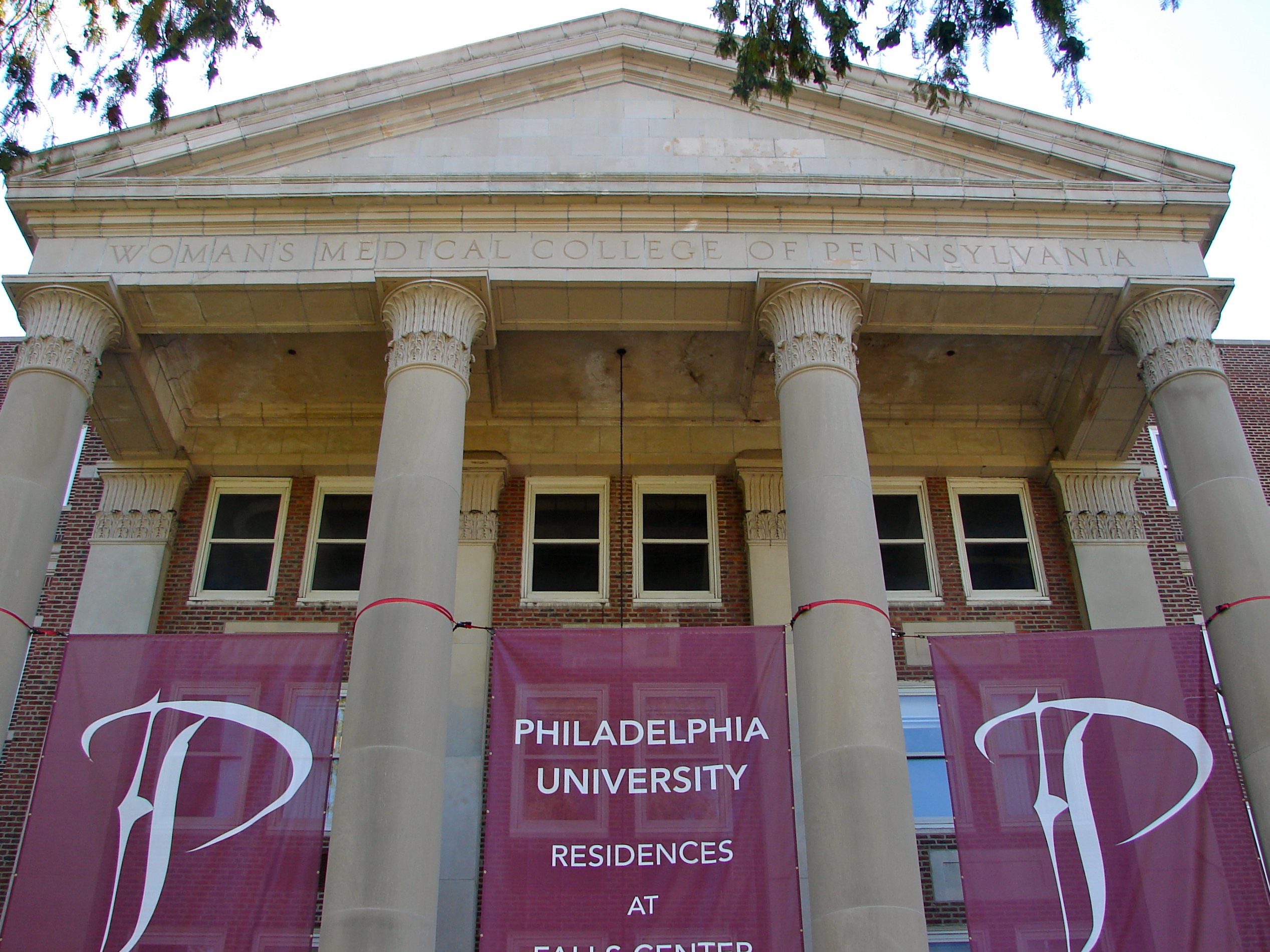
40°1′27″N 75°11′44″W / 40.02417°N 75.19556°WFairmount Park 67 Woman's Medical College of Pennsylvania 
November 26, 2008 3300 Henry Ave.
40°0′42″N 75°11′3″W / 40.01167°N 75.18417°WEast Falls 68 Wyck House 
October 26, 1971 6026 Germantown Avenue
40°2′24″N 75°10′42.5″W / 40.04°N 75.178472°WGermantown 69 YMCA of Germantown 
November 14, 1991 5722 Greene Street
40°2′4″N 75°10′38.5″W / 40.03444°N 75.177361°WGermantown See also
- List of National Historic Landmarks in Philadelphia
- National Register of Historic Places listings in Philadelphia, Pennsylvania
References
- ^ The latitude and longitude information provided in this table was derived originally from the National Register Information System, which has been found to be fairly accurate for about 99% of listings. For about 1% of NRIS original coordinates, experience has shown that one or both coordinates are typos or otherwise extremely far off; some corrections may have been made. A more subtle problem causes many locations to be off by up to 150 yards, depending on location in the country: most NRIS coordinates were derived from tracing out latitude and longitudes off of USGS topographical quadrant maps created under North American Datum of 1927, which differs from the current, highly accurate GPS system used by Google maps. Chicago is about right, but NRIS longitudes in Washington are higher by about 4.5 seconds, and are lower by about 2.0 seconds in Maine. Latitudes differ by about 1.0 second in Florida. Some locations in this table may have been corrected to current GPS standards.
- ^ Numbers represent an ordering by significant words. Various colorings, defined here, differentiate National Historic Landmark sites and National Register of Historic Places Districts from other NRHP buildings, structures, sites or objects.
- ^ "NPS Focus". National Register of Historic Places. National Park Service. http://nrhp.focus.nps.gov. Retrieved November 20, 2009.
- ^ "The Political and Community Service Boundaries of Philadelphia" (PDF). Philadelphia City Planning Commission. June 2004. http://www.philaplanning.org/data/boundaries.pdf.
- ^ Skyscraperpage.com
Neighborhoods of the Northwest Philadelphia section of Philadelphia, Pennsylvania Andorra • Beggarstown • Chestnut Hill • East Falls • Germantown • Manayunk • Morton • Mount Airy • Roxborough • Wissahickon • Wister
 Categories:
- Buildings and structures in Philadelphia, Pennsylvania
- National Register of Historic Places in Philadelphia, Pennsylvania


Wikimedia Foundation. 2010.