There are 29 properties and districts listed on the National Register in the county, including 1 National Historic Landmark.
| [3] |
Landmark name [4] |
Image |
Date listed |
Location |
City or town |
Summary |
| 1 |
Charles Andres House |
|
01995-11-06November 6, 1995 |
County Road 154 (Fox Rd.) on Middle Bass Island
41°41′08″N 82°48′39″W / 41.685556°N 82.810833°W / 41.685556; -82.810833 (Charles Andres House) |
Put-in-Bay Township |
|
| 2 |
Carroll Township Hall |
|
01990-03-09March 9, 1990 |
Toussaint E. Rd. and Behlman Rd.
41°34′05″N 83°07′35″W / 41.568056°N 83.126389°W / 41.568056; -83.126389 (Carroll Township Hall) |
Oak Harbor |
|
| 3 |
Catawba Island Wine Company |
|
01983-05-05May 5, 1983 |
3845 Wine Celler Rd., east of Port Clinton
41°31′55″N 82°51′31″W / 41.531944°N 82.858611°W / 41.531944; -82.858611 (Catawba Island Wine Company) |
Danbury Township |
|
| 4 |
Alexander Clemons House |
|
01987-09-17September 17, 1987 |
133 Clemons St.
41°32′33″N 82°43′24″W / 41.5425°N 82.723333°W / 41.5425; -82.723333 (Alexander Clemons House) |
Marblehead |
|
| 5 |
Jay Cooke House |
|
01966-11-13November 13, 1966 |
Gibraltar Island, Put-in-Bay, Lake Erie
41°39′29″N 82°49′16″W / 41.658056°N 82.821111°W / 41.658056; -82.821111 (Jay Cooke House) |
Put-in-Bay Township |
|
| 6 |
East Point Manor |
|
01990-06-15June 15, 1990 |
S. Shore Dr. on Middle Bass Island
41°41′40″N 82°47′13″W / 41.694444°N 82.786944°W / 41.694444; -82.786944 (East Point Manor) |
Put-in-Bay Township |
|
| 7 |
First Congregational Church |
|
02000-09-22September 22, 2000 |
802 Prairie St.
41°32′32″N 82°44′05″W / 41.542222°N 82.734722°W / 41.542222; -82.734722 (First Congregational Church) |
Marblehead |
|
| 8 |
Foster-Gram House |
|
01992-03-19March 19, 1992 |
Langrum Rd. on South Bass Island
41°38′43″N 82°49′13″W / 41.645278°N 82.820278°W / 41.645278; -82.820278 (Foster-Gram House) |
Put-in-Bay Township |
|
| 9 |
Genoa Town Hall |
|
01976-06-07June 7, 1976 |
Main and 6th Sts.
41°31′05″N 83°21′30″W / 41.518056°N 83.358333°W / 41.518056; -83.358333 (Genoa Town Hall) |
Genoa |
|
| 10 |
Gill-Luchsinger-Bahnsen House and Barn |
|
01992-07-16July 16, 1992 |
426 E. 4th St.
41°30′31″N 82°56′04″W / 41.508611°N 82.934444°W / 41.508611; -82.934444 (Gill-Luchsinger-Bahnsen House and Barn) |
Port Clinton |
|
| 11 |
Golden Eagle Wine Cellars |
|
01986-04-24April 24, 1986 |
Fox and Lonz Rds. on Middle Bass Island
41°40′36″N 82°48′37″W / 41.676667°N 82.810278°W / 41.676667; -82.810278 (Golden Eagle Wine Cellars) |
Put-in-Bay Township |
|
| 12 |
Green Island Light |
|
01990-12-18December 18, 1990 |
Green Island in Lake Erie
41°38′44″N 82°51′57″W / 41.645556°N 82.865833°W / 41.645556; -82.865833 (Green Island Light) |
Put-in-Bay Township |
ARLHS USA 353 |
| 13 |
Inselruhe |
|
01976-12-12December 12, 1976 |
Northeast of Put-in-Bay at the junction of Bayview Ave. and Chapman Rd. on South Bass Island
41°39′25″N 82°48′35″W / 41.656944°N 82.809722°W / 41.656944; -82.809722 (Inselruhe) |
Put-in-Bay |
|
| 14 |
Island House |
|
02008-07-02July 2, 2008 |
102 Madison St.
41°30′48″N 82°56′28″W / 41.513267°N 82.941147°W / 41.513267; -82.941147 (Island House) |
Port Clinton |
|
| 15 |
Johnson Island Civil War Prison and Fort Site |
|
01975-03-27March 27, 1975 |
Eastern shore area of Johnson's Island
41°29′42″N 82°43′53″W / 41.495106°N 82.731311°W / 41.495106; -82.731311 (Johnson Island Civil War Prison and Fort Site) |
Danbury Township |
|
| 16 |
Lakeside Historic District |
|
01983-03-29March 29, 1983 |
Roughly bounded by Lake Erie, railroad tracks, and Poplar and Oak Aves., in Lakeside
41°32′32″N 82°44′53″W / 41.542222°N 82.748056°W / 41.542222; -82.748056 (Lakeside Historic District) |
Danbury Township |
|
| 17 |
Main Street Historic District |
|
01992-09-22September 22, 1992 |
Roughly bounded by 8th, Washington, 5th, and West Sts.
41°31′07″N 83°21′31″W / 41.518611°N 83.358611°W / 41.518611; -83.358611 (Main Street Historic District) |
Genoa |
|
| 18 |
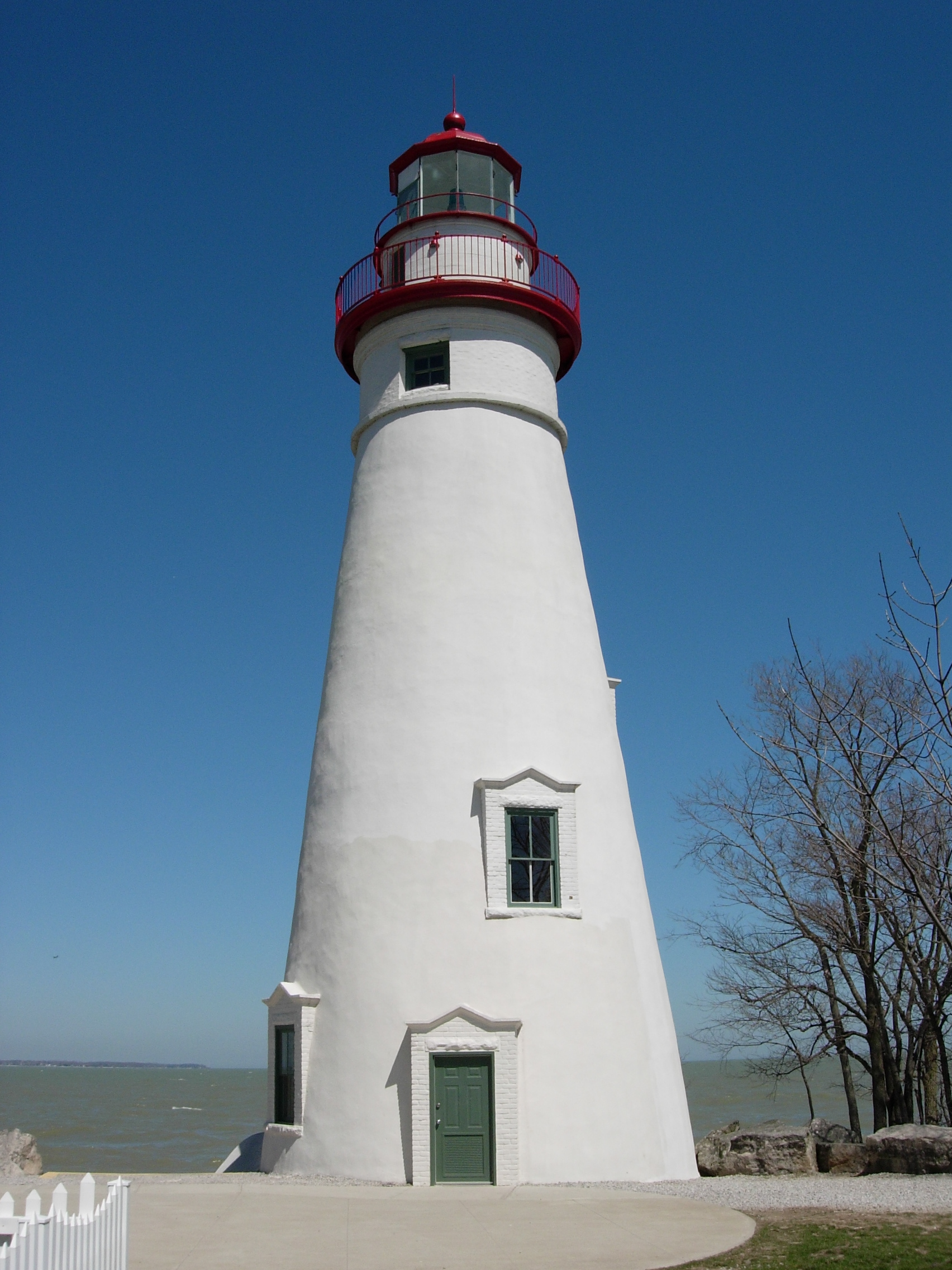
Marblehead Lighthouse |
|
01969-12-17December 17, 1969 |
State Route 163
41°32′11″N 82°42′42″W / 41.536389°N 82.711667°W / 41.536389; -82.711667 (Marblehead Lighthouse) |
Marblehead |
|
| 19 |
Middle Bass Club Historic District |
|
01985-08-23August 23, 1985 |
Grape and Grove Aves. on Middle Bass Island
41°41′05″N 82°49′30″W / 41.684722°N 82.825°W / 41.684722; -82.825 (Middle Bass Club Historic District) |
Put-in-Bay Township |
|
| 20 |
Betsy Mo-John Cabin |
|
01976-05-06May 6, 1976 |
About 4 mi (6.4 km) east of Port Clinton off State Route 53
41°31′55″N 82°51′29″W / 41.531944°N 82.858056°W / 41.531944; -82.858056 (Betsy Mo-John Cabin) |
Danbury Township |
|
| 21 |
Ohio State Route 51 Bridge over the Portage River |
|
01994-03-17March 17, 1994 |
State Route 51 over the Portage River
41°28′37″N 83°17′44″W / 41.476944°N 83.295556°W / 41.476944; -83.295556 (Ohio State Route 51 Bridge over the Portage River) |
Elmore and Harris Township |
|
| 22 |
Old School Privy |
|
01975-07-31July 31, 1975 |
310 Main St.
41°30′54″N 83°21′34″W / 41.515°N 83.359444°W / 41.515; -83.359444 (Old School Privy) |
Genoa |
|
| 23 |
Ottawa County Courthouse |
|
01974-05-03May 3, 1974 |
W. 4th and Madison Sts.
41°30′35″N 82°56′25″W / 41.509722°N 82.940278°W / 41.509722; -82.940278 (Ottawa County Courthouse) |
Port Clinton |
|
| 24 |
Perry's Victory and International Peace Memorial |
|
01966-10-15October 15, 1966 |
South Bass Island
41°39′15″N 82°48′41″W / 41.654167°N 82.811389°W / 41.654167; -82.811389 (Perry's Victory and International Peace Memorial) |
Put-in-Bay |
|
| 25 |
Port Clinton City Hall |
|
02000-02-10February 10, 2000 |
Adams St.
41°30′44″N 82°56′16″W / 41.512222°N 82.937778°W / 41.512222; -82.937778 (Port Clinton City Hall) |
Port Clinton |
|
| 26 |
South Bass Island Light |
|
01990-04-05April 5, 1990 |
Langram Rd., on the southwestern point of South Bass Island
41°37′46″N 82°50′30″W / 41.629444°N 82.841667°W / 41.629444; -82.841667 (South Bass Island Light) |
Put-in-Bay Township |
|
| 27 |
St. Thomas Episcopal Church |
|
01999-07-15July 15, 1999 |
214 E. 2nd St.
41°30′41″N 82°56′20″W / 41.511389°N 82.938889°W / 41.511389; -82.938889 (St. Thomas Episcopal Church) |
Port Clinton |
|
| 28 |
War Of 1812 Battle Site |
|
01972-02-23February 23, 1972 |
East Bay Shore Rd., 1 mi (1.6 km) west of its junction with Township Road 142
41°30′51″N 82°44′43″W / 41.514167°N 82.745278°W / 41.514167; -82.745278 (War Of 1812 Battle Site) |
Danbury Township |
|
| 29 |
Benajah Wolcott House |
|
01991-03-14March 14, 1991 |
9999 E. Bay Shore Rd., southwest of Marblehead
41°30′52″N 82°44′54″W / 41.514444°N 82.748333°W / 41.514444; -82.748333 (Benajah Wolcott House) |
Danbury Township |
|
 Location of Ottawa County in Ohio