- National Register of Historic Places listings in Summit County, Ohio
-
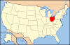
 Location of Summit County in Ohio
This is a list of the National Register of Historic Places listings in Summit County, Ohio.
This is intended to be a complete list of the properties and districts on the National Register of Historic Places in Summit County, Ohio, United States. Latitude and longitude coordinates are provided for many National Register properties and districts; these locations may be seen together in a Google map.[1]
There are 160 properties and districts listed on the National Register in the county, including 1 National Historic Landmark. The city of Akron is the location of 50 of these properties and districts, including the National Historic Landmark; they are listed separately, while the 111 properties and districts in the remaining parts of the county are listed here. One district, the Valley Railway Historic District, is split between Akron and other parts of the county, and is thus included on both lists. Another property was once listed but has been removed.
-
- This National Park Service list is complete through NPS recent listings posted November 10, 2011.[2]
Current listings
Akron
Outside of Akron
[3] Landmark name [4] Image Date listed Location City or town Summary 1 Francis D. Alling House November 30, 1987 323 East Ave.
41°06′06″N 81°25′43″W / 41.101667°N 81.428611°WTallmadge 2 Anna-Dean Farm July 14, 1977 State Route 619
41°00′24″N 81°37′38″W / 41.006667°N 81.627222°WBarberton 3 O. C. Barber Barn No. 1 February 28, 1973 115 3rd St.
41°00′26″N 81°35′37″W / 41.007222°N 81.593611°WBarberton 4 O. C. Barber Colt Barn October 9, 1974 Austin Dr.
41°00′18″N 81°34′44″W / 41.005°N 81.578889°WBarberton 5 O. C. Barber Creamery May 22, 1973 365 Portsmouth Ave.
41°00′25″N 81°35′33″W / 41.006944°N 81.5925°WBarberton 6 O. C. Barber Machine Barn October 9, 1974 Austin Dr.
41°00′22″N 81°34′42″W / 41.006111°N 81.578333°WBarberton 7 O. C. Barber Piggery May 22, 1973 248 Robinson Ave.
41°00′35″N 81°35′49″W / 41.009722°N 81.596944°WBarberton 8 William Barker Residence June 11, 1979 805 Wye Rd. in Ghent
41°09′27″N 81°38′12″W / 41.1575°N 81.636667°WBath Township 9 Bath Township Hall June 11, 1979 1241 N. Cleveland-Massilon Rd.
41°10′08″N 81°38′12″W / 41.168889°N 81.636667°WBath Township 10 Bath Township School June 11, 1979 4655 Akron-Medina Rd., southeast of Ghent
41°08′13″N 81°40′09″W / 41.136944°N 81.669167°WBath Township 11 Francis Becker House June 24, 2002 3010 Hickory St.
40°55′33″N 81°38′28″W / 40.925833°N 81.641111°WClinton 12 Boston Mills Historic District 
November 9, 1992 Roughly Riverview, Boston Mills, and Stanford Rds. and Main St.
41°15′52″N 81°33′34″W / 41.264444°N 81.559444°WBoston Township 13 Botzum Farm 
October 21, 1999 3486 Riverview Rd.
41°10′29″N 81°34′54″W / 41.174722°N 81.581667°WCuyahoga Falls 14 Brookdale Farm December 7, 2010 1148 N. Cleveland-Massillon Rd., north of Akron
41°10′00″N 81°38′14″W / 41.166667°N 81.637222°WBath Township Historic Bath Township, 1810-1959 MPS 15 Jim Brown House 
March 2, 1979 South of Peninsula at 3491 Akron Peninsula Rd.
41°10′54″N 81°34′42″W / 41.181667°N 81.578333°WCuyahoga Falls 16 Jim Brown Tavern 
December 11, 1979 Boston Mills Rd.
41°15′48″N 81°33′31″W / 41.263333°N 81.558611°WBoston Township 17 John Brown Farmhouse September 22, 1977 1842 Hines Hill Rd.
41°15′48″N 81°26′54″W / 41.263333°N 81.448333°WHudson 18 H. Karl Butler Memorial January 2, 1997 Truxell Rd., southeast of its junction with Peninsula Rd., Camp Manatoc
41°13′19″N 81°31′49″W / 41.221944°N 81.530278°WBoston Township 19 Camp Manatoc Concord Lodge and Adirondacks Historic District January 2, 1997 Truxell Rd., southeast of its junction with Peninsula Rd., Camp Manatoc
41°13′07″N 81°31′46″W / 41.218611°N 81.529444°WBoston Township 20 Camp Manatoc Dining Hall January 2, 1997 Truxell Rd., southeast of its junction with Peninsula Rd., Camp Manatoc
41°13′15″N 81°31′44″W / 41.220833°N 81.528889°WBoston Township 21 Camp Manatoc Foresters Lodge and Kit Carson-Dan Boone Cabins Historic District January 2, 1997 Truxell Rd., southeast of its junction with Peninsula Rd., Camp Manatoc
41°13′39″N 81°31′58″W / 41.2275°N 81.532778°WBoston Township 22 Camp Manatoc Legion Lodge January 2, 1997 Truxell Rd., southeast of its junction with Peninsula Rd., Camp Manatoc
41°13′07″N 81°31′46″W / 41.218611°N 81.529444°WBoston Township 23 Chuckery Race December 15, 1972 South of and in Cuyahoga Falls
41°07′15″N 81°29′34″W / 41.120833°N 81.492778°WCuyahoga Falls 24 Clinton Ohio and Erie Canal Historic District-Clinton Lock 2 and 3-Clinton Upper (Lock 2) and Clinton Lower (Lock 3) March 16, 2003 Approximately along the canal channel parallel to Water St.
40°55′44″N 81°37′47″W / 40.928889°N 81.629722°WClinton 25 Albert Cofta Farmstead 
November 4, 2004 2966 Brush Rd., northeast of Richfield
41°15′13″N 81°36′56″W / 41.253611°N 81.615556°WRichfield Township 26 Copley Depot May 31, 2001 3772 Copley Rd.
41°05′56″N 81°39′14″W / 41.098889°N 81.653889°WCopley Township 27 John William Creswell Corbusier House October 5, 1989 226 College St.
41°14′57″N 81°26′18″W / 41.249167°N 81.438333°WHudson 28 Edward Cranz Farm 
March 12, 1993 2780 Oak Hill Dr., south of Peninsula
41°11′50″N 81°35′31″W / 41.197222°N 81.591944°WBath Township 29 William and Eugene Cranz Farm March 12, 1993 2401 Ira Rd., south of Peninsula
41°11′15″N 81°35′31″W / 41.1875°N 81.591944°WBath Township 30 Diamond Match Historic District February 29, 1996 3, 21, and 27 4th St., NW., and 8 2nd St., NW.
41°00′39″N 81°36′31″W / 41.010833°N 81.608611°WBarberton 31 Michael Duffy Farm 
March 12, 1993 4965 Quick Rd., southeast of Peninsula
41°12′15″N 81°30′58″W / 41.204167°N 81.516111°WBoston Township 32 Everett Historic District 
January 14, 1993 4731-4642 Riverview Rd. and 2151-2279 Everett Rd., south of Peninsula, in the Cuyahoga Valley National Park
41°12′16″N 81°34′29″W / 41.204444°N 81.574722°WBoston Township 33 Everett Knoll Complex May 25, 1977 Southern side of Everett Rd., west of its junction with Riverview Rd.
41°12′15.5″N 81°34′32.75″W / 41.204306°N 81.5757639°W[5]Boston Township 34 First Congregational Church of Cuyahoga Falls November 3, 1975 130 Broad Boulevard
41°08′00″N 81°29′04″W / 41.133333°N 81.484444°WCuyahoga Falls 35 Fort Island Works December 2, 1970 In Fort Island Park, at 413 Tunko Rd.
41°7′9.56″N 81°37′2.64″W / 41.1193222°N 81.6174°W[6]Fairlawn 36 Furnace Run Aqueduct December 11, 1979 Furnace Run
41°12′06″N 81°34′22″W / 41.201667°N 81.572778°WCuyahoga Falls 37 Ghent Historic District December 7, 2010 western side of Wye Rd. between Granger and Yellow Creek Rd. in Ghent
41°09′26″N 81°38′13″W / 41.157361°N 81.637083°WBath Township Historic Bath Township, 1810-1959 MPS 38 Elijah Hale Residence June 11, 1979 3243 Ira Rd.
41°11′21″N 81°37′16″W / 41.189167°N 81.621111°WBath Township 39 Jonathan Hale Homestead 
April 23, 1973 2686 Oak Hill Rd.
41°11′35″N 81°35′33″W / 41.193056°N 81.5925°WBath Township 40 John Harshey Residence June 11, 1979 4270 Bath Rd.
41°10′07″N 81°39′07″W / 41.168611°N 81.651944°WBath Township 41 Levi J. Hartong House and Farm October 17, 2007 6521 Mt. Pleasant Rd.
40°54′29″N 81°28′10″W / 40.908039°N 81.469325°WGreen 42 Edward Heller Residence June 11, 1979 3891 Granger Rd., west of Ghent
41°09′39″N 81°39′02″W / 41.160833°N 81.650556°WBath Township 43 J. Hershey Residence June 11, 1979 286 Cleveland-Massilon Rd., south of Ghent
41°08′37″N 81°38′15″W / 41.143611°N 81.6375°WBath Township 44 Roswell Hopkins Residence June 11, 1979 299 Hametown Rd., southeast of Ghent
41°08′38″N 81°40′13″W / 41.143889°N 81.670278°WBath Township 45 Hudson Historic District 
November 28, 1973 Roughly bounded by College, Streetsboro, S. Main, and Baldwin Sts.; also roughly bounded by Hudson St., Old Orchard Dr., Aurora St., Oviatt St., Streetsboro St., and College St. to Aurora
41°14′37″N 81°26′31″W / 41.243611°N 81.441944°WHudson Second set of boundaries represents a boundary increase of October 5, 1989 46 Humberger House October 11, 2002 7616 N. 2nd Ave.
40°55′30″N 81°38′27″W / 40.925°N 81.640833°WClinton 47 Hunt-Wilke Farm March 12, 1993 2049 Bolanz Rd.
41°12′04″N 81°34′19″W / 41.201111°N 81.571944°WCuyahoga Falls 48 Grace Goulder Izant House October 4, 1989 250 College St.
41°15′02″N 81°26′17″W / 41.250556°N 81.438056°WHudson 49 Jaite Mill Historic District 
May 21, 1979 Southeast of Brecksville at Riverview and Vaughan Rds.
41°17′10″N 81°34′06″W / 41.286111°N 81.568333°WSagamore Hills Township Extends into Brecksville in Cuyahoga County 50 Dustin Johnson Residence June 11, 1979 1946 Cleveland-Massilon Rd.
41°11′18″N 81°38′12″W / 41.188333°N 81.636667°WBath Township 51 Jyurovat Farmstead 
May 25, 1995 696 Streetsboro Rd., southeast of Peninsula
41°13′54″N 81°31′05″W / 41.231667°N 81.518056°WBoston Heights 52 Virginia Kendall State Park Historic District 
January 2, 1997 701, 801, and 1000 Truxell Rd. and 434 W. Streetsboro, southeast of Peninsula
41°13′04″N 81°31′15″W / 41.217778°N 81.520833°WBoston Township 53 J. Kent Residence June 11, 1979 1727 Medina Line Rd.
41°11′00″N 81°41′07″W / 41.183333°N 81.685278°WBath Township 54 James Kirby Mill December 14, 1978 West of West Richfield off State Route 303
41°14′26″N 81°40′44″W / 41.240556°N 81.678889°WRichfield Township 55 David Kittinger Residence June 11, 1979 1904 Cleveland-Massilon Rd.
41°11′14″N 81°38′12″W / 41.187222°N 81.636667°WBath Township 56 Jeremiah Lambert House and Barn December 7, 2010 2138 Cleveland-Massillon Rd. in Ghent
41°11′37″N 81°38′12″W / 41.193611°N 81.636667°WBath Township Historic Bath Township, 1810-1959 MPS 57 J. Ligget Residence June 11, 1979 481 Cleveland-Massilon Rd., south of Ghent
41°08′55″N 81°38′12″W / 41.148611°N 81.636667°WBath Township 58 Limbach Block Historic District November 29, 2001 7843, 7845, 7847, 7849, 7851, and 7853 Main St.
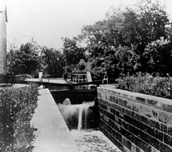
40°55′38″N 81°37′48″W / 40.927222°N 81.63°WClinton 59 Lock No. 26 
December 11, 1979 3.3 mi (5.3 km) north of Ira Rd.
41°11′08″N 81°34′53″W / 41.185556°N 81.581389°WCuyahoga Falls 60 Lock No. 27 
December 11, 1979 Approximately 400 ft (120 m) east of the intersection of Riverview and Everett Rds. at Everett
41°12′11″N 81°34′15″W / 41.203056°N 81.570833°WBoston Township 61 Lock No. 28 
December 11, 1979 Deep Lock Q Quarry Metro Park
41°13′58″N 81°33′09″W / 41.232778°N 81.5525°WPeninsula 62 Lock No. 29 and Aqueduct 
December 11, 1979 Off State Route 303
41°14′34″N 81°33′02″W / 41.242778°N 81.550556°WPeninsula 63 Lock No. 30 and Feeder Dam 
December 11, 1979 Off State Route 303
41°14′41″N 81°33′14″W / 41.244722°N 81.553889°WPeninsula 64 Lock No. 31 
December 11, 1979 200 ft (61 m) east of the Cuyahoga River and approximately 0.5 mi (0.80 km) south of the Ohio Turnpike
41°15′06″N 81°32′46″W / 41.251667°N 81.546111°WPeninsula 65 Lock No. 32 
December 11, 1979 800 ft (240 m) north of Boston Mills
41°15′58″N 81°33′32″W / 41.266111°N 81.558889°WBoston Township 66 Lock No. 33 
December 11, 1979 1 mi (1.6 km) south of Highland Rd.
41°16′36″N 81°33′40″W / 41.276667°N 81.561111°WBoston Township 67 Lock No. 34 
December 17, 1979 Highland Rd.
41°17′21″N 81°33′53″W / 41.289167°N 81.564722°WSagamore Hills Township 68 Lock No. 35 
December 11, 1979 Off State Route 82
41°18′38″N 81°34′56″W / 41.310556°N 81.582222°WSagamore Hills Township 69 Lutz-Martin Farm 
July 3, 2003 2470 Martin Rd.
41°10′28″N 81°35′30″W / 41.174444°N 81.591667°WBath Township 70 Frank H. Mason House April 20, 1995 615 Latham Ln.
40°57′49″N 81°32′44″W / 40.963611°N 81.545556°WNew Franklin 71 Robert McKisson House December 4, 1974 7878 N. Gannett Rd.
41°19′22″N 81°33′51″W / 41.322778°N 81.564167°WSagamore Hills Township 72 Harvey Miller Residence June 11, 1979 188 Hametown Rd., southeast of Ghent
41°08′27″N 81°40′15″W / 41.140833°N 81.670833°WBath Township 73 Northfield Town Hall August 10, 2000 9546 Brandywine Rd. at Northfield Center
41°18′50″N 81°32′23″W / 41.313889°N 81.539722°WNorthfield Center Township 74 Oakwood Cemetery Chapel November 12, 1999 2420 Oakwood Dr.
41°08′37″N 81°29′15″W / 41.143611°N 81.4875°WCuyahoga Falls 75 Ohio and Erie Canal Deep Lock September 9, 1974 South of Peninsula on Riverview Rd.
41°13′58″N 81°33′09″W / 41.232778°N 81.5525°WPeninsula 76 Isaac and Maria Ozmun Farmstead December 28, 2000 6928 Olde Eight Rd.
41°15′15″N 81°30′29″W / 41.254167°N 81.508056°WBoston Heights 77 Palmer House August 13, 1974 9370 Olde Eight Rd.
41°18′55″N 81°32′22″W / 41.315278°N 81.539444°WNorthfield Center Township 78 Peninsula Village Historic District 
August 23, 1974 Both sides of State Route 303
41°14′24″N 81°33′03″W / 41.24°N 81.550833°WPeninsula 79 Nathaniel Point Farm 
September 3, 1999 4606 and 4631 Akron-Peninsula Rd., south of Peninsula
41°12′20″N 81°33′46″W / 41.205556°N 81.562778°WBoston Township 80 Orin Porter House October 5, 1989 240 College St.
41°14′59″N 81°26′20″W / 41.249722°N 81.438889°WHudson 81 Porter-Aue House September 6, 2002 2798 North St.
40°55′40″N 81°37′44″W / 40.927778°N 81.628889°WClinton 82 Jonathan Price House October 7, 2002 7903 Main St.
40°55′36″N 81°37′40″W / 40.926667°N 81.627778°WClinton 83 Dr. Rufus Randall Residence June 11, 1979 3675 Ira Rd.
41°11′21″N 81°38′06″W / 41.189167°N 81.635°WBath Township 84 Luther B. Ranney Farm December 1, 1988 6484 Old State Route 8
41°14′35″N 81°30′04″W / 41.243056°N 81.501111°WBoston Heights 85 Frank Mason Raymond House April 20, 1995 655 Latham Ln.
40°57′59″N 81°32′42″W / 40.966389°N 81.545°WNew Franklin 86 John Richard Residence June 11, 1979 1924 Cleveland-Massilon Rd.
41°11′15″N 81°39′38″W / 41.1875°N 81.660556°WBath Township 87 Louis Schmitt House and Store February 14, 2002 2967 Hickory St.
40°55′32″N 81°38′21″W / 40.925556°N 81.639167°WClinton 88 Samuel Shaw Residence June 11, 1979 1588 Hametown Rd.
41°10′51″N 81°39′59″W / 41.180833°N 81.666389°WBath Township 89 Sylvester Shaw Residence June 11, 1979 1786 Medina Line Rd.
41°11′09″N 81°39′58″W / 41.185833°N 81.666111°WBath Township 90 David Smith House October 4, 2002 7966 Cleveland-Massillon Rd.
40°55′32″N 81°37′43″W / 40.925556°N 81.628611°WClinton 91 William Smith House March 11, 2003 7894 Main St.
40°55′36″N 81°37′43″W / 40.926667°N 81.628611°WClinton 92 Sorrick-Oster Store October 11, 2002 7846 Main St.
40°55′37″N 81°37′47″W / 40.926944°N 81.629722°WClinton 93 George Stanford Farm 
February 17, 1982 6093 Stanford Rd., north of Peninsula
41°16′16″N 81°33′25″W / 41.271111°N 81.556944°WBoston Township 94 Station Road Bridge 
March 7, 1979 East of Brecksville at the Cuyahoga River
41°19′10″N 81°35′16″W / 41.319444°N 81.587778°WSagamore Hills Township Extends into Brecksville in Cuyahoga County 95 Stewart-Hanson Farm October 15, 1992 2832 Call Rd.
41°11′18″N 81°24′19″W / 41.188333°N 81.405278°WStow 96 Stumpy Basin December 11, 1979 200 ft (61 m) east of the Cuyahoga River and approximately 0.5 mi (0.80 km) south of the Ohio Turnpike, north of Peninsula
41°15′09″N 81°32′45″W / 41.2525°N 81.545833°WBoston Township 97 Tallmadge Town Square Historic District 
May 6, 1971 Public Sq.
41°06′05″N 81°26′29″W / 41.10146°N 81.44131°WTallmadge 98 Thornton-Guise Kitchen And House May 6, 1976 147 S. Main St.
41°08′06″N 81°26′25″W / 41.135°N 81.440278°WMunroe Falls 99 Manville Thorp Residence June 11, 1979 1907 Medina Lane Rd.
41°11′20″N 81°41′03″W / 41.188889°N 81.684167°WBath Township 100 Daniel Tilden House 
June 20, 1985 2325 Stine Rd., west of Peninsula
41°14′48″N 81°35′17″W / 41.246667°N 81.588056°WBoston Township 101 Tuscarawas Avenue-Alexander Square Commercial Historic District May 17, 1990 Bounded by Park Ave., Tuscarawas Ave., and 4th and 5th Sts.
41°00′47″N 81°36′39″W / 41.013056°N 81.610833°WBarberton 102 Twinsburg Congregational Church 
May 3, 1974 Twinsburg Public Sq.
41°18′43″N 81°26′32″W / 41.311944°N 81.442222°WTwinsburg 103 Twinsburg Institute January 1, 1976 8996 Darrow Rd.
41°18′38″N 81°26′27″W / 41.310556°N 81.440833°WTwinsburg 104 Valley Railway Historic District 
May 17, 1985 Cuyahoga Valley between Rockside Rd. in the Cuyahoga Valley National Park and Howard St. at Little Cuyahoga Valley
41°13′38″N 81°34′13″W / 41.227222°N 81.570278°WBoston Township, Cuyahoga Falls, and Peninsula Extends into Akron and into National Register of Historic Places listings in Cuyahoga County, Ohio 105 Peter Voris, Jr., House December 7, 2010 3622 Ira Rd. in Ghent
41°11′20″N 81°37′59″W / 41.188889°N 81.633056°WBath Township Historic Bath Township, 1810-1959 MPS 106 Wallace Farm 
June 27, 1985 8230 Brandywine Rd.
41°16′40″N 81°32′26″W / 41.277778°N 81.540556°WNorthfield Center Township 107 Ward House March 17, 1987 1410 Hines Hill Rd.
41°15′38″N 81°27′46″W / 41.260556°N 81.462778°WHudson 108 Warwick Interlocking Tower December 12, 2002 2955 S. 1st. St.
40°55′20″N 81°38′34″W / 40.922222°N 81.642778°WClinton 109 Allen Welton House 
May 7, 1979 Southwest of Peninsula at 2485 Major Rd.
41°14′00″N 81°35′01″W / 41.233333°N 81.583611°WBoston Township 110 Western Reserve Academy 
June 30, 1975 Roughly bounded by Aurora St. and both sides of Oviatt, High, and Hudson
41°14′46″N 81°26′15″W / 41.246111°N 81.4375°WHudson 111 Wolcott House May 5, 1988 56 E. Twinsburg Rd., south of Northfield
41°16′50″N 81°30′48″W / 41.280556°N 81.513333°WNorthfield Center Township Former listing
[3] Landmark name Image Date listed Location City or town Summary 1 Everett Road Covered Bridge October 29, 1985 Southwest of Peninsula on Everett Rd. over Furnace Creek
41°12′14.5″N 81°35′0″W / 41.204028°N 81.583333°WPickerington Listed in 1974 See also
References
- ^ The latitude and longitude information provided in this table was derived originally from the National Register Information System, which has been found to be fairly accurate for about 99% of listings. For about 1% of NRIS original coordinates, experience has shown that one or both coordinates are typos or otherwise extremely far off; some corrections may have been made. A more subtle problem causes many locations to be off by up to 150 yards, depending on location in the country: most NRIS coordinates were derived from tracing out latitude and longitudes off of USGS topographical quadrant maps created under the North American Datum of 1927, which differs from the current, highly accurate WGS84 GPS system used by Google maps. Chicago is about right, but NRIS longitudes in Washington are higher by about 4.5 seconds, and are lower by about 2.0 seconds in Maine. Latitudes differ by about 1.0 second in Florida. Some locations in this table may have been corrected to current GPS standards.
- ^ "National Register of Historic Places: Weekly List Actions". National Park Service, United States Department of the Interior. Retrieved on November 10, 2011.
- ^ a b Numbers represent an ordering by significant words. Various colorings, defined here, differentiate National Historic Landmark sites and National Register of Historic Places Districts from other NRHP buildings, structures, sites or objects.
- ^ "National Register Information System". National Register of Historic Places. National Park Service. . http://nrhp.focus.nps.gov/natreg/docs/All_Data.html.
- ^ Location derived from Brose, David S. "The Everett Knoll: A Late Hopewellian Site in Northeastern Ohio", 38-39. The NRIS lists the site as "Address Restricted".
- ^ Location derived from this Fairlawn city webpage; the NRIS lists the site as "Address Restricted".
External links
National Register of Historic Places in Ohio Lists by county Adams • Allen • Ashland • Ashtabula • Athens • Auglaize • Belmont • Brown • Butler • Carroll • Champaign • Clark • Clermont • Clinton • Columbiana • Coshocton • Crawford • Cuyahoga • Darke • Defiance • Delaware • Erie • Fairfield • Fayette • Franklin • Fulton • Gallia • Geauga • Greene • Guernsey • Hamilton • Hancock • Hardin • Harrison • Henry • Highland • Hocking • Holmes • Huron • Jackson • Jefferson • Knox • Lake • Lawrence • Licking • Logan • Lorain • Lucas • Madison • Mahoning • Marion • Medina • Meigs • Mercer • Miami • Monroe • Montgomery • Morgan • Morrow • Muskingum • Noble • Ottawa • Paulding • Perry • Pickaway • Pike • Portage • Preble • Putnam • Richland • Ross • Sandusky • Scioto • Seneca • Shelby • Stark • Summit • Trumbull • Tuscarawas • Union • Van Wert • Vinton • Warren • Washington • Wayne • Williams • Wood • Wyandot
Lists by city Other lists Municipalities and communities of Summit County, Ohio Cities Akron | Barberton | Cuyahoga Falls | Fairlawn | Green | Hudson | Macedonia | Munroe Falls | New Franklin | Norton‡ | Stow | Tallmadge‡ | Twinsburg

Villages Boston Heights | Clinton | Lakemore | Mogadore‡ | Northfield | Peninsula | Reminderville | Richfield | Silver Lake
Townships Bath | Boston | Copley | Coventry | Northfield Center | Richfield | Sagamore Hills | Springfield | Twinsburg
CDPs Unincorporated
communitiesFootnotes ‡This populated place also has portions in an adjacent county or counties
Categories:- National Register of Historic Places in Ohio by county
- Summit County, Ohio
-


Wikimedia Foundation. 2010.