- National Register of Historic Places listings in Tompkins County, New York
-
 Location of Tompkins County in New York
List of the National Register of Historic Places listings in Tompkins County, New York
This is intended to be a complete list of properties and districts listed on the National Register of Historic Places in Tompkins County, New York. The locations of National Register properties and districts (at least for all showing latitude and longitude coordinates below) may be seen in a Google map by clicking on "Map of all coordinates".[1] One property, Morrill Hall, is further designated a U.S. National Historic Landmark.
-
- This National Park Service list is complete through NPS recent listings posted November 18, 2011.[2]
Contents: Counties in New York Albany (Albany) – Allegany – Bronx – Broome – Cattaraugus – Cayuga – Chautauqua – Chemung – Chenango – Clinton – Columbia – Cortland – Delaware – Dutchess – Erie (Buffalo) – Essex – Franklin – Fulton – Genesee – Greene – Hamilton – Herkimer – Jefferson – Kings (Brooklyn) – Lewis – Livingston – Madison – Monroe (Rochester) – Montgomery – Nassau – New York (Manhattan – Below 14th Street, 14th to 59th Streets, 59th to 110th Streets, Above 110th Street, Islands) – Niagara – Oneida – Onondaga (Syracuse) – Ontario – Orange – Orleans – Oswego – Otsego – Putnam – Queens – Rensselaer – Richmond (Staten Island) – Rockland – Saratoga – Schenectady – Schoharie – Schuyler – Seneca – St. Lawrence – Steuben – Suffolk – Sullivan – Tioga – Tompkins – Ulster – Warren – Washington – Wayne – Westchester (New Rochelle, Peekskill, Yonkers) – Wyoming – Yates Listings county-wide
[3] Landmark name Image Date listed Location City or town Summary 1 William Austin House July 19, 2002 34 Seneca St.
42°32′40″N 76°40′01″W / 42.544444°N 76.666944°WTrumansburg 2 Bailey Hall 
September 24, 1984 Cornell University campus
42°26′58″N 76°28′50″W / 42.449444°N 76.480556°WIthaca 3 Rufus and Flora Bates House Rufus and Flora Bates HouseAugust 29, 2010 107 Giles St.
42°26′18″N 76°29′33″W / 42.438333°N 76.4925°WIthaca New listing; refnum 10000595 4 Boardman House May 6, 1971 120 E. Buffalo St.
42°25′01″N 76°27′31″W / 42.416944°N 76.458611°WIthaca 5 Caldwell Hall 
September 24, 1984 Cornell University campus
42°26′58″N 76°28′43″W / 42.449444°N 76.478611°WIthaca 6 Hermon Camp House 
December 4, 1973 Camp St.
42°32′19″N 76°39′42″W / 42.538611°N 76.661667°WTrumansburg 7 Cascadilla School Boathouse October 4, 1991 S. shore of Cayuga Lake at the mouth of Fall Cr., Stewart Park
42°27′37″N 76°30′33″W / 42.460278°N 76.509167°WIthaca 8 Luther Clarke House 
June 8, 1984 39 W. Main St.
42°29′25″N 76°18′03″W / 42.490278°N 76.300833°WDryden 9 Clinton Hall July 7, 1988 108-114 N. Cayuga St.
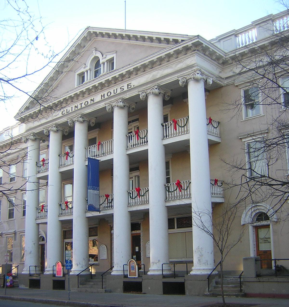
42°26′23″N 76°30′00″W / 42.439722°N 76.5°WIthaca 10 Clinton House 
August 12, 1971 116 N. Cayuga St.
42°26′25″N 76°29′58″W / 42.440278°N 76.499444°WIthaca 11 Comstock Hall September 24, 1984 Cornell University campus
42°26′58″N 76°28′45″W / 42.449444°N 76.479167°WIthaca 12 Cornell Heights Historic District September 14, 1989 Roughly bounded by Kline Rd., Highland Ave., Brock Ln., Triphammer Rd., Fall Creek, Stewart Ave., and Needham Pl.
42°27′18″N 76°29′13″W / 42.455°N 76.486944°WCayuga Heights and Ithaca 13 De Witt Park Historic District October 26, 1971 A square bounded roughly by properties fronting on E. Buffalo, E. Court, N. Cayuga, and N. Tioga Sts.
42°26′30″N 76°29′53″W / 42.441667°N 76.498056°WIthaca 14 Deke House (Ithaca, New York) 
January 11, 1991 13 South Ave.
42°26′40″N 76°29′16″W / 42.444444°N 76.487778°WIthaca 15 District No. 2 School, Caroline and Dryden January 5, 2005 2670 Slaterville Rd.
42°23′40″N 76°21′00″W / 42.394444°N 76.35°WSlaterville Springs 16 District Number 7 School November 30, 2004 Mill Rd. at the Park
42°18′15″N 76°15′12″W / 42.304167°N 76.253333°WSpeedsville 17 Dryden District School No. 5 November 4, 1994 1756 Hanshaw Rd.
42°28′26″N 76°25′53″W / 42.473889°N 76.431389°WDryden 18 Dryden Historic District 
June 15, 1984 Roughly bounded by E. Main, James, Lake and South Sts.
42°29′21″N 76°17′46″W / 42.489167°N 76.296111°WDryden 19 East Hill Historic District August 14, 1986 Roughly bounded by Cascadilla Creek, Eddy St., Six Mile Creek, and Aurora St.
42°22′27″N 76°29′11″W / 42.374167°N 76.486389°WIthaca 20 East Robert Hall September 24, 1984 Cornell University campus
42°26′55″N 76°28′42″W / 42.448611°N 76.478333°WIthaca Building which no longer exists, erroneously still listed 21 Ellis Methodist Episcopal Church May 27, 1993 Ellis Hollow Rd.
42°25′00″N 76°23′00″W / 42.416667°N 76.383333°WEllis Hollow 22 Enfield Falls Mill and Miller's House 
February 25, 1979 SW of Ithaca in Robert H. Treman State Park
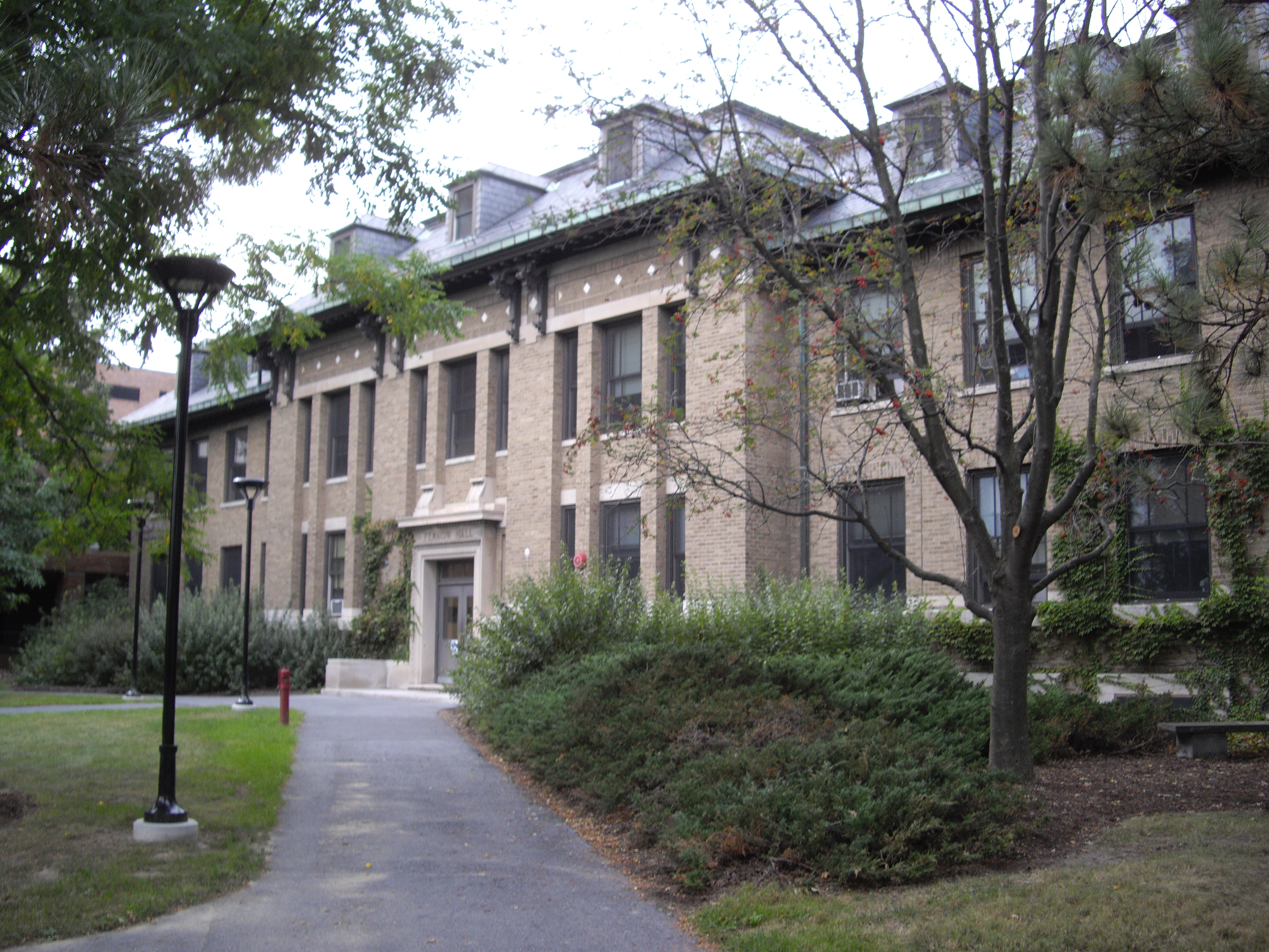
42°24′05″N 76°35′26″W / 42.401389°N 76.590556°WIthaca 23 Fernow Hall 
September 24, 1984 Cornell University campus
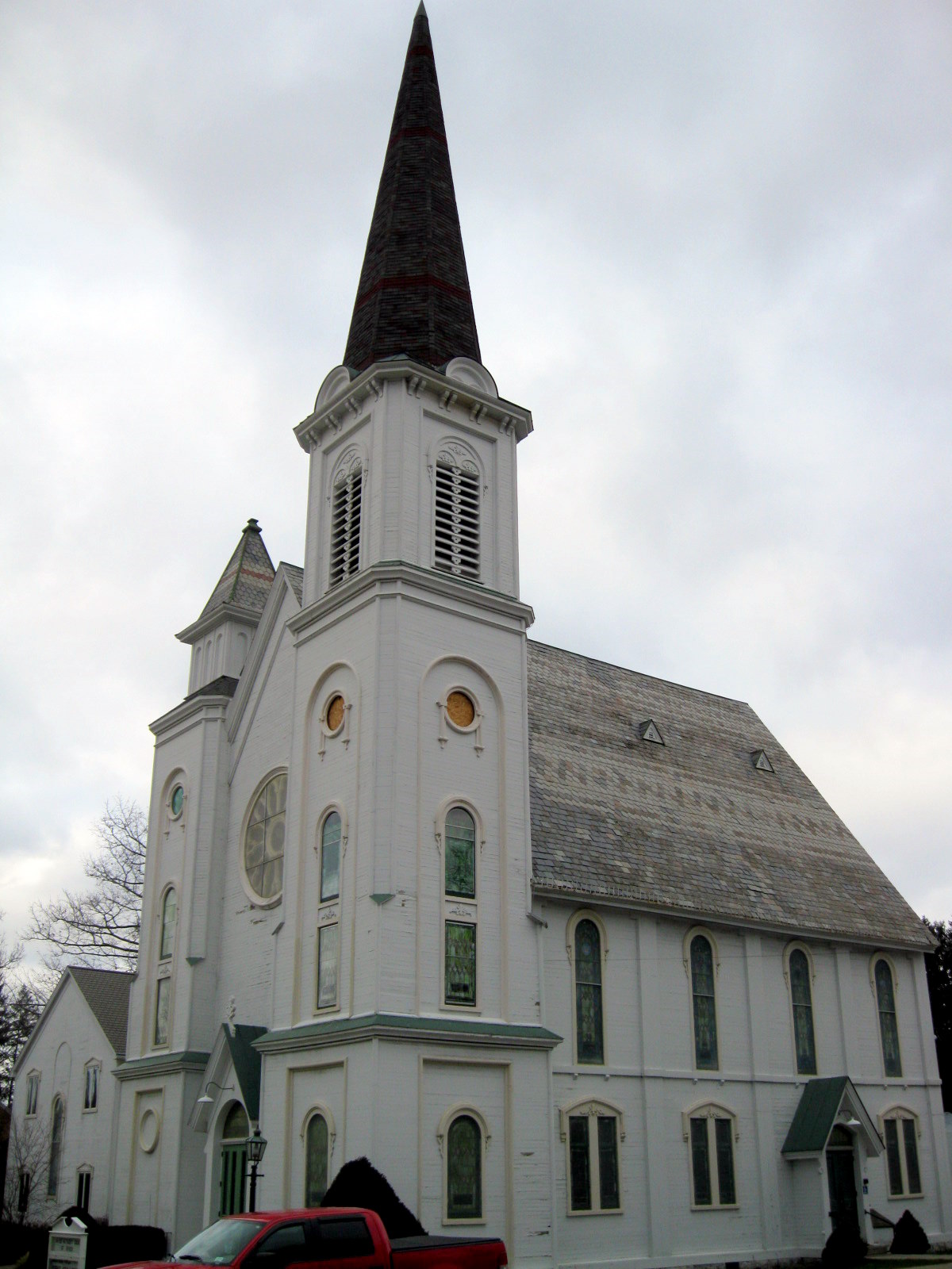
42°26′55″N 76°28′33″W / 42.448611°N 76.475833°WIthaca 24 First Presbyterian Church of Ulysses 
June 3, 1999 Main St.
42°32′29″N 76°39′34″W / 42.541389°N 76.659444°WTrumansburg 25 Forest Home Historic District August 6, 1998 Roughly along NY392
42°27′06″N 76°28′11″W / 42.451667°N 76.469722°WForest Home 26 Groton High School July 24, 1992 177 Main St.
42°35′17″N 76°22′00″W / 42.588056°N 76.366667°WGroton 27 Nicoll Halsey House and Halseyville Archeological Sites June 24, 1993 Address Restricted
42°31′50″N 76°38′15″W / 42.530556°N 76.6375°WHalseyville 28 Hayt's Chapel and Schoolhouse December 22, 2005 1296-1298 Trumansburg Rd.
42°28′08″N 76°32′43″W / 42.468889°N 76.545278°WIthaca 29 Indian Fort Road Site September 30, 1983 Address Restricted Trumansburg 30 Ithaca Downtown Historic District February 9, 2005 E. and W. State, N & S Cayuga, N. Aurora, N. Tioga Sts.
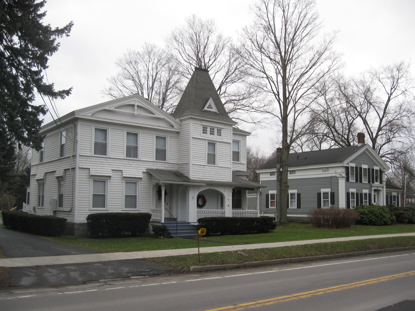
42°26′23″N 76°29′53″W / 42.439722°N 76.498056°WIthaca 31 Ithaca Pottery Site July 17, 1979 Address Restricted Ithaca 32 Jennings-Marvin House 
June 8, 1984 9 Library St.
42°29′30″N 76°17′59″W / 42.491667°N 76.299722°WDryden 33 Lacy-Van Vleet House 
June 8, 1984 45 W. Main St.
42°29′25″N 76°18′07″W / 42.490278°N 76.301944°WDryden 34 Lehigh Valley Railroad Station December 31, 1974 W. Buffalo St. and Taughannock Blvd.
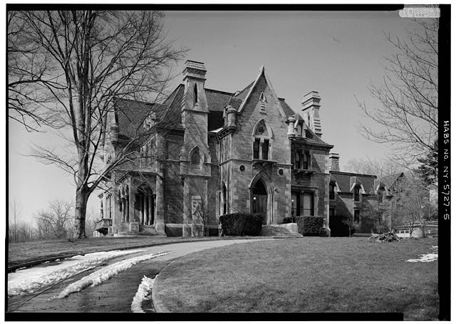
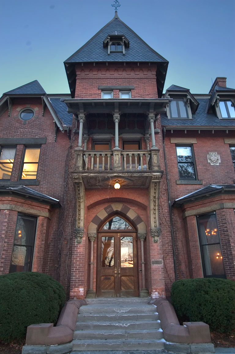
42°26′28″N 76°30′41″W / 42.441111°N 76.511389°WIthaca 35 Llenroc 
April 16, 1980 100 Cornell Ave.
42°26′48″N 76°29′32″W / 42.446667°N 76.492222°WIthaca Home of Ezra Cornell 36 Methodist Episcopal Church 
June 8, 1984 2 North St.
42°29′26″N 76°17′51″W / 42.490556°N 76.2975°WDryden 37 Morrill Hall, Cornell University 
October 15, 1966 Cornell University campus
42°26′55″N 76°29′08″W / 42.448611°N 76.485556°WIthaca 38 Newfield Covered Bridge 
February 25, 2000 Covered Bridge St.
42°21′47″N 76°35′27″W / 42.363056°N 76.590833°WNewfield 39 Rice Hall 
September 24, 1984 Cornell University campus
42°26′53″N 76°28′28″W / 42.448056°N 76.474444°WIthaca 40 Roberts Hall 
September 24, 1984 Cornell University campus
42°26′55″N 76°28′44″W / 42.448611°N 76.478889°WIthaca Building which no longer exists, erroneously still listed 41 Rockwell House 
June 8, 1984 52 W. Main St.
42°29′26″N 76°18′10″W / 42.490556°N 76.302778°WDryden 42 Rogues' Harbor Inn Rogues' Harbor InnAugust 26, 2009 2079 E. Shore Dr.
42°32′16″N 76°30′20″W / 42.537769°N 76.505464°WLansing New listing; refnum 09000657 43 St. James AME Zion Church July 22, 1982 116-118 Cleveland Ave.
42°26′16″N 76°30′18″W / 42.437778°N 76.505°WIthaca 44 St. John's Episcopal November 22, 2000 1504 Seventy Six Rd.
42°18′10″N 76°15′16″W / 42.302778°N 76.254444°WSpeedsville 45 St. Thomas Episcopal Church April 20, 1995 2740 Slaterville Rd. (NY 79)
42°23′39″N 76°20′44″W / 42.394167°N 76.345556°WSlaterville Springs 46 Second Baptist Society of Ulysses December 28, 2001 1 Congress St.
42°32′35″N 76°39′45″W / 42.543056°N 76.6625°WTrumansburg 47 Second Tompkins County Courthouse March 18, 1971 121 E. Court St.
42°26′31″N 76°32′48″W / 42.441944°N 76.546667°WIthaca 48 Southworth House June 8, 1984 14 North St.
42°29′32″N 76°17′52″W / 42.492222°N 76.297778°WDryden 49 Southworth Library 
June 8, 1984 24 W. Main St.
42°29′26″N 76°17′58″W / 42.490556°N 76.299444°WDryden 50 State Theater June 14, 1996 107-119 W. State St.
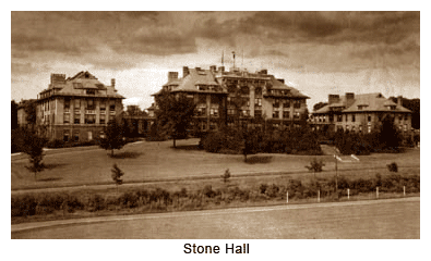
42°26′21″N 76°29′59″W / 42.439167°N 76.499722°WIthaca 51 Stone Hall 
September 24, 1984 Cornell University campus
42°26′55″N 76°28′46″W / 42.448611°N 76.479444°WIthaca Building which no longer exists, erroneously still listed 52 Telluride House Telluride HouseFebruary 22, 2011 217 West St.
42°26′46″N 76°29′13″W / 42.446111°N 76.486944°WIthaca New listing; refnum 11000042 53 US Post Office-Ithaca May 11, 1989 213 N. Tioga St.
42°26′28″N 76°29′48″W / 42.441111°N 76.496667°WIthaca 54 West Dryden Methodist Episcopal Church August 9, 1991 Jct. of W. Dryden and Sheldon Rds.
42°31′02″N 76°24′54″W / 42.517222°N 76.415°WDryden 55 Andrew Dickson White House 
December 4, 1973 27 East Ave.
42°26′54″N 76°28′57″W / 42.448333°N 76.4825°WIthaca 56 Wing Hall 
September 24, 1984 Cornell University campus
42°26′49″N 76°28′19″W / 42.446944°N 76.471944°WIthaca Formerly listed in the county
Landmark name Image Dates Location City or Town Summary a Strand Theatre listed in 1979; delisted in 1999 310 E. State St. Ithaca See also
References
- ^ The latitude and longitude information provided in this table was derived originally from the National Register Information System, which has been found to be fairly accurate for about 99% of listings. For about 1% of NRIS original coordinates, experience has shown that one or both coordinates are typos or otherwise extremely far off; some corrections may have been made. A more subtle problem causes many locations to be off by up to 150 yards, depending on location in the country: most NRIS coordinates were derived from tracing out latitude and longitudes off of USGS topographical quadrant maps created under North American Datum of 1927, which differs from the current, highly accurate GPS system used by Google maps. Chicago is about right, but NRIS longitudes in Washington are higher by about 4.5 seconds, and are lower by about 2.0 seconds in Maine. Latitudes differ by about 1.0 second in Florida. Some locations in this table may have been corrected to current GPS standards.
- ^ "National Register of Historic Places: Weekly List Actions". National Park Service, United States Department of the Interior. Retrieved on November 18, 2011.
- ^ Numbers represent an ordering by significant words. Various colorings, defined here, differentiate National Historic Landmark sites and National Register of Historic Places Districts from other NRHP buildings, structures, sites or objects.
Categories:- National Register of Historic Places in New York by county
- Buildings and structures in Tompkins County, New York
-


Wikimedia Foundation. 2010.