- Manchester, New Hampshire
-
This article is about the city in New Hampshire. For other uses, see Manchester (disambiguation).
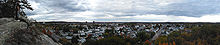
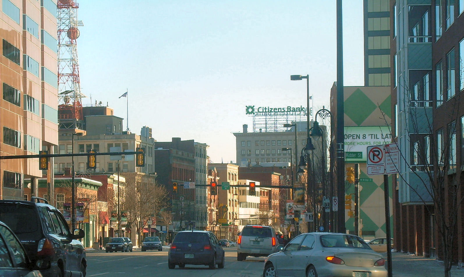
Manchester, New Hampshire — City — View of downtown from Hampshire Plaza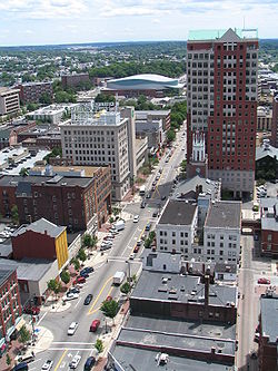

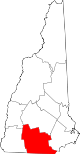
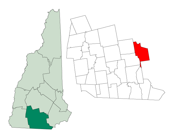
SealNickname(s): Queen City, Manch Vegas Location in Hillsborough County, New Hampshire
Coordinates: 42°59′27″N 71°27′49″W / 42.99083°N 71.46361°WCoordinates: 42°59′27″N 71°27′49″W / 42.99083°N 71.46361°W Country United States State New Hampshire County Hillsborough Incorporated 1751 Government – Mayor Ted Gatsas (R) Area – City 34.9 sq mi (90.4 km2) – Land 33.0 sq mi (85.5 km2) – Water 1.9 sq mi (4.9 km2) 5.44% Elevation 210 ft (64 m) Population (2010) – City 109,565 – Density 3,320.2/sq mi (1,281.5/km2) – Urban 187,596 – Metro 400,721 [1][2][3] Time zone Eastern (UTC-5) – Summer (DST) Eastern (UTC-4) Zip code 03101-03111 (03110 assigned to suburb Bedford) Area code(s) 603 FIPS code 33-45140 GNIS feature ID 0868243 Website www.manchesternh.gov Manchester is the largest city in the U.S. state of New Hampshire, the tenth largest city in New England, and the largest city in northern New England, an area comprising the states of Maine, New Hampshire, and Vermont. It is in Hillsborough County along the banks of the Merrimack River, which divides the city into eastern and western sections. Manchester is near the northern end of the Northeast megalopolis. As of the 2010 U.S. Census, the city had a population of 109,565,[1] the most of any New England city north of Boston, including other Massachusetts cities.
In 2009 CNNMoney.com rated Manchester 13th in a list of the 100 best cities to live and launch a business in the United States.[4] In addition, Kiplinger voted Manchester the second most tax friendly city in the United States, second only to Anchorage, Alaska.[5] Also in 2009, Forbes magazine ranked the Manchester region first on its list of "America's 100 Cheapest Places to Live."[6]
Contents
History
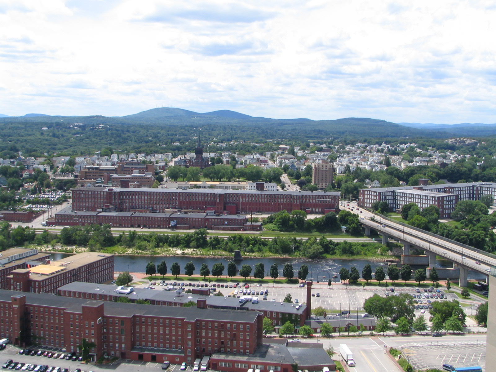
 Mills on Merrimack River and the West Side of Manchester
Pennacook Indians called it Namoskeag, meaning "good fishing place"—a reference to the Amoskeag Falls in the Merrimack River. In 1722, John Goffe settled beside Cohas Brook, later building a dam and sawmill at what was dubbed Old Harry's Town. It was granted by Massachusetts in 1727 as Tyngstown to veterans of Queen Anne's War who served in 1703 under Captain William Tyng. But at New Hampshire's 1741 separation from Massachusetts, the grant was ruled invalid and substituted with Wilton, Maine, so Governor Benning Wentworth rechartered the town in 1751 as Derryfield. Derryfield remains a neighborhood in contemporary Manchester, along its easternmost area adjacent to Massabesic Lake.
In 1807, Samuel Blodget opened a canal and lock system to allow vessels passage around the falls. He envisioned here a great industrial center, "the Manchester of America", like the Industrial Revolution's Manchester in England, the first industrialized city in the world. Sure enough, in 1809, Benjamin Prichard and others built a cotton spinning mill operated by water power on the western bank of the Merrimack. Following Blodgett's suggestion, Derryfield was renamed Manchester in 1810, the year the mill was incorporated as the Amoskeag Cotton & Woolen Manufacturing Company.[7] It would be purchased in 1825 by entrepreneurs from Massachusetts, expanded to 3 mills in 1826, and then incorporated in 1831 as the Amoskeag Manufacturing Company.
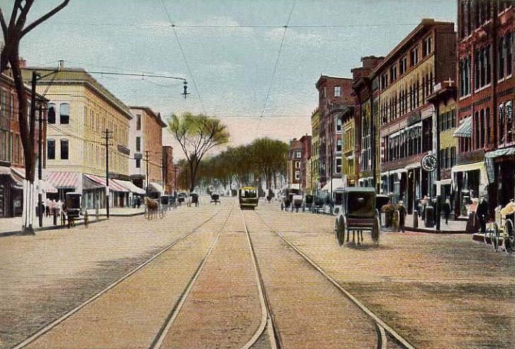
 Elm Street c. 1905
On the eastern bank, Amoskeag engineers and architects planned a model company town, founded in 1838 with Elm Street as its main thoroughfare. Incorporated as a city in 1846, Manchester would become home to the largest cotton mill in the world—Mill No. 11, stretching 900 feet (270 m) long by 103 feet (31 m) wide, and containing 4,000 looms. Other products made in the community included shoes, cigars, and paper. The Amoskeag foundry made rifles, sewing machines, textile machinery, fire engines, and locomotives in a division called the Amoskeag Locomotive Works (later, the Manchester Locomotive Works). The rapid growth of the mills demanded a large influx of workers, resulting in a flood of immigrants, particularly French Canadians. Many current residents descend from these workers. The Amoskeag Manufacturing Company went out of business in 1935, although its red brick mills have been renovated for other uses. Indeed, the mill town's 19th century affluence left behind some of the finest Victorian commercial, municipal, and residential architecture in the state.
 View of downtown from the north
Manchester is nicknamed the Queen City, as well as the more recently coined "Manch Vegas".[8] In 1998, Manchester was named the "Number One Small City in the East" by Money magazine. The Mall of New Hampshire, on Manchester's southern fringe near the intersection of Interstates 93 and 293, is the city's main retail center. In 2001, the Verizon Wireless Arena, a venue seating more than 10,000, opened for major concerts and sporting events, enhancing the city's downtown revitalization efforts with a major hotel and convention center already in place directly across the street from the arena.
Geography and climate
Manchester is located at 42°59′11″N 71°27′6″W / 42.98639°N 71.45167°W (42.986284, -71.451560).
According to the United States Census Bureau, the city has a total area of 34.9 square miles (90 km2), of which 33.0 square miles (85 km2) is land and 1.9 square miles (4.9 km2) is water, comprising 5.44% of the city. Manchester is drained by the Merrimack River, the Piscataquog River and Cohas Brook. Massabesic Lake is on the eastern border. The highest point in Manchester is its extreme northwest corner, where the elevation reaches 560 feet (170 m) above sea level.
Manchester has a four-season humid continental climate (Koppen Dfb), with long, cold, snowy winters, and very warm and somewhat humid summers; spring and autumn in between are crisp and brief transitions. The following data are presented from Massabesic Lake, which is located at the eastern edge of the city. Precipitation is well-spread throughout the year, though summer is the wettest. Snowfall, delivered often through nor'easters, averages around 47 inches (119 cm) per season, but varies widely each year.
Climate data for Manchester, New Hampshire (Massabesic Lake, 1971-2000) Month Jan Feb Mar Apr May Jun Jul Aug Sep Oct Nov Dec Year Record high °F (°C) 67
(19)70
(21)86
(30)94
(34)95
(35)98
(37)100
(38)99
(37)96
(36)88
(31)91
(33)75
(24)100
(38)Average high °F (°C) 32.3
(0.2)35.6
(2.0)44.3
(6.8)56.0
(13.3)68.3
(20.2)77.4
(25.2)82.1
(27.8)80.2
(26.8)72.2
(22.3)60.9
(16.1)49.6
(9.8)37.4
(3.0)58.0 Average low °F (°C) 5.2
(−14.9)8.2
(−13.2)18.4
(−7.6)29.0
(−1.7)40.2
(4.6)49.5
(9.7)54.6
(12.6)52.8
(11.6)43.5
(6.4)31.8
(−0.1)23.6
(−4.7)12.3
(−10.9)30.8 Record low °F (°C) −35
(−37)−23
(−31)−18
(−28)4
(−16)19
(−7)29
(−2)36
(2)32
(0)20
(−7)14
(−10)−4
(−20)−25
(−32)−35
(−37)Precipitation inches (mm) 3.07
(78)2.27
(57.7)2.95
(74.9)3.32
(84.3)3.51
(89.2)3.57
(90.7)3.58
(90.9)3.59
(91.2)3.28
(83.3)3.74
(95)3.66
(93)3.28
(83.3)39.82
(1,011.4)Snowfall inches (cm) 14.4
(36.6)10.5
(26.7)6.0
(15.2)2.5
(6.4)0
(0)0
(0)0
(0)0
(0)0
(0)0
(0)1.9
(4.8)11.4
(29)46.7
(118.6)Avg. precipitation days 9.8 8.0 9.7 11.2 11.0 11.1 10.3 10.0 9.9 9.4 10.6 9.5 120.5 Avg. snowy days 5.2 4.1 2.5 0.7 0 0 0 0 0 0 1.1 3.7 17.3 Source: The Weather Channel (records),[9] NOAA (normals)[10] -
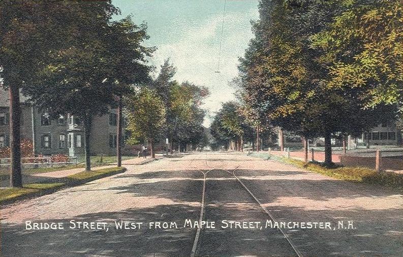
Bridge Street in 1909
-
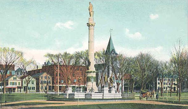
War Monument c. 1905
-

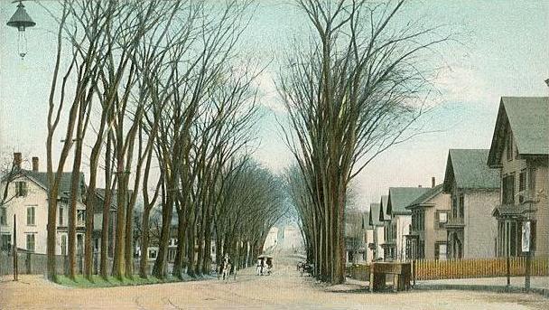
Granite Street c. 1900
-

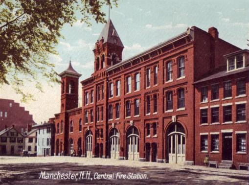
Old Fire Station in 1907
Government
Board of Mayor and Aldermen
2009-10- Mayor: Ted Gatsas
- Ward 1: Joyce Craig
- Ward 2: Ron Ludwig
- Ward 3: Patrick Long
- Ward 4: Jim Roy
- Ward 5: Ed Osborne
- Ward 6: Garth Corriveau
- Ward 7: William P. Shea
- Ward 8: Betsi DeVries
- Ward 9: Barbara E. Shaw
- Ward 10: Phil Greazzo
- Ward 11: Russell Ouellette
- Ward 12: Patrick Arnold
- At-large: Michael “Mike” Lopez
- At-large: Daniel P. O’Neil
Manchester is incorporated as a city under the laws of the State of New Hampshire, and operates under a strong mayoral form of government. The mayor serves as chairman of the fourteen-member Board of Mayor and Aldermen, the city's legislative body. Each of Manchester's twelve wards elects a single alderman, and two additional at-large members are elected citywide.
The mayor also serves as the chair of the board of school committee. Like the board of aldermen, the school board has twelve members elected by ward and two at-large members. The School Board is not a city department; rather, it is a school district coterminous with the city, which obtains financing from the Board of Mayor and Aldermen.
Neighborhoods
In 2007, the city began a Neighborhood Initiatives program to "insure that our neighborhoods are vibrant, livable areas since these are the portions of the city where most of the residents spend their time living, playing, shopping and going to school."[11] The purpose of this initiative is to foster vibrancy and redevelopment in the neighborhoods, and to restore the sense of neighborhood communities that had been overlooked in the city for some time. The city began the program with street-scape and infrastructure improvements in the Rimmon Heights neighborhood of the West Side, which has spurred growth and investment in and by the community.[12] Since the initial investment, however, it is unclear how city government plans to implement similar programs throughout the city.
The major neighborhoods, historically, include Amoskeag, Rimmon Heights, Notre Dame/McGregorville and Piscataquog/Granite Square on the West Side; and the North End, Janeville/Corey Square, Hallsville and Bakersville on the East Side; along with Youngsville and Goffes Falls on the periphery of the city.
The Manchester Planning Board in its 2010 Master Plan has begun to define 25 neighborhoods within the city. LivableMHT has drawn maps of the neighborhoods and neighborhood village centers as defined by the city. The 25 neighborhoods are:[13]
West Side
- Northwest - largely suburban neighborhood along Front Street, includes former Amoskeag neighborhood and Hackett Hill open space
- Rimmon Heights - dense, formerly French Canadian neighborhood anchored along Kelley and Amory streets
- Notre Dame - dense neighborhood below Rimmon Heights along Main and McGregor streets
- Piscataquog - dense neighborhood centered around Granite Square and the Piscataquog River
- Mast Road - mid-density, suburban neighborhood that developed along the original road to Goffstown and prewar streetcar line
- Wolfe Park - largely suburban neighborhood with greater density around prewar "A Street" streetcar line
East Side
- Downtown - center city including the city's major businesses and cultural institutions, Elm Street, the Millyard and The Nob/North of Bridge
- North End - historically affluent neighborhood with density and businesses along Webster Street, more suburban in the north
- Straw/Smyth - historically affluent, residential neighborhood home to the Currier Museum of Art
- Corey Square - also known as Janeville, the dense, center city neighborhood along Bridge Street is unique in that it deviates from the city's grid
- Kalivas Union - dense center city neighborhood includes Valley and Union streets
- Bakersville - south of downtown, location of recent redevelopment along the River's Edge
- Hanover Hill - mid-density neighborhood east of Corey Square, location of Derryfield Park
- Hallsville - dense neighborhood anchored around the Hollow area, location of Elliot Hospital
- Somerville - mid-density neighborhood south of Hallsvile anchored around Somerville and Wilson streets
- Eaton Heights - largely suburban neighborhood that developed along the prewar streetcar line along Hanover Street
- Green Acres - largely suburban neighborhood, also home to the original town center of Derryfield
- South End - largely postwar suburban neighborhood home to much of the city's suburban-style commercial development
- Highlands - largely suburban neighborhood that developed along the prewar streetcar line to Pine Island Park
Outside the I-93/293 belt
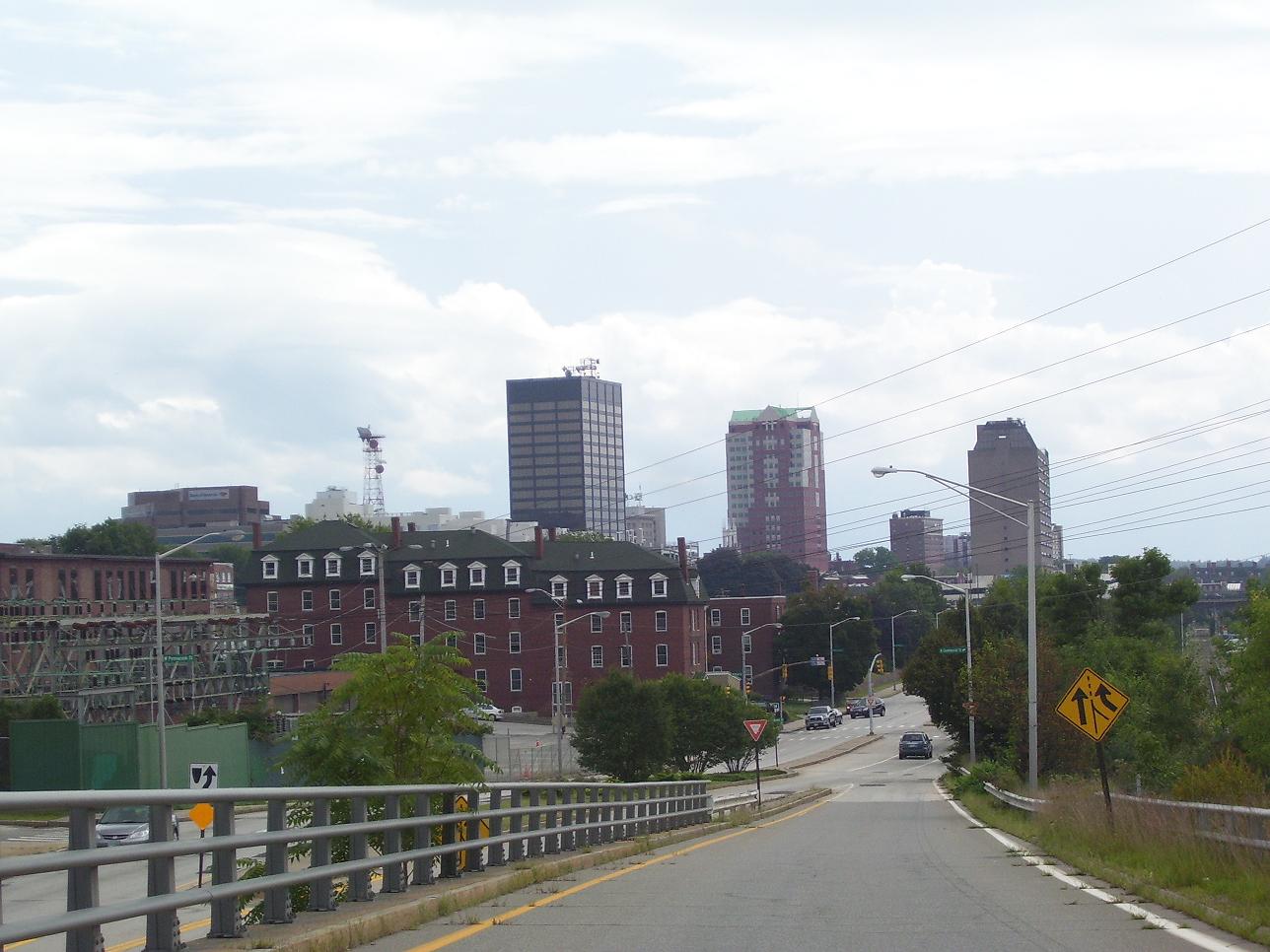
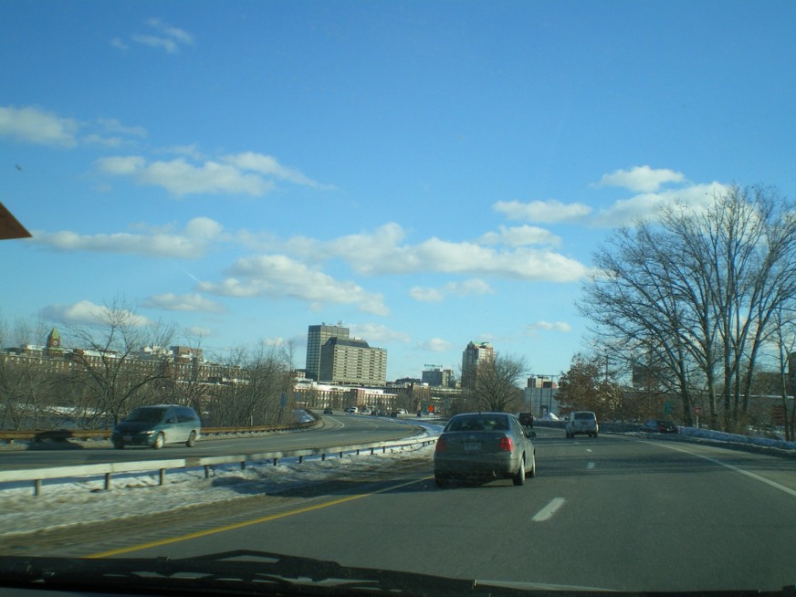
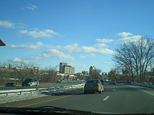 Downtown Manchester viewed from I-293
- Wellington
- Youngsville
- Southeast
- Crystal Lake
- Lower South Willow/Airport - Location of the Mall of New Hampshire and many large stores
- Goffes Falls
Surrounding communities
The urban core of Manchester extends beyond its city limits in several directions, particularly west and south of downtown, including:
- Pinardville - In the town of Goffstown, a fairly dense, former streetcar suburb area along Mast Road to the west of Manchester. Pinardville is home to St. Anselm College.
- River Corridor - In the town of Bedford, a mid-density, primarily shopping district along South River Road about two-and-a-half miles from downtown Manchester. The area has recently implemented Tax Increment Financing to improve and maintain infrastructure, and the Town of Bedford's most recent master plan has called for increasing mixed-use development and promoting walkability and transit use, though the Manchester Transit Authority bus service in the area was also recently curtailed.
- Northeast Bedford - In the town of Bedford, mainly low to mid-density suburban residential area near the terminus of the of former St. Joseph's streetcar line along Donald Street and post-war development along Boynton Street, with some businesses scattered throughout. The area does not have a formal name, but the section along Boynton Street has variously been called the Plains and the Pines. The northern area is more rural with large portions owned by St. Anselm College.
- South Hooksett - In the town of Hooksett, a sprawling, suburban shopping area north of Manchester.
Demographics
Manchester's population at the 2010 census was 109,565.[1] The city is the center of the Manchester, NH, New England City and Town Metropolitan Area (NECTA MA), which had a population of 187,596 as of the 2010 census.[14]
As of the census of 2010,[15] there were 109,565 people, 45,766 households, and 26,066 families residing in the city. The population density was 3,320.2 people per square mile (1,281.5/km²). There were 49,288 housing units at an average density of 1,493.6 per square mile (576.5/km²). The racial makeup of the city was 86.1% White, 4.1% Black or African American, 0.30% Native American, 3.7% Asian, 0.1% Pacific Islander, 3.1% from some other race, and 2.7% from two or more races. Hispanic or Latino of any race were 8.1% of the population.
The largest ancestry groups within the city's population are: French (22.1%), Irish (20.2%), English (10.3%), Italian (7.9%) and German (7.4%).[16]
Historical populations Census Pop. %± 1790 362 — 1800 557 53.9% 1810 615 10.4% 1820 761 23.7% 1830 877 15.2% 1840 3,235 268.9% 1850 13,932 330.7% 1860 20,107 44.3% 1870 23,536 17.1% 1880 32,630 38.6% 1890 44,126 35.2% 1900 56,987 29.1% 1910 70,063 22.9% 1920 78,384 11.9% 1930 76,834 −2.0% 1940 77,685 1.1% 1950 82,732 6.5% 1960 88,282 6.7% 1970 87,754 −0.6% 1980 90,936 3.6% 1990 99,332 9.2% 2000 107,219 7.9% 2010 109,565 2.2% At the 2010 census there were 45,766 households, out of which 26.4% had children under the age of 18 living with them, 38.4% were married couples living together, 13.1% had a female householder with no husband present, and 43.0% were non-families. 32.4% of all households were made up of individuals and 9.8% had someone living alone who was 65 years of age or older. The average household size was 2.34 persons and the average family size was 2.99.[15]
 West Side neighborhood
In the city the population was spread out with 21.6% under the age of 18, 10.2% from 18 to 24, 30.4% from 25 to 44, 26.0% from 45 to 64, and 11.8% who were 65 years of age or older. The median age was 36.0 years. For every 100 females there were 98.5 males. For every 100 females age 18 and over, there were 96.6 males.[15]
At the 2000 census the median income for a household in the city was $40,774, and the median income for a family was $50,039. Males had a median income of $34,287 versus $26,584 for females. The per capita income for the city was $21,244. 10.6% of the population and 7.7% of families were below the poverty line. Out of the total people living in poverty, 14.6% are under the age of 18 and 11.7% are 65 or older.
Media
The city is served by four newspapers: the New Hampshire Union Leader (formerly the Manchester Union Leader) (a daily); the Manchester Express (a weekly newspaper published by Hippo Press); The Hippo (weekly); and the Manchester Mirror (a weekly produced by the New Hampshire Union Leader).
In addition to several commercial AM and FM radio stations, Manchester is also served by local cable television and hosts one commercial television station:
- WMUR-TV Channel 9, the Manchester ABC television affiliate
- Manchester Public Television Service Inc, a Public, educational, and government access (PEG) cable television facility.
Manchester is on the northern fringe of the Boston television market.
Education
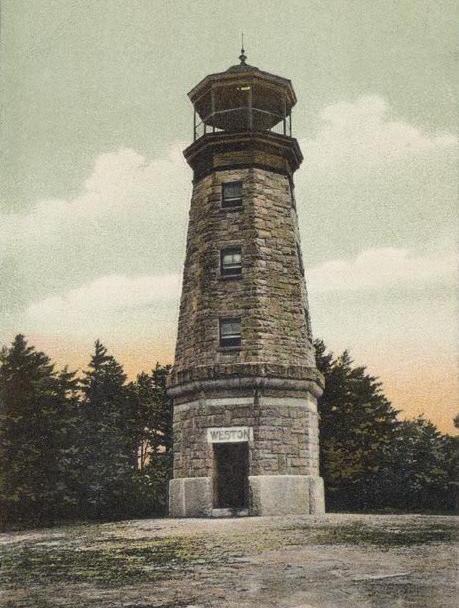
 Pearl Street School c. 1910
 Weston Observatory in 1906
 Elm Street in 2009
Public schools
Manchester's public school system is run by the Manchester School District.
- High schools
Manchester School District has four public high schools:
- Manchester High School West (West High School)
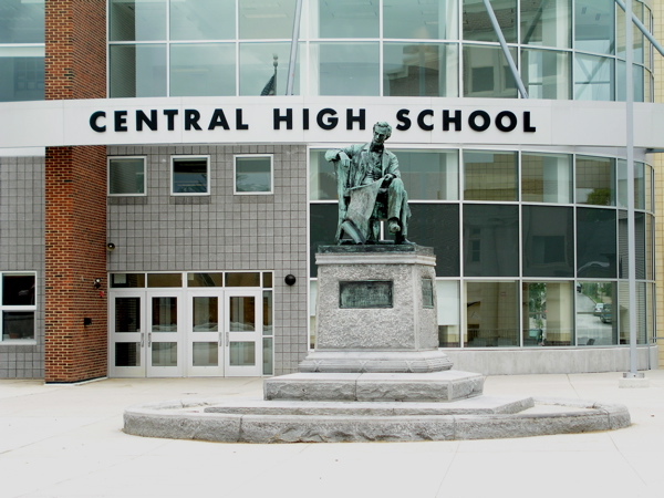
- Manchester Central High School (Central High School)
- Manchester Memorial High School (Memorial High School)
- Manchester School of Technology (MST)
- Middle schools
Manchester School District has four public middle schools:
- Hillside Middle School
- Henry J. McLaughlin Middle School
- Middle School at Parkside
- Southside Middle School
- Elementary schools
Manchester School District has fourteen elementary schools:
- Bakersville Elementary School
- Beech Street School
- Gossler Park School
- Green Acres Elementary School
- Hallsville Elementary School
- Highland-Goffes Falls Elementary School
- Jewett Street School
- McDonough Elementary School
- Northwest Elementary School
- Parker-Varney School
- Smyth Road School
- Webster School
- Weston School
- Henry Wilson School
Private schools
Manchester is served by three private high schools:
- Trinity High School, a private, Roman Catholic high school
- The Derryfield School, a private school serving sixth through twelfth grades
- Holy Family Academy, a small Roman Catholic private school serving seventh through twelfth grades
Other Roman Catholic schools include:
- St. Joseph Regional Junior High School
- St. Catherine School, an elementary school
- St. Anthony School, an elementary school
- St. Casimir, elementary and junior high school
- St. Benedict Academy, an elementary school
- Mount Saint Mary Academy, an elementary school
In addition:
- Mount Zion Christian Schools, a nondenominational, evangelical Christian school serving kindergarten through twelfth grade; recently relocated from neighboring Bedford to Manchester
- Easter Seals Robert B. Jolicoeur School, a private special education school
Post-secondary schools
Area institutions of higher education, together enrolling more than 8,000 students, include:
- Hesser College - Manchester
- Manchester Community College
- Massachusetts College of Pharmacy and Health Sciences -Manchester, NH Secondary Campus
- New Hampshire Institute of Art (formerly called The Manchester Institute of Arts and Sciences)
- North Eastern Institute of Whole Health - School of Massage Therapy [4]
- Saint Anselm College, located within the adjacent town of Goffstown, but with a Manchester mailing address
- Southern New Hampshire University, located on the boundary between Manchester and Hooksett
- Springfield College School of Human Services [5]
- University of New Hampshire at Manchester
Culture
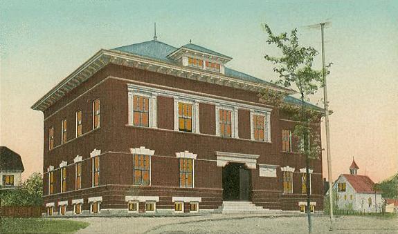
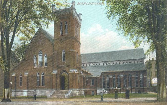
 Old Library in 1908
Cultural landmarks include the historic Palace Theatre; the Currier Museum of Art; the New Hampshire Institute of Art; the Franco-American Center; the Manchester Historic Association Millyard Museum; the Massabesic Audubon Center; the Amoskeag Fishways Learning and Visitors Center; the Lawrence L. Lee Scouting Museum and Max I. Silber Library; and the SEE Science Center. Valley Cemetery, since 1841 the resting place of numerous prominent citizens, is an early example of a garden-style burial ground.
The Verizon Wireless Arena is a civic center that hosts a variety of events, from professional minor-league sports such as hockey and arena football to concerts with major recording artists and comedians, national touring theatrical productions, family-oriented shows, and fairs. It opened in November 2001 and seats more than 10,000 patrons.[17] The John F. Kennedy Memorial Coliseum is another, smaller venue located in downtown Manchester with a capacity of approximately 3,000 seats. It was completed in 1963, serves as home ice for the Manchester Central and Memorial High School hockey teams, and is home to the Southern New Hampshire Skating Club.[18]
The nickname "ManchVegas" was derived from illegal gambling in local businesses during the late 1980s or early '90s. Many pizza shops and local bars had video poker machines that would pay out real money. The nickname was coined following a city-wide bust of these machines. It was then adopted as a lampoon of the city's limited entertainment opportunities. The term has since become a source of pride as the city's entertainment scene has grown. By 2003 it was well enough known that a note on Virtualtourist.com said, "Residents reflect the regional dry humor by referring to sedate Manchester as 'ManchVegas'."[19] By 2005, an article in Manchester's Hippo Press (a local alternative weekly) said that then-Mayor Robert A. Baines "is pushing to replace the nickname ManchVegas with Manchhattan" (meaning Manchester+Manhattan).[20] In 2009 the film Monsters, Marriage and Murder in Manchvegas was released referencing Manchester's popular nickname and using much of the city as its backdrop.[21]
Sports
Club League Venue Established Championships Amoskeag Rugby Club NERFU, Rugby Northeast Athletic Club 1984 0 New Hampshire Fisher Cats EL, Baseball (professional) Northeast Delta Dental Stadium 2004 2 Manchester Monarchs AHL, Ice hockey (professional) Verizon Wireless Arena 2001 0 Manchester Wolves af2, Arena football (professional) Verizon Wireless Arena 2002 0 New Hampshire Phantoms PDL, Soccer Manchester Memorial High School 1996 0 ManchVegas Roller Girls USARS, Flat track roller derby West Side Ice Arena 2008 0 New Hampshire Roller Derby WFTDA[22] Flat track roller derby JFK Memorial Coliseum[23] 2007 0 Manchester Freedom IWFL, Women's Tackle Football West High 2002 0 Transportation
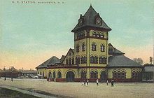 Union Station c. 1910
The city is served by Manchester-Boston Regional Airport, the fourth largest airport in New England. It is the secondary airport serving Boston, Massachusetts, and is used by most of the nation's major airlines, with the largest market share held by Southwest Airlines. The airport has international service to Toronto, Ontario, via Air Canada; customs are handled in Toronto. Alternative airports include Boston's Logan International Airport and Portland International Jetport in Maine.
Interstates 93 and 293 and the F.E. Everett Turnpike are multi-lane highways that connect the metropolitan area to Concord and the White Mountains to the north and Nashua and Boston to the south. NH 101 is a four-lane highway eastbound from Manchester to Hampton Beach, connecting the city with the southeastern part of the state and the seacoast, as well as Maine and the Massachusetts North Shore via Interstate 95. West of Manchester, NH 101 is a two-lane highway serving as the main artery to Keene, the Monadnock region, and other points in southwestern New Hampshire, eventually connecting to NH 9 and the state's border with Vermont.
Construction is underway to connect the Everett Turnpike just south of the city with the Manchester-Boston Regional Airport via a Merrimack River-crossing connector road, the first direct highway access with the airport to date. Currently most airport patrons must exit I-293 and then drive on Brown Avenue, a four-lane city street, to access the airport.
Public transportation is provided by the Manchester Transit Authority, which runs several bus routes throughout the city and surrounding areas. Concord Trailways and Boston Express run commuter services to Boston and other parts of the state. Vermont Transit Lines (affiliated with Greyhound Lines) has lines to Montreal. In 2008, Boston Express moved to suburb Londonderry, New Hampshire, and now provides only limited service to downtown Manchester.
Manchester would be served by the Capital Corridor, an extension of the MBTA commuter rail from its current terminus in Lowell, Massachusetts to Concord, which would also include a stop at Manchester-Boston Regional Airport. The route is being studied by the New Hampshire Rail Transit Authority and New Hampshire Department of Transportation, which have received federal funding for studying and planning the route.[24] The Capital Corridor route is also being studied as a possible future high-speed rail line connecting Montreal and Boston.[25] Currently, Manchester is one of the largest cities and metropolitan areas in the United States without Amtrak service.[26] With the expansion of Interstate 93 to eight lanes from Salem to Manchester under construction, space is being reserved in the median for potential future commuter or light rail service along this corridor.[27]
Economy
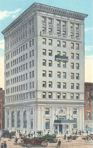
 Amoskeag Bank in 1913
Manchester is northern New England's largest city, and its metropolitan area is one of the fastest growing in New England. Its economy has changed greatly, as Manchester was a textile mill town about 20 years ago. In March 2009 Kiplinger voted Manchester the second most tax friendly city in America, after Anchorage, Alaska.[5] Earlier in the year, CNN rated Manchester 13th in its 100 best places to live and launch a business in America.[4]
Manchester is the home of Segway, Inc., manufacturers of a two-wheeled, self-balancing electric vehicle invented by Dean Kamen.
Downtown
City Hall Plaza, the tallest New England building north of Cambridge, Massachusetts, is located in downtown Manchester. Other notable downtown buildings include the all-black Hampshire Plaza (shorter than City Hall Plaza by only a few feet and, like its counterpart, towers above the rest of Northern New England at 20 stories high); the New Hampshire Tower; the New Hampshire headquarters of Citizens Bank, in the renovated and heightened former Amoskeag Bank building (at the original 10 stories, once Manchester's "skyscraper" for many decades); and Bank of America.
The Verizon Wireless Arena has become the centerpiece of downtown Manchester. The venue can seat more than 10,000 for concerts and sporting events. The Verizon is also home to the Manchester Monarchs, the local AHL affiliate of the Los Angeles Kings. The Northeast Delta Dental Stadium (formerly Merchantsauto.com Stadium) is a baseball park located on the Merrimack River in downtown Manchester and is home to the local AA baseball affiliate of the Toronto Blue Jays, the New Hampshire Fisher Cats. Historic Gill Stadium supported professional minor-league baseball into the early 21st century and continues to be a viable and popular downtown venue for many sporting and entertainment events, seating nearly 4,000 patrons, depending on the event format.
The Red Arrow, rated in 1998 as one of the top 10 diners in the United States,[28] is located downtown.
In recent years there has been continual redevelopment of the Amoskeag Millyard and its residential Historic District. The increasing popularity of downtown living has caused many properties originally built as tenement housing for mill workers in the 19th century to be converted to stylish, eclectic residential condominiums. Many new retail stores and higher education institutions have been uniquely retro-fitted into properties along Commercial and Canal Street.
Shopping
Manchester has two main retail areas: downtown Manchester and South Willow Street (NH Route 28). The Mall of New Hampshire is located on South Willow Street, and, with more than 125 stores, is one of the largest shopping centers in southern New Hampshire and central New England.
Notable inhabitants
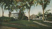 Gen. Stark House in 1906
- See List of people from Manchester, New Hampshire, for a more complete list.
- Joseph Carter Abbott, Union general and a Senator from North Carolina
- Jane Badler, Miss N.H. 1973; evil Diana in 1983-85 original and guest-star reprise in 2011 season of remake of sci-fi TV series V
- Steve Balboni, Major League baseball player
- Matt Czuchry, actor (currently on CBS series The Good Wife)
- Charlie Davies, soccer player
- Mike Flanagan, Major League pitcher and winner of the 1979 Cy Young Award
- Rene Gagnon, a US Marine who helped raise the flag over Iwo Jima and one of the servicemen in the iconic photograph associated with it
- Chip Kelly, head coach of the University of Oregon Ducks football team
- William Loeb, publisher of the Manchester Union Leader newspaper, 1946–81
- Dick and Mac McDonald, founders of McDonald's
- Grace Metalious, author of Peyton Place
- Seth Meyers, anchor of 'Weekend Update' segment and current head writer of NBC's Saturday Night Live (from neighboring Bedford; attended school in Manchester)
- Bob Montana, cartoonist and creator of the characters of Archie Comics; graduate of Manchester Central High School
- Lee Morin, astronaut
- Charles Revson, businessman, founder of the cosmetics company Revlon
- Adam Sandler, comic actor
- Sarah Silverman, comic actress (from Bedford; attended school in Manchester)
- John Stark, Revolutionary War general and commander
Sister cities
 Nashville, Tennessee, United States
 Neustadt an der Weinstraße, Germany
 Taichung, Taiwan
 Hof HaCarmel Region, Israel
 Gweru, Zimbabwe
See also
References
- Manchester: A Brief record of its Past and a Picture of its Present (1876) 598pp online
- ^ a b c United States Census Bureau, American FactFinder, 2010 Census figures. Retrieved March 23, 2011.
- ^ "Race, Hispanic or Latino, Age, and Housing Occupancy: 2010 Census Redistricting Data (Public Law 94-171) Summary File (QT-PL), Manchester, NH Metropolitan NECTA". U.S. Census Bureau, American FactFinder 2. http://factfinder2.census.gov. Retrieved August 17, 2011.
- ^ "Race, Hispanic or Latino, Age, and Housing Occupancy: 2010 Census Redistricting Data (Public Law 94-171) Summary File (QT-PL), Manchester-Nashua, NH Metro Area". U.S. Census Bureau, American FactFinder 2. http://factfinder2.census.gov. Retrieved September 7, 2011.
- ^ a b http://mutualfunds.info/2008/03/18/smbusiness/manchester_new_hampshire.fsb/index.htm
- ^ a b http://finance.yahoo.com/taxes/article/106691/Top-10-Tax-Friendly-Cities
- ^ Forbes, "In Depth: America's Best Cheap Cities" (July 13, 2009)
- ^ Tamara K. Hareven, Amoskeag: Life and Work in an American Factory City
- ^ Brooks, Scott (2005-10-26). "ManchVegas: Love it or hate it, the Queen City's other name has stuck". New Hampshire Union Leader. http://www.unionleader.com/article.aspx?articleId=11cfd129-6a77-4625-be5d-df6704734e8a. Retrieved 2011-01-20.
- ^ "Monthly Averages for Manchester, NH – Temperature and Precipitation". The Weather Channel. http://www.weather.com/weather/wxclimatology/monthly/graph/USNH0136. Retrieved 2010-05-04.
- ^ "Climatography of the United States No. 20 (1971–2000)" (PDF). National Oceanic and Atmospheric Administration. 2004. http://cdo.ncdc.noaa.gov/climatenormals/clim20/nh/275211.pdf. Retrieved 2010-06-07.
- ^ http://www.yourmanchesternh.com/plans-and-projects/current-projects.aspx
- ^ http://www.nhpr.org/node/16970
- ^ http://www.manchesternh.gov/website/Departments/PlanningCommDev/MasterPlan/tabid/1421/Default.aspx
- ^ "Profile of General Population and Housing Characteristics: 2010 Demographic Profile Data, Manchester, NH Metropolitan NECTA". U.S. Census Bureau, American FactFinder. http://factfinder2.census.gov. Retrieved September 16, 2011.
- ^ a b c "Profile of General Population and Housing Characteristics: 2010 Demographic Profile Data, Manchester city, New Hampshire". U.S. Census Bureau, American FactFinder. http://factfinder2.census.gov. Retrieved September 16, 2011.
- ^ http://factfinder.census.gov/servlet/ADPTable?_bm=y&-geo_id=16000US3345140&-qr_name=ACS_2007_3YR_G00_DP3YR2&-ds_name=ACS_2007_3YR_G00_&-_lang=en&-redoLog=false&-_sse=on
- ^ [1]
- ^ [2]
- ^ "Manchester Local Customs". VirtualTourist.com. http://www.virtualtourist.com/travel/North_America/United_States_of_America/New_Hampshire/Manchester-831355/Local_Customs-Manchester-R-1.html. Retrieved June 7, 2010.
- ^ "Manchester Parks need help". The Hippo. http://www.hippopress.com/pubnote/pubnote05818.html. Retrieved June 7, 2010.
- ^ [3]
- ^ http://wftda.com/leagues Women's Flat Track Derby Association Leagues
- ^ Rivers, Bryon (2009-08-21). The women of Skate Free or Die prepare for final match”. Lawrence Eagle Tribune. Retrieved 2010-02-12.
- ^ http://www.nh.gov/dot/programs/nhrta/documents/2010-10-29NHRTAminutes.pdf
- ^ http://www.fra.dot.gov/rpd/downloads/HSIPR_Summary_of_Federal_Investments.pdf
- ^ http://en.wikipedia.org/wiki/List_of_major_cities_in_U.S._lacking_Amtrak_service
- ^ Rebuilding I93: Salem to Manchester (NHDOT) — Frequently Asked Questions (F.A.Q.)
- ^ USA Today, Sep 18, 1998
External links
- Manchester, NH official website
- Manchester (New Hampshire) travel guide from Wikitravel
- Manchester School District
- Manchester Historic Association
- Manchester City Library
- New Hampshire Economic and Labor Market Information Bureau Profile
Municipalities and communities of Hillsborough County, New Hampshire Cities Manchester | Nashua
Towns Amherst | Antrim | Bedford | Bennington | Brookline | Deering | Francestown | Goffstown | Greenfield | Greenville | Hancock | Hillsborough | Hollis | Hudson | Litchfield | Lyndeborough | Mason | Merrimack | Milford | Mont Vernon | New Boston | New Ipswich | Pelham | Peterborough | Sharon | Temple | Weare | Wilton | Windsor
Villages East Merrimack | Grasmere | Pinardville
New England Topics Flag | Culture | Cuisine | Geography | Economy | Government | History | Population | Sports
States Major cities Boston | Bridgeport | Burlington | Cambridge | Hartford | Lowell | Manchester | New Haven | Portland | Providence | Quincy | Springfield | Stamford | Waterbury | Worcester
State capitals Augusta | Boston | Concord | Hartford | Montpelier | Providence
Transportation Rail MBTA (MA and RI) · Northeast Corridor (CT, MA, and RI) · Acela Express (CT, MA, and RI) · Downeaster (ME, NH, and MA) · Vermonter (CT, MA, and VT) · Shore Line East (CT) · Metro-North Railroad (CT and NY)Air Bradley International Airport (CT) · Portland International Jetport (ME) · Logan International Airport (MA) · Manchester-Boston Regional Airport (NH) · T. F. Green Airport (RI) · Burlington International Airport (VT)Categories:- Manchester, New Hampshire
- Cities in New Hampshire
- Populated places established in 1751
- Company towns in New Hampshire
- County seats in New Hampshire
- Early American industrial centers
- History of the textile industry
- Populated places in Hillsborough County, New Hampshire
-


Wikimedia Foundation. 2010.