- Visalia, California
-
This article is about the city in California. For the metropolitan area, see Visalia Metropolitan Area. For other meanings of "Visalia", see Visalia (disambiguation).
Visalia — City — City of Visalia Acequia Ave

Flag
LogoNickname(s): Gateway to the Sequoias Location within Tulare County in the state of California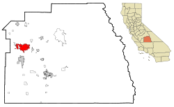 Location in the United States
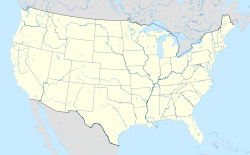
 Visalia
Coordinates: 36°19′27″N 119°18′26″W / 36.32417°N 119.30722°WCoordinates: 36°19′27″N 119°18′26″W / 36.32417°N 119.30722°W Country  United States
State  California
County Tulare Settled 1852 Incorporated 1864 Government - Type Council-Manager - City Council Mayor Bob Link
Amy Shuklian
Mike Lane
E. Warren Gubler
Steven Nelsen- City Manager Steve Salomon - Treasurer / Finance Director Eric Frost - City Clerk Donjia Huffmon - Chief of Police Colleen Mestas Area[1] - Total 36.266 sq mi (93.928 km2) - Land 36.246 sq mi (93.876 km2) - Water 0.02 sq mi (0.051 km2) 0.05% Elevation 331 ft (101 m) Population (2010) - Total 124,442 - Rank 1st in Tulare County
44th in California
201st in the United States- Density 3,431.4/sq mi (1,324.9/km2) - Demonym Visalian Time zone PST (UTC-8) - Summer (DST) PDT (UTC-7) ZIP code 93277-93279, 93290-93292 Area code(s) 559 Website Official Website of the city of Visalia Visalia (
 /vaɪˈseɪljə/ vy-sayl-yə) is a Central California city situated in the heart of California’s agricultural San Joaquin Valley, approximately 230 miles (370 km) southeast of San Francisco and 190 miles (310 km) north of Los Angeles. The population was 124,442 at the 2010 census.
Visalia is the 44th largest city in the state of California and the 201 largest in the United States.[2]
Often referred to as the Gateway to the Sequoias, Visalia has an estimated population of 125,921[3] and spans over 28.6 square miles (74.1 km2) in Central California. Its inhabitants are known as "Visalians". In 2007, Visalia was named the 3rd fastest growing city in California and 19th fastest growing city in the U.S.[4]
Settled in 1852, Visalia is the oldest permanent inland settlement between Stockton and Los Angeles. As the county seat and largest city of Tulare County, Visalia serves as the economic center to the region known as the Sequoia Valley, one of the most productive single agricultural areas in the United States.[5][6] Visalia lies within miles of the tallest mountain range in the contiguous United States, the Sierra Nevada (U.S.) (see Mount Whitney, which is located in Tulare and Inyo counties), and is the closest major city to Sequoia National Park, home to some of the largest living things on Earth, the Giant Sequoia trees. It is known as "Where The Valley Meets The Giants."
Contents
History
Main article: History of VisaliaThe Visalia Area was first settled by the Yokuts and Mono Native American tribes thousands of years ago.[7] It is unknown when the first Europeans arrived, but the first to make a written record of the area was, Pedro Fages in 1722.[8]
When California achieved statehood in 1850, Tulare County did not exist. The land that is now Tulare County was part of the huge County of Mariposa.[9] In 1852, some pioneers settled in the area, then called Four Creeks. The area got its name from the many watershed creeks and rivers flowing from the Sierra Nevada Mountains. All the water resulted in a widespread swampy area with a magnificent oak forest. The industrious group of settlers petitioned the state legislature for county status and on July 10 of that same year, Tulare County became a reality.[10]
One of the first inhabitants of a fort built by the settlers was Nathaniel Vise. Nathaniel was responsible for surveying the new settlement. In November 1852, he wrote, "The town contains from 60-80 inhabitants, 30 of whom are children of school age. The town is located upon one of the subdivisions of the Kaweah River and is destined to be the county seat of Tulare.” In 1853, that prediction became a reality and Visalia has remained the county seat since that time.[11][12] Visalia is named for Nathaniel Vises' ancestral home, Visalia, Kentucky.
Early growth in Visalia can be attributed in part to the gold rush along the Kern River. The gold fever brought many transient miners through Visalia along the way and when the lure of gold failed to materialize, many returned to Visalia to live their lives and raise families. In 1859 Visalia was added to John Butterfield's Overland Stage route from St. Louis, Missouri to San Francisco. A plaque commemorating the location can be found at 116 East Main Street. Included in the early crop of citizens were some notorious and nasty individuals who preyed upon the travelers along the Butterfield Stage route. Many saloons and hotels sprouted up around the stage stop downtown and commerce was brisk if a bit risky.[13][14]
The next memorable event was the arrival of the telegraph in 1860. Visalians then could get timely information of the events taking place on the East Coast which would ultimately develop into the American Civil War. During the American Civil War, many citizens of Visalia couldn't decide whether Visalia should stand on the side of the North or the South, so they simply had a Mini Civil War of their own on Main Street. No one really knows the outcome of the war, but apparently it was concluded to the satisfaction of the participants and life returned to normal. The federal government however, was not so easily convinced and reacting to concern about sedition banned Visalia’s pro-south Equal Rights Expositor newspaper and established a military garrison. Camp Babbitt was built in 1862 to stop overt southern support as well as maintain law and order in the community. During these Civil War years, Visalia was incorporated which gave the town new rights.[15]
The second incorporation in 1874 moved Visalia into city status with a common council and an ex-officio Mayor and President.[16]
In 1904, the Visalia Electric Railroad was incorporated.[17]
Visalia served as a host city for the Amgen Tour of California in 2009 and 2010.[18]
Cityscape


Panorama of Downtown Visalia The city is divided into neighborhoods, some of which were incorporated places or communities. There are also several independent cities around Visalia that are popularly grouped with the city of Visalia, due to its immediate vicinity. Generally, the city is divided into the following areas: Downtown Visalia, North Visalia, The Eastside, Southwest Visalia, the Industrial Area, Mooney, and the Westside.
Geography
See also: Central Valley (California), San Joaquin Valley, Tulare County, California, and List of California area codes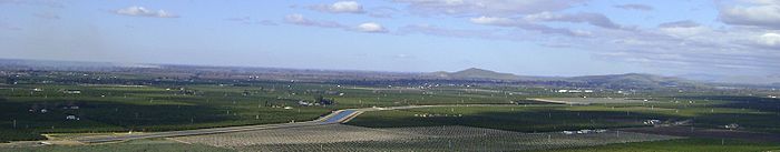
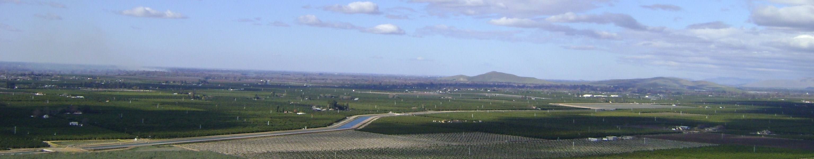
A view of East Visalia from Rocky Hill. Left to right: Exeter, Visalia, Friant-Kern Canal (foreground), Sequoia Freeway, Venice Hills, and Woodlake. Visalia is irregularly shaped and covers a total area of 36.3 square miles (94 km2), of which, 36.3 square miles (94 km2) of it is land and 0.05% of it is covered by water. Visalia is located at 36°19'27" North, 119°18'26" West (36.324100, -119.307347).[19]
The highest point in the Visalia area is Mount Whitney.[20] Located at the far reaches of the Sierra Nevada, it reaches a height of 14,505 ft (4,421 m). The hilliest parts of the Visalia area are the Venice Hills and the entire Sierra Nevada foothills east of the city. There are four main streams that run through the city. The major stream being the St. John's River, which begins at the diversion dam in the Kaweah River and is largely seasonal. The others are Mill Creek, Cameron Creek, and Packwood Creek. There are also many smaller creeks that flow through the city. The Friant-Kern Canal runs just east of the city along the western edge of the Sierra Nevada Foothills.
Geology
Visalia is subject to aftershocks due to its proximity to the Pacific Ring of Fire. The geologic instability produces numerous fault lines both above and below ground, which altogether cause approximately 10,000 earthquakes every year.[21] One of the major fault lines is the San Andreas Fault. No major earthquakes have hit the Visalia area.[22] All but a few quakes are of low intensity and are not felt.[21] Parts of the city are also vulnerable to floods. The San Joaquin Valley and metropolitan areas are also at risk from blind thrust earthquakes.[23]
Climate
Visalia is somewhat like a Mediterranean climate, but more like a semi-arid climate (Köppen climate classification Bsh), and receives just enough annual precipitation to stay out of Köppen's BWh (desert climate) classification. Visalia enjoys plenty of sunshine throughout the year, with an average of only 26 days with measurable precipitation annually.[24]
The period of April through October is warm to hot and dry with average high temperatures of 74–94 °F (23–34 °C) and lows of 48–65 °F (9–18 °C), however temperatures frequently exceed 100 °F (38 °C) and occasionally reach 105 °F (41 °C).
The period of November through March is mild and somewhat rainy with average high temperatures of 54–67 °F (12–19 °C) and lows of 36–45 °F (2–7 °C), but temperatures could occasionally drop to low 30s (~5°C) or be as high as 70 °F (21 °C) for few days during winter.[25]
Visalia averages 11 inches (279.40 mm) of precipitation annually, which mainly occurs during the winter and spring (November thru April) with generally light rain showers, but sometimes as heavy rainfall and thunderstorms. The valley gets slightly less rainfall, while the mountains get slightly more. Years of average rainfall are rare; the usual pattern is bimodal, with a short string of dry years (perhaps 7–8 inches/180–200 millimetres) followed by one or two wet years that make up the average. Snowfall is extremely rare in the valley, but the mountains a couple miles east of city limits receive snowfall every winter. The greatest snowfall recorded in Visalia was just below 3 inches (7.62 cm) on January 25, 1999.[26]
Climate data for Visalia, California (1971-2000) Month Jan Feb Mar Apr May Jun Jul Aug Sep Oct Nov Dec Year Average high °F (°C) 54.2
(12.3)61.7
(16.5)66.8
(19.3)73.7
(23.2)81.6
(27.6)89.2
(31.8)93.8
(34.3)92.2
(33.4)86.9
(30.5)78.0
(25.6)63.7
(17.6)54.2
(12.3)74.7 Average low °F (°C) 37.4
(3.0)41.1
(5.1)44.9
(7.2)48.1
(8.9)54.0
(12.2)60.1
(15.6)64.8
(18.2)63.8
(17.7)59.3
(15.2)51.8
(11.0)42.2
(5.7)36.2
(2.3)50.3 Precipitation inches (mm) 2.03
(51.6)1.95
(49.5)2.15
(54.6)0.80
(20.3)0.37
(9.4)0.14
(3.6)0.01
(0.3)0.02
(0.5)0.25
(6.4)0.65
(16.5)1.17
(29.7)1.49
(37.8)11.03
(280.2)Source: National Oceanic and Atmospheric Administration[27] Flora
The Visalia area is rich in native plant species due in part to a diversity in habitats, including creeks, rivers, hills, and mountains. Native plants include: Incense Cedar (Calocedrus decurrens), Oak (Valley oak), California Bay (Umbellularia californica), Manzanita (Arctostaphylos manzanita), Salvia (Salvia spathacea), Mountain Mahogany (Cercocarpus betuloides), Milkweed (Asclepias speciosa), California fuchsia (Epilobium cleistogamum), Monkeyflower (Mimulus), Penstemon, Western Melica (Melica californica), and Deer Grass (Muhlenbergia rigens).[28]
Environmental issues
Owing to geography, heavy reliance on automobiles, and agriculture, Visalia suffers from air pollution in the form of smog. The Visalia area and the rest of San Joaquin Valley are susceptible to atmospheric inversion, which holds in the exhausts from road vehicles, airplanes, locomotives, agriculture, manufacturing, and other sources. Unlike other cities that rely on rain to clear smog, Visalia gets only 11.03 inches (280.16 mm) of rain each year: pollution accumulates over many consecutive days. Issues of air quality in Visalia and other major cities led to the passage of early national environmental legislation, including the Clean Air Act. More recently, the state of California has led the nation in working to limit pollution by mandating low emission vehicles. Smog levels are only high during summers because it is dry and warm. In the winter, storms help to clear the smog and it is not as much of a problem. Smog should continue to drop in the coming years due to aggressive steps to reduce it, electric and hybrid cars, amongst other pollution reducing measures taken.[29]
As a result, pollution levels have dropped in recent decades. The number of Stage 1 smog alerts has declined from over 100 per year in the 1970s to almost zero in the new millennium. Despite improvement, the 2006 annual report of the American Lung Association ranked the city as the 11th most polluted in the country with short-term particle pollution and year-round particle pollution.[30] In 2007 the annual report of the American Lung Association ranked the city as the 4th most polluted in the country with short-term particle pollution and year-round particle pollution.[31] In 2008, the city was ranked the third most polluted and again fourth for highest year-round particulate pollution.[32]
Economy
The economy of Visalia is driven by agriculture (especially grapes, olives, cotton, citrus, and nursery products), livestock, and distribution and manufacturing facilities (electronics and paper products are a couple of significant manufacturing sectors).[33] Light manufacturing and industrial/commercial distribution represent the fastest growing portion of Visalia's employer base.[34]
According to the city's 2010 Comprehensive Annual Financial Report,[35] the top ten employers in the city are the County of Tulare, Kaweah Delta Medical Center, Visalia Unified School District, College of the Sequoias, Cigna, the City of Visalia, Turning Point of Central California, Walmart, San Joaquin Valley College and the Visalia Medical Clinic.
Culture
See also: List of people from VisaliaIn popular culture
- Visalia was featured in several episodes of season 2 of the TV series 24, though many characters mispronounced its name.
- Ken Park, a controversial 2002 film directed by Larry Clark and Edward Lachman, was filmed on location in Visalia. Never released in the United States, the film is much better known in Europe and abroad.
- Kevin Costner attended Mt. Whitney High School for one semester in Visalia. His movie Bull Durham mentions the town's professional baseball team, the Visalia Oaks (now the Visalia Rawhide), which has been in Visalia for more than 60 years (book-ending a brief stint of the team as the Central Valley Rockies.)
Media
Main article: Media in VisaliaThe major daily newspaper in the area is the Visalia Times-Delta; El Sol is the city's major Spanish-language paper. There are also a number of smaller regional newspapers, alternative weeklies and magazines, including the Valley Voice Newspaper, Tulare Advance-Register and Tulare Voice (which focuses coverage on Tulare, Valley Response, ROI Magazine, Living Here (which focuses on living in the Greater Visalia Area). The major online magazine is the VisaliaGrapevine.com ,the local Interactive City Magazine which serves all of Tulare County. In addition to the English- and Spanish-language papers, numerous local periodicals serve immigrant communities in their native languages, including Armenian, Laos, Hmong, and Chinese. Many cities adjacent to Visalia also have their own daily newspapers whose coverage and availability overlaps into certain Visalia neighborhoods.
Sports
Visalia is home to the Visalia Rawhide (a "high-A" class team of the Arizona Diamondbacks) of Minor League Baseball. The Rawhide compete in the California League at Recreation Park.[36]
 Visalia Buddhist Temple
Religion
With 233,293 Christians in the Metropolitan Area (85,000 in city proper) the region has a large population of Christians.[37][38] Churches of the Catholic, Methodist, Presbyterian. Lutheran, Baptist, Church of Christ, Assemblies of God, Church of Jesus Christ of Latter-day Saints, Pentecostal, Seventh-Day Adventist Church, Mennonite, and other denominations can be found throughout the city. Several are located in south Visalia along Caldwell Avenue.
Because of Visalia's large multi-ethnic population, a wide variety of faiths are practiced, including Judaism, Islam, Buddhism, Hinduism, Zoroastrianism, Sikhism, Bahá'í, various Eastern Orthodox Churches, Sufism and others. Immigrants from Southeast Asia for example, have formed a Buddhist Temple making the city home to the only Buddhist Temple in the Visalia Area.
Education
Colleges and universities
College of the Sequoias, a community college, is the only public college located in Visalia. San Joaquin Valley College and Milan Institute are the only private colleges in the city.
There are two universities with branch campuses located within the city limits: Chapman University and Fresno Pacific University.
Visalia is the only major city in the Central Valley, with a population of over 100,000, that does not have a local four year university.
Schools and libraries
See also: List of schools in Visalia, CaliforniaVisalia Unified School District serves the entire city of Visalia, as well as several surrounding communities, with a student population of about 30,000.[39] The Tulare County Public Library operates its largest branch, the Visalia Branch in Downtown Visalia. There are other smaller libraries in Visalia, such as the Visalia Learning Center.
Transportation
Main article: Transportation in Visalia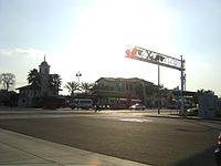 Visalia Transit Center
Freeways and highways
California State Route 99, known as the Pearl Harbor Survivors Memorial Freeway, is the major north-south highway that heads north to Fresno and south to Bakersfield. California State Route 198, the Sequoia Freeway, runs east to Sequoia National Park and west to Hanford. California State Route 63, Mooney Boulevard, heads north towards Orosi and Kings Canyon National Park, and south to Tulare. California State Route 216, Lovers Lane, heads north to Woodlake.
Public transportation
The Visalia Transit (formerly the Visalia City Coach) operates environmentally-friendly and convenient public transportation to, from and within the communities of Visalia, Goshen, Farmersville and Exeter.[40] The Visalia Transit also provides Dial-A-Ride curb-to-curb para-transit service on a shared-ride, demand-response basis to locations within the city limits of Visalia, Goshen and Farmersville.[41]
The Visalia Towne Trolley serves the Downtown Visalia area.[42]
The Tulare County Area Transit (TCaT) provides the public transit services between Visalia and smaller communities throughout the greater Visalia Area. Service includes Fixed Route and Demand Responsive services that are offered Monday through Saturday.[43]
The Sequoia Shuttle provides convenient, affordable, and an environmentally-friendly alternative form of transportation from Visalia and Three Rivers to the majestic Sequoia National Park.[44]
The Loop is an easy, safe and free way for all school aged kids to get to community centers and recreation centers throughout Visalia where activities for youth are happening.[45]
Air transportation
Visalia has one airport, the Visalia Municipal Airport (IATA: VIS, ICAO: KVIS, FAA LID: VIS).
Other nearby commercial airports include:
- (IATA: FAT, ICAO: KFAT, FAA LID: FAT) Fresno Yosemite International Airport, owned by the City of Fresno; serves the San Joaquin Valley.
- (IATA: BFL, ICAO: KBFL, FAA LID: BFL) Meadows Field Airport, also known as Kern County Airport #1, serves the South Valley
Demographics
Main article: Demographics of VisaliaHistorical populations Year Pop. ±% 1860 548 — 1870 913 +66.6% 1880 1,412 +54.7% 1890 2,885 +104.3% 1900 3,085 +6.9% 1910 4,550 +47.5% 1920 5,753 +26.4% 1930 7,263 +26.2% 1940 8,904 +22.6% 1950 11,749 +32.0% 1960 15,791 +34.4% 1970 27,130 +71.8% 1980 49,729 +83.3% 1990 75,636 +52.1% 2000 91,565 +21.1% 2010 124,442 +35.9% source:[46][47] 2010
The 2010 United States Census[48] reported that Visalia had a population of 124,442. The population density was 3,431.4 people per square mile (1,324.9/km²). The racial makeup of Visalia was 80,203 (64.5%) White, 2,627 (2.1%) African American, 1,730 (1.4%) Native American, 6,768 (5.4%) Asian, 164 (0.1%) Pacific Islander, 27,249 (21.9%) from other races, and 5,701 (4.6%) from two or more races. Hispanic or Latino of any race were 57,262 persons (46.0%).
The Census reported that 123,116 people (98.9% of the population) lived in households, 606 (0.5%) lived in non-institutionalized group quarters, and 720 (0.6%) were institutionalized.
There were 41,349 households, out of which 18,102 (43.8%) had children under the age of 18 living in them, 21,219 (51.3%) were opposite-sex married couples living together, 6,508 (15.7%) had a female householder with no husband present, 2,909 (7.0%) had a male householder with no wife present. There were 3,282 (7.9%) unmarried opposite-sex partnerships, and 314 (0.8%) same-sex married couples or partnerships. 8,383 households (20.3%) were made up of individuals and 3,330 (8.1%) had someone living alone who was 65 years of age or older. The average household size was 2.98. There were 30,636 families (74.1% of all households); the average family size was 3.42.
The population was spread out with 37,406 people (30.1%) under the age of 18, 12,461 people (10.0%) aged 18 to 24, 33,922 people (27.3%) aged 25 to 44, 27,779 people (22.3%) aged 45 to 64, and 12,874 people (10.3%) who were 65 years of age or older. The median age was 31.6 years. For every 100 females there were 95.2 males. For every 100 females age 18 and over, there were 92.1 males.
There were 44,205 housing units at an average density of 1,218.9 per square mile (470.6/km²), of which 25,380 (61.4%) were owner-occupied, and 15,969 (38.6%) were occupied by renters. The homeowner vacancy rate was 2.6%; the rental vacancy rate was 6.7%. 73,980 people (59.4% of the population) lived in owner-occupied housing units and 49,136 people (39.5%) lived in rental housing units.
2006/2008
According to the 2006–2008 American Community Survey, the racial composition of Visalia was as follows:
- White: 84.0% (Non-Hispanic Whites: 50.0%)
- Black or African American: 2.2%
- Native American: 1.8%
- Asian: 5.0%
- Native Hawaiian and Other Pacific Islander: 0.1%
- Some other race: 7.6%
- Two or more races: 2.9%
- Hispanic or Latino (of any race): 40.6%
African Americans make up 2.2% of Visalia's population. According to the survey, there were 2,574 African Americans residing in Visalia.
Native Americans make up 0.7% of Visalia's population. According to the survey, there were 827 Native Americans residing in Visalia.
Asian Americans make up 5.0% of Visalia's population. According to the survey, there were 5,762 Asian Americans residing in Visalia. The seven largest Asian American groups were the following:
- Other Asian (Cambodian, Laotian, Thai, Hmong, Lahu, Mien, etc.): 2.7% (3,092)
- Vietnamese: 0.7% (804)
- Filipino: 0.5% (597)
- Chinese: 0.4% (500)
- Indian: 0.4% (437)
- Japanese: 0.2% (237)
- Korean: 0.1% (97)
Pacific Islander Americans make up 0.1% of Visalia's population. According to the survey, there were 138 Pacific Islander Americans residing in Visalia.
Multiracial Americans make up 2.9% of Visalia's population. According to the survey, there were 3,350 multiracial Americans residing in Visalia. The four main multiracial groups were the following:
- White & Black: 0.4% (468)
- White & Native American: 0.9% (1,007)
- White & Asian: 0.5% (534)
- Black & Native American: 0.1% (68)
Hispanics and Latinos make up 40.6% of Visalia's population. According to the survey, there were 47,251 Hispanics and Latinos residing in Visalia. The four main Hispanic/Latino groups were the following:
- Mexican: 38.2% (44,397)
- Puerto Rican: 0.2% (177)
- Cuban: 0.1% (91)
- Other Hispanic or Latino (Colombian, Panamanian, Uruguayan, etc.): 2.2% (2,586)
White Americans make up 84.0% of Visalia's population. According to the survey, there were 97,735 White Americans residing in Visalia. Much of the European American population is of German, Irish, English, Italian, Russian, Polish, and French descent.
Source:[49]
According to the 2006–2008 American Community Survey, the top ten European ancestries were the following:
- German: 8.2% (9,486)
- English: 6.4% (7,445)
- Irish: 5.8% (6,726)
- Portuguese: 2.5% (2,983)
- Italian: 2.4% (2,792)
- French: 2.0% (2,278)
- Dutch: 1.6% (1,877)
- Scottish: 1.0% (1,178)
- Scotch-Irish: 0.8% (953)
- Polish: 0.7% (820)
Source:[50]
2000
The 2000 census[51] recorded 91,565 people, 30,883 households, and 22,901 families residing in the city, with a population density of 3,203.8 people per square mile. There were 32,658 housing units. As of the 2000 US Census, the racial distribution in Visalia was 54.9% White American, 2.3% African American, 6.0% Asian American, 2.4% Native American, 0.3% Pacific Islander, 20.3% from other races, and 4.2% from two or more races. 35.6% of the population was Hispanic or Latino (of any race).[52]
The census indicated that 70.9% spoke English, 12.1% Spanish, 1.0% Lahu, 0.8% Mien, 0.7% Hmong, 0.6% Laotian and 0.5% Tagalog as their first language.[53]
According to the census, 41.1% of households had children under 18, 54.9% were married couples, 14.9% had a female householder with no husband present, and 25.8% were non-families. 20.7% of households were made up of individuals and 8.4% had someone living alone who was 65 years of age or older. The average household size was 2.91 and the average family size 3.37.[51]
The age distribution was: 31.3% under 18, 9.6% from 18 to 24, 28.5% from 25 to 44, 19.7% from 45 to 64, and 10.9% who were 65 or older. The median age was 32. For every 100 females there were 99.4 males. For every 100 females aged 18 and over, there were 88.9 males.[51]
The median income for a household was $53,975, and for a family was $61,823. Males had a median income of $46,423, females $34,265. The per capita income was $23,751. 14.8% of the population and 13.2% of families were below the poverty line. 21.4% of those under the age of 18 and 9.4% of those aged 65 or older were below the poverty line.[54]
Government
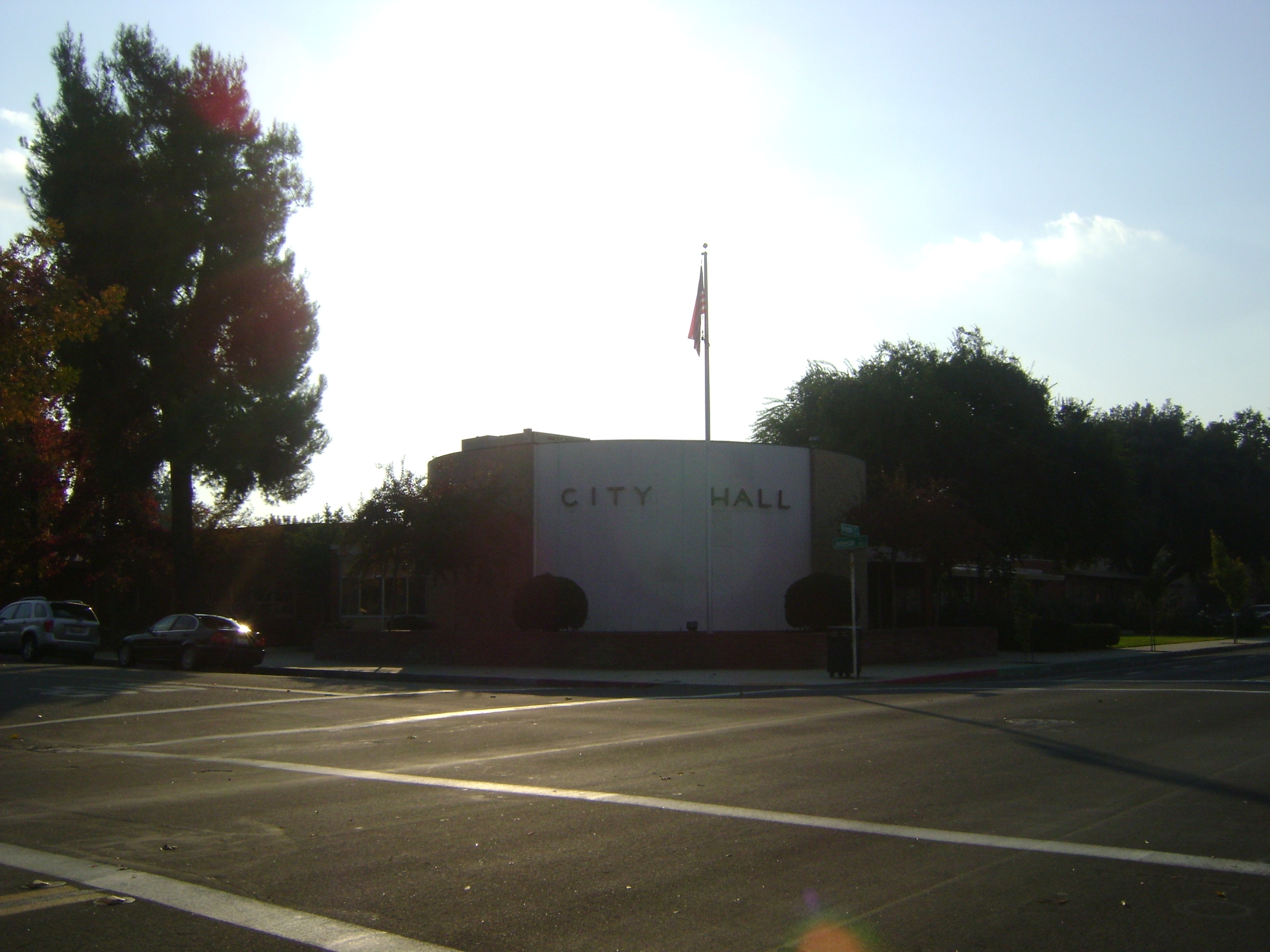
 Visalia City Hall
Local government
Like much of the San Joaquin Valley, more resident voters are registered in the Republican Party than the Democratic Party.
Of the 51,718 registered voters in Visalia; approximately 31.9% are Democrats and 49.1% are Republicans. The remaining 19.0% are Independents or are registered with one of the many smaller political parties, like the Green Party or the Libertarian Party.[55]
Visalia is a general law city governed by a five-member City Council including the mayor and vice mayor. The City Council hires a city manager to carry out policies and serve as executive officer. Every odd-numbered year either two or three members are elected by the people to serve a four-year term. Each March the City Council meets and chooses one of its members as mayor and one as vice-mayor.
 Visalia Town Center Post Office
County, state, and federal representation
In the state legislature Visalia is located in the 18th Senate District, represented by Republican Roy Ashburn, and in the 34th Assembly District, represented by Republican Connie Conway. Federally, Visalia is located in California's 21st congressional district, which has a Cook PVI of R +13[56] and is represented by Republican Devin Nunes.
The United States Postal Service operates the Town Center Post Office at 111 West Acequeia Avenue,[57] the Visalia Post Office at 2345 West Beech Avenue,[58] and the Millenium Post Office at 100 North Akers Street,[59][60] The Town Center Post Office received listing in the National Register of Historic Places on January 11, 1985.[61]
Sister cities
Visalia has 2 sister cities,[62] listed chronologically by year joined:
See also
References
- ^ U.S. Census
- ^ "Table 1: Annual Estimates of the Population for Incorporated Places Over 100,000, Ranked by July 1, 2005 Population: April 1, 2000 to July 1, 2005" (CSV). 2008 Population Estimates. United States Census Bureau, Population Division. 2006-06-20. http://www.census.gov/popest/cities/tables/SUB-EST2008-01.csv. Retrieved 2007-01-26.
- ^ http://www.dof.ca.gov/research/demographic/reports/estimates/e-1/2009-10/documents/E-1_2010-Press_Release.pdf
- ^ "The 258 fastest growing U.S. cities". CNN. June 27, 2007. http://money.cnn.com/2007/06/27/real_estate/258_fastest_growing_cities/index.htm. Retrieved May 27, 2010.
- ^ calruralhousing
- ^ Visit Visalia - About Visalia
- ^ The Tulare County Chamber of Commerce. A Few Facts about Tulare County California: History of Tulare County. Visalia, California. 1959. 11.
- ^ Downtown Visalia Statistics
- ^ Tulare County, California Genealogical Records Information
- ^ CERES: State Historical Landmarks for Tulare County - NO.410 CHARTER OAK OR ELECTION TREE
- ^ Historic California Posts: Fort Visalia
- ^ California Genealogy & History Archives
- ^ California Genealogy & History Archives
- ^ BUTTERFIELD OVERLAND MAIL STAGE ROUTE
- ^ Pioneer life: The telegraph arrives, and war continues
- ^ Visalia, Tulare County
- ^ Visalia Electric
- ^ AMGEN Tour of California
- ^ "US Gazetteer files: 2010, 2000, and 1990". United States Census Bureau. 2011-02-12. http://www.census.gov/geo/www/gazetteer/gazette.html. Retrieved 2011-04-23.
- ^ "Mount Whitney - Britannica Online Encyclopedia". Original.britannica.com. http://original.britannica.com. Retrieved 2009-11-21.
- ^ a b Earthquake Facts
- ^ http://www.consrv.ca.gov/CGS/rghm/quakes/historical/events/18970620_2014/Pages/VISALIA.aspx
- ^ "Earthquake and Volcano Deformation and Stress Triggering Research Group home page". Quake.usgs.gov. http://quake.usgs.gov/research/deformation/modeling/socal/index_gerald.html. Retrieved 2008-10-06.
- ^ "Weatherbase: Historical Weather for Visalia, California, United States of America". Weatherbase.com. http://www.weatherbase.com/weather/weather.php3?s=21157&refer=&units=us. Retrieved 2009-01-21.
- ^ www.weather.com
- ^ Durfee, Kevin. "Two Rare Snow Events in the San Joaquin Valley". http://www.wrh.noaa.gov/hnx/newslet/spring99/story2.htm. Retrieved 2009-11-21.
- ^ "NOW Data-NOAA Online Weather Data". National Oceanic and Atmospheric Administration. 2009. http://www.wrh.noaa.gov/hnx/coop/visalia.htm. Retrieved 2010-06-15.
- ^ http://www.sequoiariverlands.org/pdf/native-plants.pdf
- ^ Driveclean from the California Government web site
- ^ People at Risk In 25 U.S. Cities Most Polluted by Short-Term Particle Pollution. American Lung Association. Retrieved on January 5, 2007.
- ^ People at Risk In 25 U.S. Cities Most Polluted by Year-Round Particle Pollution. American Lung Association. Retrieved on January 5, 2007.
- ^ "Pittsburgh and Los Angeles the most polluted US cities". http://www.citymayors.com/environment/polluted_uscities.html.
- ^ Employment and Industries in the Visalia, California Area
- ^ Visalia Economic Development Corporation
- ^ City of Visalia CAFR
- ^ Visalia Rawhide: Home
- ^ Visalia, California (CA) Detailed Profile
- ^ Tulare County, California (CA) Detailed Profile
- ^ US Census, District information
- ^ Visalia Transit
- ^ Dial-A-Ride
- ^ Visalia Towne Trolley
- ^ Tulare County Area Transit (TCaT)
- ^ Sequoia Shuttle
- ^ The Loop
- ^ Moffatt, Riley. Population History of Western U.S. Cities & Towns, 1850–1990. Lanham: Scarecrow, 1996, 41.
- ^ "Annual Estimates of the Resident Population for Incorporated Places Over 100,000, Ranked by July 1, 2009 Population: April 1, 2000 to July 1, 2009" (CSV). United States Census Bureau, Population Division. 2009-07-01. http://www.census.gov/popest/cities/tables/SUB-EST2009-01.csv. Retrieved 2010-11-06.
- ^ All data are derived from the United States Census Bureau reports from the 2010 United States Census, and are accessible on-line here. The data on unmarried partnerships and same-sex married couples are from the Census report DEC_10_SF1_PCT15. All other housing and population data are from Census report DEC_10_DP_DPDP1. Both reports are viewable online or downloadable in a zip file containing a comma-delimited data file. The area data, from which densities are calculated, are available on-line here. Percentage totals may not add to 100% due to rounding. The Census Bureau defines families as a household containing one or more people related to the householder by birth, opposite-sex marriage, or adoption. People living in group quarters are tabulated by the Census Bureau as neither owners nor renters. For further details, see the text files accompanying the data files containing the Census reports mentioned above.
- ^ "ACS Demographic and Housing Estimates: 2006-2008: Visalia city, California". 2006-2008 American Community Survey. United States Census Bureau. http://www.factfinder.census.gov/servlet/ADPTable?_bm=y&-geo_id=16000US0682954&-qr_name=ACS_2008_3YR_G00_DP3YR5&-ds_name=ACS_2008_3YR_G00_&-_lang=en&-redoLog=false&-_sse=on. Retrieved November 7, 2010.
- ^ "Selected Social Characteristics in the United States: 2006-2008: Visalia city, California". 2006-2008 American Community Survey. United States Census Bureau. http://www.factfinder.census.gov/servlet/ADPTable?_bm=y&-geo_id=16000US0682954&-qr_name=ACS_2008_3YR_G00_DP3YR2&-ds_name=&-_lang=en&-redoLog=false. Retrieved November 6, 2010.
- ^ a b c "American FactFinder". United States Census Bureau. http://factfinder.census.gov. Retrieved 2008-01-31.
- ^ "Census 2000 Demographic Profile Highlights for Visalia, California". United States Census Bureau. 2000. http://factfinder.census.gov/servlet/QTTable?_bm=y&-geo_id=16000US0682954&-qr_name=DEC_2000_SF1_U_DP1&-ds_name=DEC_2000_SF1_U&-_lang=en&-redoLog=false&-_sse=on. Retrieved 2008-11-06.
- ^ Modern Language Association Data Center Results of Visalia, California Modern Language Association
- ^ "Selected Social Characteristics in the United States: 2006-2008: Visalia city, California". 2006-2008 American Community Survey. United States Census Bureau. http://factfinder.census.gov/servlet/ADPTable?_bm=y&-geo_id=16000US0682954&-qr_name=ACS_2008_3YR_G00_DP3YR3&-ds_name=ACS_2008_3YR_G00_&-_lang=en&-redoLog=false&-_sse=on. Retrieved November 6, 2010.
- ^ politicalsub.xls in PDF
- ^ "Will Gerrymandered Districts Stem the Wave of Voter Unrest?". Campaign Legal Center Blog. http://www.clcblog.org/blog_item-85.html. Retrieved 2008-02-10.
- ^ "Post Office Location - VISALIA." United States Postal Service. Retrieved on October 29, 2009.
- ^ "Post Office Location - VISALIA." United States Postal Service. Retrieved on October 29, 2009.
- ^ "Post Office Location - VISALIA." United States Postal Service. Retrieved on October 29, 2009.
- ^ "Official Zoning Map." City of Visalia. Retrieved on October 29, 2009.
- ^ National Register Information System[dead link], National Register of Historic Places, National Park Service. Retrieved October 29, 2009.
- ^ City of Visalia
Further reading
External links
- City of Visalia Official Website
- Experience Visalia
- Visalia Chamber of Commerce
- Visalia Convention & Visitors Bureau
- Visalia Magazine
- Visalia travel guide from Wikitravel
Categories:- NRHP articles with dead external links
- Visalia, California
- Incorporated cities and towns in California
- Cities in Tulare County, California
- San Joaquin Valley
- County seats in California
- Populated places in the United States with Hispanic plurality populations
- Stagecoach stops
- Butterfield Overland Mail


Wikimedia Foundation. 2010.